
As the barges moved to the surface in the upwelling current, they would have been drawn toward the west, heading directly into the center of the 90-mile long Santa Elena Peninsula where the ocean currents would have drawn them into shore, very likely somewhere between Chanduy and the Playas.

The tip or promontory of Santa Elena Peninsula known as Punta Salinas
(Salinas Point): Note the (yellow arrow) strong northward moving currents to
the south of the peninsula that move directly in toward land; Also note the
(white arrow) sea to the north shows no currents moving inland or any currents
at all, since the northern waters here gently move toward the south
While the topography of the peninsula itself is relatively flat, with low terraces bordering seasonal streams and small rolling hills up to two hundred elevation on the peninsula periphery—inland, were mangrove forests and dense gallery forests along interior streams separated by grasslands. Further north in Ecuador were coastal rain forests harbored a great diversity of fauna and flora, and the further north into Colombia were wet forests and semi-arid savannas. The coastal plains are typically tropical heat with the temperature becoming cooler inland at higher elevations.
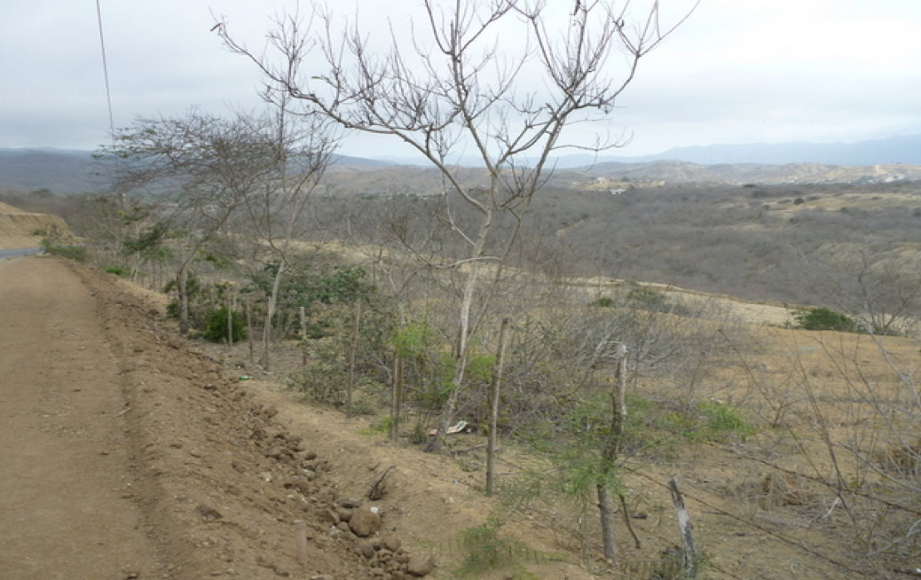
Most think of Ecuador as jungle, but the southwest coastal area,
particularly Santa Elena peninsula, is dusty and dry, with a few cactus trees,
sage brush and squatty trees—there is little rain on the peninsula
Numerous tropical fish, sea lions, and birds frequent the peninsula and fierce waves along the beaches facing south because of the heavy currents that flow into the peninsula…today much of the south shore is protected by engineering works carried out offshore to create an inlet protected by boulders. Chanduy (Chimu “Llano Alto”) in the center south shore of the Santa Elena Peninsula area was occupied before the Spanish arrival, and there were shipyards in Guayaquil in 1654 building huge three-masted Spanish galleons—one was stranded on the beach of Chanduy (see map in previous post). These currents flowing into the south shore would have brought the Jaredite barges to rest along this 90 mile peninsula that is the westernmost point along the South American west coast

Differences in temperature and rainfall in the Costa are caused by the Peruvian Current and periodic appearances of El Niño. The Peruvian Current, also known as the Humboldt Current, is a cold ocean current that flows north along the coasts of Chile and Peru. At Cabo Blanco, where the Gulf of Guayaquil begins, the main current veers to the west; a branch continues northward to Cabo Pasado, in Manabí Province, where it also turns westward to merge with the main current near the Galápagos Islands. The cold water and air temperatures associated with the Peruvian Current inhibit rainfall along the coast, creating dry to arid conditions. This effect is greatest along the southern coast of Ecuador.
When the Peruvian Current is dominant, the amount of precipitation along the coast varies from north to south, with levels ranging from 118.1 to 11.8 inches, respectively. Two rainy seasons in the northernmost part of the coast become a single season (December through June) not far south. Near Esmeraldas, average annual rainfall is 98.4 inches. The rainy season shortens farther south, lasting only from January to May at Guayaquil. Very little rainfall occurs on the end of the Santa Elena Peninsula west of Guayaquil. Arid conditions prevail on the border with Peru south of the Gulf of Guayaquil.
Separated from the effects of ocean currents by the Cordillera Costañera, the Costa Internal has a hot and humid climate. Temperatures can surpass 78.8 °F, and the vegetation and cloud cover tend to retain and augment the heat. Rain is constant during the winter months of December through May, with the heaviest rainfall occurring in February and March.

The northern Ecuadorian Andes are divided into three parallel cordilleras which run in what is similar to an S-shape from north to south: the western, central (Cordillera Real) and eastern (Cordillera Occidental). The cordilleras were formed when the Nazca Plate was subducted underneath the South American Plate and has raised the mountain range. In the south, the cordilleras are not as well defined.
Temperatures in the Sierra do not vary greatly on a seasonal basis; the hottest month averages 60.8 °F and the coolest month 55.4 °F in the upper elevations. Daily temperatures, however, vary dramatically, from cold mornings to hot afternoons. The almost vertical sun and the rarefied air in the higher Sierra region allow the land to warm quickly during the day and lose heat quickly at night. Mornings typically are bright and sunny, whereas afternoons often are cloudy and rainy. In general, rainfall amounts are highest on exposed locations at lower altitudes. Rain also can vary on a local basis. Sheltered valleys normally receive 19.7 inches per year, whereas annual rainfall is 59.1 inches in Quito and can reach 98.4 inches on exposed slopes that catch rain-bearing winds. On a seasonal basis, the driest months are June through September.
Climate in the Sierra is divided into levels based on altitude. The tropical level—1,312 to 5,906 feet—has temperatures ranging from 68.0 to 77.0 °F and heavy precipitation. The subtropical level—5,906 to 8,202 feet has temperatures from 59 to 68 °F and moderate precipitation. The temperate level—8,202 to 10,499 feet has a year-round temperature in the range of 50 to 59 °F and an annual rainfall of 39.4 inches. The temperate level experiences rainstorms, hailstorms, and fog. Winter, or the rainy season, lasts from January through June, and the dry season or summer from July through December. Most rain falls in April. There also is a short rainy period in early October caused by moisture penetrating the Sierra from the Oriente.
From such a description it is not difficult to understand what any fighting discussed in the scriptural record does not last long—and occurs only during a single period of an entire year, basically it would be between April and October. Thus, those who gathered armies to fight, did so during the times when mounting an attack was not feasible because of the rain and temperatures, and readied themselves for summer battles. It is also why, after a defeat, the losing side retreated to their own lands as seen most often in the way in which the Lamanite armies fought periodically against the Nephites.
(See the next post, “The Jaredite Lands in the Land Northward-Part III,” for more information about the Land Northward and the Jaredite landing)


No comments:
Post a Comment