Wednesday, July 31, 2019

The Long History of Horses in America – Part II

Continued from the previous post regarding the enormous evidences of horses in the Americas long before Columbus arrived.
According to Daniel Johnson 9left), in a presentation given at the Book of Mormon Archaeological Forum’s 2012 conference, there is hard evidence to show that horses survived in the Americas. As he states: “Although incomplete, the geological and archaeological record does provide support for horses and even wheeled vehicles in ancient America. The extinction of the ancient horse and the origins of the modern horse in the Americas have become clouded and unsure in light of the latest research. Much of this evidence is not questionable or even that new, but still, sadly, both critics and faithful members are unaware of it. Several valid arguments are worth considering” ("Hard" Evidence of Ancient American Horses,” BYU Studies Quarterly, Journal 54:3, pp149-177).
    Although hard evidence is available to consider, so far no incontrovertible proof of Book of Mor- mon horses exists—that is to say, physical remains conclusively dated to around 500 bc (and earlier) from supposed Book of Mormon lands in Mesoamerica are yet to be found. Because of this, more than any other criticism of the Book of Mormon, its inclusion of horses has generated greater accusation of its supposedly fraudulent nature. The horse is still used in this day and age to cast doubt on the book’s divine origins.
    In the Book of Mormon references to horses are few and not a central part of the narrative. Early on, the Jaredites had horses—interestingly, the elephants, cureloms, and cumoms mentioned in the Jaredite history, which are nowhere to be found in the Nephite records, however, the horse is, though seemingly in a lesser role. With the Jaredites, the horse was delegated to a secondary role behind elephants, cureloms and cumoms (Ether 9:19), and with Nephi, was mentioned equally with other domestic animals (1 Nephi 18:25). A generation later, horses were still available among the Nephites, again seemingly on an equal footing with domestic animals (Enos 1:21). As mentioned earlier, the Lamanite king Lamoni is described as having horses and chariots (Alma 18:9–10), and the Nephites had numerous horses and chariots, with seemingly greater importance than other domestic animals (3 Nephi 3:22) and when they returned to their lands after dealing with the Gadianton robbers (3 Nephi 6:1).
    For generations, science has claimed the horse became extinct in the Americas around 8,000 years ago, though no specific reason or evidence can be produced to support that claim. The one factor most often claimed is that the Spanish conquerors did not find any horses when they invaded Mexico, Central America, and Andean South America. However, the land factor covered by these invasions inolved only a tiny amount of the vast prairies, woodlands, mountains and altiplanos. There are many who think that there were horses in the Americas, but not where the Spanish conquistadors and later Europeans traveled.
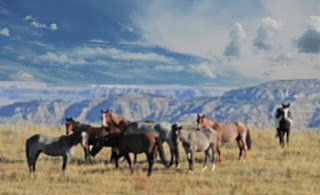
The non-feral wild horse Przewalskii, or Mongolian wild horse

As an example the case of the Przewalskii, or Mongolian wild horse (Equus przewalskii)—one of only two wild horse breed believed to have existed, shows how difficult it can be to observe a horse in the wild. The unknown Przewalskii was not discovered in Mongolia until 1879 by a Russian captain named Nikolai Mikailovich Przewalskii, who sighted the horse as he traveled through the remote valleys of Mongolia.
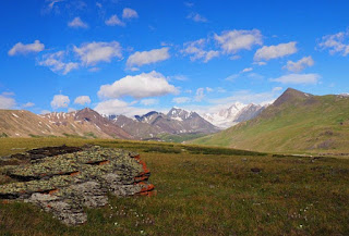
    As an example, the rugged and remote far reaches of western Mongolia are a series of wild landscapes capped by glacier-wrapped mountains, divided by green river valleys and shadowed by soaring peaks. This area is home to the famous Kazakh eagle hunters and has some of the best preserved petroglyphs in the country. But it is the majestic Altai Mountains that dominate this isolated corner of Mongolia. Straddling the borders with Russia and China, the Tavan Bogd is a cluster of Mongolia’s soaring peaks and a draw for climbers, trekkers and horse riders. It culminates in the dramatic 14,350-feet high Khüiten Peak, the highest point in the country.
    The tarpan or European wild horse (Equus ferus ferus) was found in Europe and much of Asia. It survived the extinction event and lived into the historical era, but became extinct in 1909, when the last captive died in a Russian zoo.
Isolated Western Mongolia where the Equus przewalskiii was discovered

This area, which is a lot like parts of Andean South America, tough, remote and isolated. It was not without occupation for centuries with small villages with brightly colored rooftops, where camels grazed along with other livestock across miles of pristine wilderness. Yet, no horse had been identified there until 1879, when the unknown horse, named after the Russian who found it, was discovered.
    A truly wild horse is a species or subspecies with no ancestors that were ever domesticated. One of these, the Przewalskii horse resembles another truly wild horse, the now extinct Tarpan, or European wild horse (Equus ferus), whose ancestors were captured so vividly in the cave paintings in France and Spain in early BC times. The Przewalskii horse was once believed to be a direct ancestor of all living breeds. DNA testing, however, has revealed chromosomal differences between Przewalskiis and modern horses (Equus caballus) indicating that the title of prime progenitor more likely belongs to the European based Tarpan. 
    It should also be noted that wild horses (mustangs) have no natural predators. Without human intervention, herds will double in size every four years. This should suggest their sturdy capability of survival.
    With the demise of the Nephites in 385 AD, it is likely the surviving horses they had were ignored by the warring Lamanites who were involved in protecting their numerous tribal separations. Many claim the horses were pushed to the extreme north and south, and their existence was forgotten by subsequent cultures inhabiting the original areas, who, by the time of the Spanish arrival, did not understand this “new” animal reintroduced during the Conquest.
The Chilean Matorral is one of many places in the Andean area where small pockets of horses could have been hidden for centuries

One of the obvious answers to the problem of not finding horses in North and South America when the Spanish arrived is that many small pockets of horses continued to survive in remote enough locations that they were not discovered until centuries after initial European contact and were thought to have descended entirely from Old World horses reintroduced to this continent in modern times.
    The Chilean Matorral is an ecoregion of central Chile, located on the west coast of South America. It is in the Mediterranean forests, woodlands, and scrub biome, part of the Neotropic ecozone.
    A Matorral is typically characterized by a temperate Mediterranean climate, with rainy winters and dry summers. It is one of the world's five Mediterranean climate regions, which are all located in the middle latitudes on the west coast of continents. The Matorral occupies central Chile between 32° and 37° south latitude, with the Pacific Ocean to the west, and the Chilean Coastal Range lies parallel to the coast. The Chilean Central Valley lies between the Coastal range and the Andes Mountains, which bound the Matorral ecoregion on the east. To the north is the extremely dry Atacama desert, which separates the Matorral from the tropical forests of northern South America. A semi-desert region known as El Norte Chico (the "little north") lies between 28° and 32° south latitude, and is the transition zone between the Atacama desert and the Matorral. To the south lies the cooler and wetter Valdivian temperate rain forests, which includes most of South America's temperate rain forests.
    The interesting fact is that throughout the rough and remote terrain of Andean South America there were (and even still are in some cases) areas where though once populated in BC times, the ancient populations died out and were not replaced, where horses and other animals could have been during the invasion and no one would have known they were there. Certainly there is much evidence to suggest such a possibility.
The Chilean Matorral is but one of many remote areas, inhabited anciently, but not in the last thousand years or more before the arrival of the Spanish, where horses could have been without anyone knowing for centuries after the invasion

To name just a few, there is the Ocoa Valley, Chicauma and Cuesta La Dormida to in the north central area of Chile, where the Spanish never went in their conquest of the Andes, nor the Inca before them.
    This is a solid hypothesis based on sound, up-to-date scientific research, such as artifact depicting a rider mounted on some indeterminate animal. Originally from Oaxaca, it now resides in the American Museum of Natural History in New York City. Described as a rattle, the wheeled effigy was obtained by Marshall H. Saville on one of his expeditions to Oaxaca between the years 1898 and 1902. The extraordinary feature is the human figure, unfortunately incomplete, seated on the animal’s back with legs clasping the sides of the animal in a manner exactly like that of a horseback rider. Clay fillets are also found behind and in front of the rider, obviously representing some form of saddle (Andrew K. Balkansky, “Saville, Boas, and Anthropological Archaeology in Mexico,” Mexicon Journal, Vol.27, No.5, October 2005, pp86-91).
    Unfortunately, on this basis alone, this find has been classified as post-Conquest because common knowledge would deny the understanding of such a concept (or the animal necessary for it) before accepted European contact. However, some experts claim that no such artifacts were made after the arrival of the Spanish (Richard A. Diehl and Margaret D. Mandeville, “Tula and Wheeled Animal Effigies in Mesoamerica,” Antiquity, vol.61, no. 232, July 1987, p243).
    The museum’s own listing for the artifact describes it as coming from the Late Classic/Postclassic Periods, AD 900–1521.

Tuesday, July 30, 2019

The Long History of Horses in America – Part I

The genesis of the “Horse Extinction” and “Stray Horse” theories in the Americas have a long and purposeful legacy in our history. According to most historians, geographers, and anthropologists, the American Indians knew nothing about horses until the 17th century, although much evidence exists to show otherwise. Political, religious, and economic motives were behind the emergence of theories that the New World was “isolated” from the Old World and that the indigenous people (Indians) did not have any horses until after Columbus.
The Indigenous Indians of the plains claimed to have had horses for thousands of  year

When reports surfaced to the contrary about Indians having horses before Columbus in opposition to the accepted dogma, it was dismissed by academic leaders as being groundless “fables.” As an example, claims by elders of the Sioux, Nez Perce, Chippewa, and Pawnee Tribes that their ancestors “always had horses” were cast aside by the academic authorities as being “wishful thinking.” In reality there were several powerful movements combined to crush and stifle claims that ancestors of the Plains Indians had horses and “horse culture” for thousands of years. The first force to emerge came with the War of 1812.
    Citizens of the young American Republic resented their British Heritage. After “Redcoats” burned the White House (in retaliation for raids by John Paul Jones along the English seacoast), Americans turned away from their British roots.
    At this opportune moment following the war, Washington Irving, an American intellectual who had gained popularity in Europe as a writer with works likeHistory of the Life and Voyages of Christopher Columbus (1828) and A Chronicle of Granada (1829). His three-year interlude in Spain also resulted in The Alhambra (1832), an evocative collection of legends and sketches. Upon his return to America in 1832, he published A Tour on the Prairies (1835), an autobiographical account; Astoria (1836), a narrative about John Jacob Astor's ill-fated commercial enterprise on the northwest Pacific Coast; and The Adventures of Captain Bonneville, U.S.A. (1837).
    These works were very successful, and he was tumultuously welcomed by his compatriots. For the rest of his career he enjoyed their virtually unanimous esteem. 
    Upon his writing the exciting book, The Life and Voyages of Christopher Columbus, after the War of 1812, his popularity and intellectualism went a long way in popularizing the event leading to the discovery of America, and captured the imaginations of disenchanted former British Colonists, dovetailing nicely with a campaign by Pope Pius 9th to have Columbus sainted.
    In America, following the massive industrial buildup in the Northern States to win the Civil War, the Senate and the US Congress became private clubs for wealthy industrialists and real-estate developers. Whereas the “Founding Fathers” of America had promoted isolation, neutrality, and non-interference in foreign affairs, the New Senate believed that the opposite strategy was preferable—at least when it came to making profits. Railroad barons (who had the Senate behind them) wanted to abolish the Indian Treaties. They sought to open up the Western Frontier to “Civilization.” Therefore, the Indians and their “Reservations” had to go.
The Chicago World’s Fair, or 1893 World’s Columbian Exposition—Looking West from the Peristyle, Court of Honor and Grand Basin

By sponsoring the “Chicago World’s Fair” (also called the Columbian Exposition), the US Senate hoped to reeducate the American public with a new hero—Columbus. He embodied the qualities and vision of an empire-builder. Indeed, it was due to the Columbus voyages that Spain gained sovereignty over profitable colonies from Florida to Argentina. Obviously, Columbus was an excellent hero for promoting the goals of economic expansion into the Western Indian Frontier and to overseas colonies.
    After 1859, anti-Darwinists joined in the campaign to promote Columbus as a new National Hero. A leading Swiss-French botanist, Alphonse de Candolle, added his weight to the pro-Columbus Movement by declaring that the Spanish mariner was the first to bring vital New World plants (such as maize, pineapples, pumpkins, and potatoes) back to the Old World in 1492.
    Pro-Columbus biologists declared that horses became extinct following the last Ice Age; and anthropologists promoted their own theory that all the Indians acquired “horse culture” after Columbus brought the first horses from Spain to the New World. None of these claims were ever proven in a scientific manner. They were simply the implied consequences of the “Isolationist Paradigm” that presumed the New World and Old World were isolated from contact until after God chose Columbus to discover America.
    The 1892-1893 Columbian Exposition had an enormous impact on Americans and the world. More than 26 million people viewed the exhibits. Spinoff public media and educational programs impacted practically everyone else in the Country (about 150 million people). These programs were endorsed by Presidents William H. Harrison and Grover Cleveland, and almost everyone adopted this revised “history.”
Columbus contemplating on the shores of Lisbon his future voyage to what turned out to be a New World that joined the old with the new lands

In 1992, the US Government sponsored the Columbus “Quincentennial Celebration.” New festivities featured a yearlong exhibit at the National Museum, the Smithsonian Institution. Called “The Seeds of Change,” the National Exhibit praised Columbus for uniting two previously isolated hemispheres and for bringing horses, maize, potatoes, and sugarcane across the Atlantic Ocean. A vast majority of university professors and public teachers participated in spreading this unsubstantiated “history” for the simple reason that: 1) they believed it was true; and 2) their jobs were closely tied to supporting the traditional educational and governmental agendas.
    As early as the 1700s, the geologic time scale was being developed, and seriously a part of American intellectual thinking by the late 17th century. The first grouping of periods into eras and the subdivision of the Tertiary and Quaternary periods in the early 1800s.
    In 1841 John Phillips published the first global geologic time scale based on the types of fossils found in each era. Phillips' scale helped standardize the use of terms like Paleozoic ("old life") which he extended to cover a larger period than it had in previous usage, and Mesozoic ("middle life") which he invented. As early as the 1820s, the idea that horses had anciently become extinct in America was well founded. The evolutionary dogma being spread was that “The end of the Pleistocene epoch—the geological period roughly spanning 12,000 to 2.5 million years ago, coincided with a global cooling event and the extinction of many large mammals. Evidence suggests North America was hardest hit by extinctions. This extinction event saw the demise of the horse in North America.
    In the Annales Zoologici Fennici journal, published by the Finish Zoological and Botanical Publishing Board, Augusto Azzaroli, former Professor of Palaeontology at the University of Florence, was a geologist and palaeontologist considered among the greatest of the second half of the last century, wrote an article regarding the origin and extinction of the monodactyly (one-toed) Equus horses in the Western Hemisphere (Vol.28, Florence Italy, 1992, pp151-163).
Hippidion (meaning little horse) is an extinct genus claimed to have lived in South America from the Pliocene to the mid-Holocene

Azzaroli also stated that “there were never critical periods of mass extinction and many species disappeared through evolutionary change, resulting in the radiation of the final Pleistocene. The South American genera Hippidion and Onohippidium also dispersed widely and survived into the final Pleistocene or early Holocene with an unknown, but  probably restricted number of species. In view of their remarkable capacity of adaptation, the dramatic decline of equids in number of species…can hardly have been caused by climatic factors alone and is believed to be largely the result of prehistoric overkill.”
    An article published in BYU Studies Quarterly shows some strong support for the validity of the Book of Mormon's claims and examines several possibilities that explain the apparent lack of horses as noted by the first European explorers. Some of this information is also in An LDS Guide to the Yucatán.
(See the next post, “The Long History of Horses in America – Part II,” for more regarding the horses in America nearly everyone denies)

Monday, July 29, 2019

Chariots and the Role of the Spirit in Translation

The following are comments made in a talk and PowerPoint presentation given to the Book of Mormon Lands Conference, 20 October 2007, as printed in Fair Mormon, under the title: “Horses in the Book of Mormon.” Included are our responses to their comments.
Comment #1: “The Book of Mormon authors tell us that the Nephites would have liked to have written in Hebrew but they used reformed Egyptian instead because it took up less space on the plates (Mormon 9:32-33). Reformed Egyptian was probably a more compact script than Hebrew and it’s possible that it also consisted of a more limited vocabulary. Moroni tells us that if they could have written in Hebrew instead of reformed Egyptian there would have been fewer mistakes. Maybe he understood that at least some reformed Egyptian characters only approximated a concept. As we investigate the Book of Mormon text, we discover that, indeed, reformed Egyptian appears to have had a very limited vocabulary.”
Joseph would read off the English to Oliver Cowdery, who was his principal scribe, and then it was written down and repeated to Brother Joseph to see if it was correct, and if so, then it would disappear, and another character with the interpretation would appear

Response: Irrespective of the language the Nephites used to write on the plates, when it came time to translate it, Joseph Smith was guided by the Spirit in the process of translation. The words Joseph chose to use were accepted by the Spirit, or they were rejected and the translation of the word or phrase was done again. As a result of this, it would seem certain that whatever translation Joseph made was accurate and clearly understandable.
Comment #2: “The Book of Mormon uses only one word for large bodies of water–“sea.” We don’t read of “lakes,” “ponds,” “oceans,” “pools,” etc. Some LDS scholars have suggested that–in at least some instances–the “seas” of the Book of Mormon may have been large lakes or other bodies of water (like the Dead Sea). The Bible not only uses “sea” but unlike the Book of Mormon it also uses “pond,” “pool,” and “lake.” In the D&C we find “sea,” “ocean,” and “pool.” Our idea that sea only means ocean seems faulty.”
Response: First of all, the word “sea” is clearly defined in the scriptural record in Ether 2:24-25), and 1 Nephi 12-1; 17:5-6; 18:8-10), as an ocean.  Secondly, for water other than a river, the Book of Mormon uses the term “waters” as seen in the “Waters of Mormon,” “Waters of Sidon,” “Many Waters,” “Great Deep,” etc. The point being that the use of such words in the scriptural record are sufficient for our understanding.
    As an example, the word “wilderness” today means “an uncultivated, uninhabited, and inhospitable region,” “Wilderness or wildland is a natural environment on Earth that has not been significantly modified by human activity. Words translated as “wilderness” occur nearly 300 times in the Bible. A formative Hebrew memory is the years of “wandering in the wilderness,” mixing experiences of wild landscape, of searching for a promised land, and of encounters with God.
    The Pentateuch wandering takes place in the midbar, uninhabited land where humans are nomads. This common Hebrew word refers often to a wild field where domestic animals may be grazed and wild animals live, in contrast to cultivated land, hence, sometimes “the pastures of the wilderness” (Joel 1:19–20). Another word is arabah, steppe (Genesis 36:24), also translated as desert: “The land that was desolate [midbar] and impassable shall be glad, and the wilderness [arabah] shall rejoice” (Isaiah 35:1). Land that lies waste is chorbah; land without water is yeshimon.”
    Thus, it’s use in the scriptural record is meaningful and completely understandable when we use the 1828 American Dictionary of the English Language as “a tract of land or region uncultivated and uninhabited by human beings, whether a forest or a wide barren plain.” We do not need to know if the wilderness was a jungle, desert, grassland, mountainous, full of canyons, etc. What is conveyed in the use of wilderness is exactly what it meant and means—an uninhabited and unoccupied area without permanent dwellings.
Comment #3: When explorers see an unknown animal for the first time, they often use a term from “loan-shift,” that is, using a word or name known to them of another, or close appearing animal. As an example, the American “buffalo,” which is actually a bison and is only distantly related to the water buffalo and African buffalo (the two true buffalos).”
Left: The American buffalo; Right: The European Wisent or Bison (look alike, but not related)

Response: Apologetics use this as a way of saying that animals in the Book of Mormon may not be the animals actually stated. However, the word buffalo comes from the Portuguese “bufalo,” which means “water buffalo,” originally the name of a kind of African antelope, later used of a type of domesticated ox in southern Asia and the Mediterranean lands. The European “bison,” actually called a Wisent, has the word “bison” taken from Latin “bisōn.” In the 1600s and before, the European Wisent or bison was not generally known in most of Europe, its population being in the Bialowieźa Forest of Belarus and Poland.
    These Apologetics also point out that what Americans call a “moose” is actually an elk, which are actually red deer, and “antelope” are not real antelopes. Actually, the term “moose” and “elk” are merely different language appellations for the same animal, Unfortunately, the “elk” became extinct in Europe during the Bronze Age, and few Europeans knew the name, its origin, or purpose when they came to America. The word “moose” entered the English language in 1606, and taken from the Algonqian words moosu, or mo-swa.
    The point is, it is never wise to jump to conclusions, as so many men of letters do in trying to understand unknown factors of the past. When Nephi wrote “horse,” he meant “horse.” He both knew what a horse was and was supported by the Spirit in choosing that translation.
Comment: “The English word “chariot” comes from Latin “carrus,” meaning a car, and is etymologically related to the verb to carry...We should not automatically assume that the Nephites understood chariots as wheeled war machines since no Book of Mormon verse says or suggests that chariots are mounted, dismounted, or that they carried people or were ridden…we cannot say for certain what a Book of Mormon “chariot” means. Native American kings, for example, were often carried into war or to ceremonial events on litters or palanquins. These were sedans carried on the shoulders of other men and certainly fits the Hebrew definition of a “chariot.” The Book of Mormon, it must also be noted, never mentions horses “pulling” chariots.”
The carrus “chariot” used for war and parades until replaced by heavier horses for cavalry, then was relegated to games and races

Response: First of all, the word “chariot” that comes from Latin “carrus,” meaning a car, relates only to chariots used for war or military parades, in which a biga reqired two horses, a teriga three, and a quadriga four.
    Secondly, whatever the English etymoloygy, the Hebrew word chariot has a different beginning. In Hebrew, vehicles are designated by two expressions, "'agalah" and "rakab," with "merkab" and "merkabah" derived from the latter. The former denotes the wagon used for heavy loads and general work, the name being connected with the root "to roll"; while the latter is the chariot of war or of state. Wagons for carrying burdens or persons are found among the different peoples of antiquity, having displaced at an early time the sledge and the drag on rollers, drawn by men or oxen (John Wilkinson, "Manners and Customs of the Ancient Egyptians," vol.3, Dodd, Mead and Co. New York, 1878, p324).
    The noun merkabah/merkavah "thing to ride in, cart" is derived from the consonantal root ר־כ־ב (r-k-b) with the general meaning "to ride." However, when left untranslated, in English the Hebrew term merkabah/merkavah (Hebrew: מֶרְכַּב, מרכבה, and מִרְכֶּבֶת) relates to the throne-chariot of God in prophetic visions.
    Now to understand the significance of the chariot in the Book of Mormon, we need to understand the events of King Lamoni, his servants and the Nephite Ammon. Around 90 BC, when he and his brethren, Alma and the sons of Mosiah, of which Ammon was one, went into the Land of Nephi to preach to the Lamanites, he impressed himself to the Lamanite king, Lamoni, to such a degree, the king offered Ammon one of his daughters to wed.
Lamoni and Ammon journeying to Middoni, along with Lamoni’s servants to rescue Ammon’s brethren

However, Ammon declined saying all he wanted to do was serve the king, in which capacity he stood out further and the king promised to go with Ammon to release his brethren in the land of Middoni, where one of Lamani’s brothers was king. At this point, the king “caused that his servants should make ready his horses and his chariots”(Alma20:6).
    The question arises, “Why ready the horses and chariots for a journey to another land some distance away? Why take chariots at all? The only answer that makes sense is that they rode in the chariots which were pulled by the horses.
    It also seems likely that if the word or meaning intended by Mormon was a “cart” or “wagon,” the Spirit would have waited for Joseph to determine that. After all, Joseph was far more knowledge of carts and wagons in his life and around the farm than of a “chariot,” which were never used in the Americas.
    We need to stop thinking there were errors made during the translation and what we have in the Book of Mormon is a work that requires special interpretation by the reader. Joseph translated the work and if the translation was incorrect, the Spirit did not validate the translation but waited for Joseph to correct his translation. When it was correct, the Spirit allowed him to continue on. Therefore, if chariot was in error, the Spirit would not have accepted that but waited for Joseph to chooser the correct word. While we, with our limited knowledge try to correct that translation because it does not meet our current standard of knowledge will only lead us into error.

Sunday, July 28, 2019

1830 Knowledge of Lehi’s Landing Site

Many of the comments made in the very early days of the Church, often used by theorists to support their location for the Land of Promise, have seldom been mentioned outside of Joseph Smith and Oliver Cowdery. However, an interesting non-Latter-day Saint news article appearing on November 18, 1830 seven months and two days after the forming of the Church at the home of Peter Whitmer in Fayette, New York, on April 6,1830, and eight months after the Book of Mormon was published.
The southern shore of Lake Erie between Buffalo, New York, and Sandusky, Ohio, where early Church activity took place

An article appearing in the Observer and Telegraph: a Religious, Political and Literary newspaper, published by the Reverend Warren Isham, may be the answer to this question. The Observer was a weekly newspaper published in Hudson, Ohio, about 18 miles south of Cleveland where its predecessor, the Western intelligencer, religious, literary and political, had been located in Cleveland, Ohio, and published by J.G. & D.B. M'Lain and the Reverend Kingsbury.
    Upon becoming the editor and proprietor of the newspaper from the Western Reserve College in 1827, Ishman changed the name to the Observer and Telegraph and in 833 again changed the name to The Ohio Observer. He moved the paper to Hudson considering this area the “center of science and the literary focus of this section of the West.”
Observer newspaper article November 18, 1830

His article, found in Vol.1, No.38, under the title of “The Golden Bible, or, Campbellism Improved,” Isham editorialized the following lengthy statement regarding a declaration made by Oliver Cowdery, David Whitmer and Martin Harris, which included Lehi’s landing site. Because of its final statement of importance, we thought it wise to publish the entire article:
    “For several days past, four individuals, said to have formerly resided in the State of New-York, have appeared in the northern part of Geauga County, assuming the appellation of Disciples, Prophets, and Angels. Some among us, however, are led to believe that they are nothing more than men, and impostors. They are preaching and teaching a species of Religion we are not all prepared to embrace; for we are convinced it does not accord with our old-fashioned Bible.
    “These men have brought with them copies of a Book, known in this region by the name of the "Golden Bible," or, as it is learned on its title-page, "The Book of Mormon." They solemnly affirm, that its contents were given by Divine inspiration; was written by prophets of the Most High from a period of 600 years before, to that of some hundred years after our blessed Savior's advent; was deposited by Divine command below the surface of the ground, in or near the township of Palmyra, Ontario Co., N. Y., that an Angel appeared to a certain Joseph Smith residing in that place, who, they say, was a poor, ignorant, illiterate man, and made no pretensions to religion of any kind; -- ... [section of text illegible] ... of this sacred deposit, and directed him forthwith to dig up and bring to light this precious record and prophecy. They affirm that the said Smith obeyed the heavenly messenger, when lo! a new Revelation -- the Golden Bible was discovered!
    “According to the narrative given by one of these disciples -- Oliver Cowdery -- at their late exhibition in Kirtland, this pretended Revelation was written on golden plates, or something resembling golden plates, of the thickness of tin -- 7 inches in length, 6 inches in breadth, and a pile about 6 inches deep. None among the most learned in the United States could read, and interpret the hand-writing, (save one, and he could decipher but a few lines correctly,) excepting this ignoramus, Joseph Smith, Jr. To him, they say, was given the spirit of writing, he employed this Oliver Cowdery and others to write, while he read, interpreted, and translated this mighty Revelation.
    “It appears from the testimony of these men, that while this process was going on, some of their mischievous, meddlesome neighbors, having a miserly disposition, stole some of their plates of gold before they gave them sufficient time to translate them, and as they have not yet been recovered, they fear a part of this great Revelation will be lost to our race. There were other plates among them, they say, which contained secrets from them by some mysterious dispensation of Providence, they know not how, or in what region they are secreted, but as they are to be forthcoming at the proper time, to some future generation, they appear to manifest no particular uneasiness with regard to them.
    “To convince the world that this record and prophecy is a Divine Revelation, three men, Oliver Cowdery, David Whitmer and Martin Harris, have subscribed their names to an article in this "Book of Mormon," solemnly declaring that they saw an Angel come down from heaven, who showed them those plates, and made known to them it was given by inspiration, and "they know of a surety it is true," &. &.
    “This new Revelation, they say is especially designed for the benefit, or rather for the christianizing of the Aborigines of America; who, as they affirm, are a part of the tribe of Manasseh, and whose ancestors landed on the coast of Chili 600 years before the coming of Christ, and from them descended all the Indians of America” (emphasis added).
  LtoR: Oliver Cowdery, David Whitmer, Martin Harris
   
So here we have three early leaders of the Church, Oliver Cowdery, David Whitmer and Martin Harris, who were the Three witnesses and allowed to see the gold plates and the engravings upon the plates, and heard the Lord’s voice testifying to the truthfulness of the Book of Mormon, and all upheld their testimony of the Book of Mormon at their deaths, have subscribed their names to an article in this "Book of Mormon," solemnly declaring that they saw an Angel come down from heaven, who showed them those plates, and made known to them it was given by inspiration, and "they know of a surety it is true."
    It should be noted that the article naming these early leaders and quoting them as to the landing of Lehi in Chile, was published prior to the 1836 note written by Frederick G. Williams regarding the landing at 30º South Latitude in Chile. Obviously, they did not get their information of a Chilean landing from Williams, who did not join the Church until October 1830, less than a month before the article appeared in the Observer and Telegraph newspaper, and who immediately left after his baptism for a mission to Missouri.
In 1830, there was little contact between the west coast of South America and those of North America; (maroon circle) An area of almost no contact outside of a few naval ships; (blue circle) An are of no contact with the seaboard cities; (blue line) Shipping lanes from New York to the Orient; (yellow line) Shipping lanes from New York to Indonesia; (wide red lines) Coastal contact with the east coast of the Americas 

    Consequently, it might be asked, where did these early Church leaders get the idea of a Chilean landing site for Lehi? Obviously, they did not get the idea that was published in the 1830 newspaper article, from the 1836 note written by Frederick G. Williams. And just as obviously, such information was not only known in Church leadership at the time of the article for it to be a stated fact in an article about the Book of Mormon, but held among these three witnesses to the divinity of the gold plates from which the Book of Mormon and the story of Lehi was translated.
    There are those today who claim they got the knowledge from Joseph Smith. One might conclude this to be true since only Joseph truly understood Lehi’s story and the many details about the Nephite life style and purpose to which he used to tell the stories to his parents and family quite often according to Lucy Mack Smith.
    However, the point is not who provided the Three Witnesses with this information, but that they understood that was Lehi’s landing site. Consider this with the fact that in 1830, on the western frontier around Lake Erie, the people there would have had to reason to think about Chile, a rather unknown place in the world at the time, especially to those of the American interior. Yet they knew it was the location, spoke and taught the point and believed it to be true.

Saturday, July 27, 2019

Mulekite Landing at Pachacamac – Part II

Continued from the previous post regarding several questions or comments from one of our readers about the Pachacama landing site of the Mulekites.
Comment: “Columbus proved you can navigate to Venezuela from Europe or Morocco. There is absolutely no reason to assume the Mulekites hit the beach and set up shop right there. Common sense would make one explore for the best place to settle.”
Columbus sailed from Palos, Spain, to Las Palmas in the Canary Islands before setting out on the western current toward the New World he discovered

Response: First of all, Columbus was never in Morocco that we know of, and he did not sail from there to the New World. He sailed from the Spanish port of Palos on August 3, 1492, and arrived at the Canary Islands for last minute preparation and restocking, which is 504 miles off the coast of Morocco. They left the Canaries 34 days later on September 6 and sailed on the westward current across the Atlantic to the Bahamas, a cluster of islands off the coast of southern Florida. Secondly, you cannot sail directly to the New World from Europe, but had to drop down to the area of the Canary Islands off the coast of North Africa, to pick up the westward moving current.
    Third, history shows that people arriving to a virgin land by sea settle within a harbor or short distance of that landing site. This is not only true all along the eastern seaboard of the US., but also in early Europe. While Paris and London are not on the coast, they are upriver of a larger river system that provided protection from the sea, but close enough access to use the sea to their advantage.
Comment: “If they landed in Venezuela or Colombia and it was riddled with dead men's bones you can imagine why they might venture South through all the desolation to find game to hunt and lands to farm.”
Response: First of all, no one is saying Lehi landed in Venezuela or Colombia. He landed 3500 miles to the south at Coquimbo Bay, Chile. The Nephites never reached the area of the Jaredite lands, and therefore their bodies and bones, until around 500-600 years later. Secondly, since there is no record of anyone in the land where Lehi landed (2 Nephi 1:5-8), there is no validity to the question. If the Jaredite bodies are suggested, they were not discovered until long after the Nephites discovered the Land of Zarahemla, settled down and established themselves there. However, it was a small party of 43-men on assignment to find Zarahemla that ran across the Jaredite bodies and remains nearly 600 years after Lehi’s landing.
    It should also be understood that when Mosiah discovered the Mulekites at Zarahemla, we learn that they “were brought by the hand of the Lord across the great waters, into the land where Mosiah discovered them; and they had dwelt there from that time forth.” That is, the Mulekites (People of Zarahemla) settled where they landed and lived in that same place from the time of their landing until Mosiah discovered them.     
Comment: “Pachacamac is said by science to have been established in AD 200. How do you get over that?”
The vast complex known today as Pachacamac, with the ancient temple overlooking the sea from a hill beside the ocean

Response: We need to be careful of dating ancient sites. Often such dating is what is found there and placed by archaeologists within a time frame because of what they find. As an example, the Old Temple, also called the Temple of Pachacamac, is believed to be the oldest building in Pachacamac. It is built on a rocky promontory and is characterized by the massive use of small bricks of raw adobe dated to the Early Intermediate period, under the influence of the Lima culture (3rd to 7th centuries AD). In other words, the Lima Culture is dated to 3rd to the 7th centuries. The site of Pachacamac is considered part of the Lima Culture, therefore the site could not have been occupied prior to 200 AD. However, the dating of the culture has nothing to do with the existence of other groups there before that, and the dating itself is often erroneous to begin with. Also, we need to keep in mind that Archaeologists have uncovered multiple grave sites, and that the occupants date to different periods of Pachacamac's history which are located in different parts of the city (Ancient Origins, “The little-known Pachacamac mummies of Peru,” January 2015).
Comment: “Cajamarca was more important than Pachacamac when the Spaniards arrived.”
Response: Cajamarca is the setting of the encounter between the culture of Spain and the Andean world. The layout of the city and its buildings, both civil and religious, built of adobe and volcanic stone within the Historic Center of Cajamarca, offer an exceptional testimony of Spanish-Andean culture. The architecture, which is unique and covers every century from the 16th to the 19th, makes the city center of Cajamarca a monument of great cultural value.
    In the fifteenth century the city of Cajamarca became part of the Tawantinsuyo (Inca Empire) when the Kingdom of Cuismanco was conquered by the Inca Pachacutec. Cajamarca retained its importance since for the conquering Incas it was considered to be "head of a province,” with a body of functionaries that controlled this vast and rich region of the empire resided there.
    It was also the site of the "Ransom Room" which is still standing, and is the one remaining vestige of the lnca domination of Cajamarca. It was here that Atahualpa was held prisoner and also where he offered his Spanish captors the famous ransom of gold and silver in order to obtain his freedom. In the area around the Historic Center of Cajamarca there are a number of archaeological monuments of exceptional historic importance.
Comment: “Lehi had a natural port bay at the 30 degree South Latitude. There is no natural landing site in Pachacamac.”
The numerous areas along the coast from Punta at Callao to the Lurin River, where today numerous docks have been built for deep sea ships

Response: As mentioned in the previous post, the area from the Rimac River at Callao down to the Lurin River at Pachacamac has numerous landing sites, though none as major and simplistic as that of Coquimbo Bay in Chile where Lehi landed. Besides, the mouth of the Lurin River would have been an excellent place for the Mulekites to have landed.
Comment: “There is no way to reason for Pachacamac without a nearby River Sidon.”
Response: This idea of a Sidon River next to Zarahemla has been a favorite among theorists for some time, but once again, the scriptural description places the Sidon River in the eastern borders of the Land of Zarahemla (Alma 2:15). It also states that “And it came to pass that the war began to be among them in the borders of Zarahemla, by the waters of Sidon” showing Mormon placed the Sidon in the eastern lands along the border of the Land of Zarahemla (Mormon 1:10, emphasis added)—not next to the city of Zarahemla.
    The point to all of this is that the Chilean coast, where so many early prophets and Church leaders considered to be the landing site of Lehi is, indeed, consistent with all the scriptures relating to that topic and surrounding it, especially including Nephi’s writings as to what they found at their initial landing site (1 Nephi 18:25).

Friday, July 26, 2019

Mulekite Landing at Pachacamac – Part I

We received a response to one of our recent articles about where Lehi settled and the various sites we claim in Peru to be Book of Mormon locations. To answer his litany of statements we will list his comment and our response.
• Comment: “Lehi had a natural port bay at the 30-degree South Latitude. There is no natural landing site in Pachacamac.”
Response: We know absolutely nothing about the Mulekite method of leaving Jerusalem, when precisely that occurred, where they went, where they obtained a ship or built one, how many there were in the party, where exactly they landed, or how far inland  from the shore they landed and settled. All we know is that they ended up in the area of Pachacamac.
The original area covered by what is now the Greater Lima District and anciently was known as Zarahemla, the capital city of the Nephites

This area, as recent discoveries have shown, was a very large area, stretching from the Lurin River to what is now the city of Lima, including Callao. No doubt under the Nephites after they arrived, the city grew in size and expanded into a large area. As we have shown in earlier articles, the entire area is covered with ancient ruins with hundreds of pyramids and buildings, plus all those covered over by urban sprawl of both the Spanish and modern development.
    However, the area from Callao down to Pachacamac is not without landing sites. From La Chira to Paso la Arana, and inside (shoreward) from the Isla San Lorenzo off the point of Muelle at Callao, and on the north shore of the Point through the Muelle Sur to the Rimac River, where currently several docks have been built because of the protected bay. Or running southward in a calm sweep of beach from La Punta to Chorrillos along a slight curvature of shore including San Miguel, San Isidro and Miraflores to Herradura, the latter made up of several landing areas around the point of Chorrillos.
    While it may not be a perfect landing bay, like Coquimbo, it would certainly serve as an unloading area for the Mulekites. Keep in mind there is no mention of what happened upon that landing, what took place afterward, or what became of the ship, or if it was ever used again.
“There is no way to reason for Pachacamac without a nearby River Sidon.”
Response: There is no reason to believe that any original river kept its main course following the destruction indicated in 3 Nephi 8, including the burying of cities beneath mountains, as well as mountains rising up to a “height which is great.” But even so, the Sidon did not run by the city of Zarahemla as so many theorists claim. Mormon makes it clear that the Sidon was eastward in the land of Zarahemla, next to the borders with the Land of Gideon. The river itself was near those borders (Alma 2:15).
• Comment: “You have to hike up to the Marana River hundreds of miles before you encounter an acceptable River Sidon, that flows down from a possible Manti, which would be close to the Land of Nephi, which is up from the land of their first habitation near present day La Serena, Chili.”
Response: First of all, there is no Marana River mentioned in the top 25 rivers of Peru. There is a Maran River, but that is far south of Nazca, flows southward, and is a relatively short river. There is also the Marañon River, but that is far north of Pachacamac. There is a Mantaro River, but that drains southward out of Lake Junin, north of Zarahemla. None of these rivers meet the descriptive information Mormon provided.
Comment: “The Land of Nephi is where they went up to the Bolivian High Lands. This is one of the highest habitable areas in all the Andes. Of course Zarahemla is down from up there.”
Response: The Bolivian highlands or the Altiplano (Spanish for "high plain"), Collao (Quechua and Aymara: Qullaw, meaning "place of the Qulla"), Andean Plateau or Bolivian Plateau, in west-central South America, is the area where the Andes are the widest. It is the most extensive area of high plateau on Earth outside Tibet. Along a north-south ridge runs the Eastern Andes Mountain Range, also called the Codillera Oriental, which divides Bolivia, with the lowland plains of the Amazon Basin to the east.
The Anliplano is south of where Nephi settled after fleeing his brothers, which are not the Bolivian Highlands

This area referred to as the Bolivian Highlands or Altiplano, which is mostly south of Lake Titicaca, is south of where Nephi settled after fleeing the area of their first landing following the death of Lehi.
Comment: “Pachacamac does not even have a river that flows North. It flows West to the ocean.”
Response: As indicated above, the Sidon River was in the eastern lands of the Land Sidon, near the borders of the land with the Land of Gideon. The Lurin River, that runs to the south side of Pachacamac does run west and empties into the Pacific. None of this is in disagreement with the scriptural record, only to man’s theories and opinions.
Comment: “And the River Sidon is where they dumped hundreds if not thousands of dead Lamanites. Who would float dead bodies into the sea coast next to your town?”
Response: The Sidon River, which was many miles away from the City of Zarahemla (or Pachacamac) was in the highlands to the east in the borders of the Land of Zarahemla (Alma 2:15). As Mormon describes: “the Amlicites came upon the hill Amnihu, which was east of the river Sidon, which ran by the Land of Zarahemla, and there they began to make war with the Nephites” (Alma 2:15). In addition, once the battle took place, the Amlicites began to flee before them all that day” (Alma 2:17-18).
    Alma 2:19-38 describes the ongoing battle that had them crossing the Sidon to the West and then chasing the Lamanites all that day with the Lamanites ending in the northwest away from Zarahemla into the wilderness of Hermounts, or wilderness of wild beasts. None of this was by the city of Zarahemla but to the east of it.
Comment: “The Marana river flows true North or as I said 'from the South' and I think even in the Southern Hemisphere 'from the South would still be North.”
Response: No Marana River has been identified (see the above).
Comment: “And the Marana River flows past Cajamarca (I believe that is Zarahemla) and when the Marana River passes by Cajamarca from one valley to the East, it then plunges down a great ways to the Amazon. So, yeah, toss bodies into that river and feed the piranhas in the Amazon.”
Cajamarca is 528 miles north of Lima (Zarahemla), creating a huge area for the Land of Nephi with no specific information to support such a claim, and reducing the lands of Zarahemla, Bountiful and the Land Northward to a far less size than the descriptions warrant

Response: Cajamarca (Kashamarka) is a Peruvian city far to the north in Peru and 130 miles inland from the west coast, about equal distance between the coast and the Amazon Basin. It is 9,022 feet above sea level on the Cajamarca River. It is a large mining area of Copper and God, with recently discovered silver mines at Hualgayoc.
    The city, which has been occupied by several cultures for more than 2000 years, with its beginning dated to 200 BC, is irrigated by three main rivers, the Mashcon, San Lucas and the Chonta, the former two joining together in the area to form the Cajamarca River. The Chinchipe River, also known as the Mayo River, near Moyobamba.
(See the next post, “Lehi’s Landing at Pachacamac – Part I,” for more on Lehi’s landing at Pachacamac inquiry from one of our readers)

Thursday, July 25, 2019

The Lamanite Clothing for War

Around 73 BC, when Moroni, at the age of 25, took over the Nephite armies, the Lamanites, under Zerahemnah, came with their thousands into the land of Antionum (Alma 43:5).
    “In the eighteenth year of the reign of the judges…the Zoramites became Lamanites; therefore, in the commencement of the eighteenth year the people of the Nephites saw that the Lamanites were coming upon them; therefore they made preparations for war; yea, they gathered together their armies in the land of Jershon (Alma 43:4).
    Upon arrival, the Lamanites found that the Nephites were well protected with armor of breastplates and with arm-shields, yea, and also shields to defend their heads, and also they were dressed with thick clothing (Alma 43:19).
    “Now the army of Zerahemnah was not prepared with any such thing; they had only their swords and their cimeters, their bows and their arrows, their stones and their slings; and they were naked, save it were a skin which was girded about their loins; yea, all were naked, save it were the Zoramites and the Amalekites (Alma 43:20)
    In fact, the common dress shown for the Lamanites by Nephite writers was that they were naked, save it were a skin which was girded about their loins (Alma 3:5).
    Thus, without question, we find that the Lamanites wore loincloths, a form of clothing or covering unique to certain peoples throughout the ages. To better understand this, a loincloth is a one-piece garment, sometimes kept in place by a belt. It covers the genitals and, at least partially, the buttocks. The loincloth, or breechclout, is a basic form of dress, often worn as the only garment for thousands of years. In the American southwest, Indian tribes still wear the loin clothing as a sign of or token of their history with such a covering, though now they are worn over other garments and serve no purpose other than memorial.
Left: Long, soft, shiny vegetable fiber that can be spun into coarse, strong threads. It is produced primarily from plants in the genus Corchorus; Right: Leaf Fibers of hemp broken down and extracted from the leaf-stems and ready to be formed into a material used for breechclouts
   
The loincloth in essence is a piece of material, made of bark-bast plant fibre such as flax, hemp, jute, nettle, mulberry and others; or it is made of leather, or cloth. Despite its functional simplicity, the loincloth comes in many different forms. A breechclout, or breechclout, consists of a strip of material passed between the thighs and secured by a belt, a loincloth is a long piece of cloth, passed between the thighs and wound around the waist.
    Breechcloths and loincloths are garments of dignity among those who wear them, and the styles that can be arranged are numerous. A style of loincloth characteristic of ancient Mesoamerica, was a wound loincloth of woven fabric with one end held up, with the remainder passed between the thighs, wound about the waist, and secured in back by tucking. On the other hand, in Pre-Columbian South America, ancient Peruvians wore a strip of cloth between their legs held up by strings or tape as a belt, the cloth was secured to the tapes at the back and the front portion hung in front as an apron, always well ornamented. The same garment, mostly in plain cotton but whose aprons are now, like T-shirts, some of the culturally diverse Amazonian Indians still wear an ancestral type of loincloth.
    A breechcloth, or breechclout, is a form of loincloth consisting in a strip of material—usually a narrow rectangle—passed between the thighs and held up in front and behind by a belt or string, often, the flaps hang down in front and back. In most Native American tribes, men used some form of breechcloth. The style differed from tribe to tribe, in many tribes, the flaps hung down in front and back, in others, the breechclout looped outside the belt and was tucked into the inside, for a more fitted look.
    Sometimes, the breechclout was much shorter and a decorated apron panel was attached in front, a Native American woman or teenage girl might also wear a fitted breechclout underneath her skirt, but not as outerwear. However, in many young girls did wear breechcloths like the boys until they became old enough for skirts. Among the Mohave people of the American Southwest, a breechclout given to a young female symbolically recognized her status as hwame, that is a female-bodied person who lives as a warrior.
Left: Loincloths as the only clothing; Right: Red Circle: Loincloths worn over warm clothing

It should be noted that while loincloths were worn, and have been worn, in societies where no other clothing is needed or wanted, such as in warm climates or during the summer, in cooler climates or in winter, the aboriginal people wore loincloths over other garments.
    It is interesting that Mesoamerican theorists claim that since loincloths were worn by the Lamanites that the climate of the Land of Promise had to be a warm, tropical climate. While it is well known that numerous indigenous people of the Americas wore breechclouts year round, either in warm climates with only the cloth, or in cold weather where they had full clothing beneath. This is because to the original indigenous people, i.e., the Lamanites, the breechclout had a mystical or spiritual significance.
    It should also be noted, that the scriptural record of the Lamanite confrontations seemed to basically happen once a year, and when the battles ended, they returned back to the homes in the Land of Nephi. This is typically shown that these battles or wars ended toward the end of each year (Alma 3:25; 16:12; 25:13; 27:1; 28:9; 30:1; 53:7; 58:38; 62:38).
    Typical of such large scale battles which required support, they were fought in the warm months when rains and weather were not against them, and when battles ended, they retreated to their home lands for safety and to prepared during the winter for another future attack and battle when summer came. During these times of warm weather, it would be obvious the Lamanites would have worn loincloths and little or nothing else; however, in cold climates or during the winter, under clothing would have been worn and the loincloth as an outer ceremonial symbol.
The Breechclout worn either exclusive of other clothing, or with leggings, or with leggings and shirt or vest, or a loinclothing over a full tunic and inner garments

It should be noted that in an ancient legend of Peru, referred to Four Brothers that founded the land, one of these brothers separated himself and his brethren from the other brothers and established what was referred to the as ritual of huarachicoy, or breechclout ceremony. This ceremony was established in pre-historic times wherein a young man of the tribe or group was given a loincloth to wear as a symbol of reaching manhood. A thousand years later, the Inca were still practicing this ceremony. It should also be noted that the Lamanites were wearing loincloths or breechclouts within a hundred year of Lehi’s landing. As recorded by Lehi’s grandson, Enos, recorded of the Lamanites who: “wandering about in the wilderness with a short skin girdle about their loins and their heads shaven” (Enos 1:20).
    The point is, The loincloth worn by the Lamanites was not particularly for the weather, but was part of a young lad’s development into manhood, and whether worn exclusive, or with other clothing, it was a symbol of who the warrior was and what he had accomplished.

Wednesday, July 24, 2019

An Ancient Peruvian Language

Jay Quilter, the William and Muriel Seabury Howells Director of the Peabody Museum, recently revealed an ancient letter penned by an unknown Spanish author and lost for four centuries. The battered piece of paper was pulled from the ruins of an ancient Spanish colonial church in 2008, but a team of scientists and linguists has only recently revealed the importance of the words written on the flip side of the letter.
Peabody Museum of Archaeology and Ethnology at Harvard University Cambridge, Massachusetts

The Peabody Museum of Archaeology and Ethnology is a museum affiliated with Harvard University in Cambridge, Massachusetts. Founded in 1866, the Peabody Museum is one of the oldest and largest museums focusing on anthropological material, with particular focus on the ethnography and archaeology of the Americas. Quilter, who has been the Peabody Museum’s deputy director for curatorial affairs, curator for intermediate area archaeology, and senior lecturer in the Department of Anthropology, Harvard University, revealed the importance of the revealed writing he found while excavating the letter was found during excavations of the Magdalena de Cao Viejo church at the  El Brujo Archaeological Complex in northern Peru, where the National Geographic Society, which owns National Geographic News, has sponsored fieldwork at the site in the past.
    Prior to his arrival at the Peabody, Quilter, had spent 10 years as the director of pre-Columbian studies and curator of the pre-Columbian collection at Dumbarton Oaks in Washington, D.C. His discovery of a lost language, written on a small piece of paper 400 years ago and excavated at a colonial-period site in Peru. “It is just one of hundreds of historic papers recovered at the site, which has been well preserved by the extremely arid climate—and also by the church's collapse.”
    On the back note, the original 17th-century author of the letter had translated Spanish numbers—uno, dos, tres—and Arabic numerals into a mysterious language never seen by modern scholars. As Quilter stated: "Even though [the letter] doesn't tell us a whole lot, it does tell us about a language that is very different from anything we've ever known—and it suggests that there may be a lot more out there."
    The writing is a collection of translations from Spanish names of numbers and Arabic numerals (4 – 10, 21, 30, 100 and 200) with an unknown language. Some of the translated numbers had never been seen before, others may have been borrowed from the Quechua language, or related fields. Quechua is still used today in Peru, as well as Spanish, but in the early 17th century, many languages were spoken in the region, such as Quingnam and Pescador. Information about them today is limited. Nevertheless, archaeologists were able to conclude that the language of the speakers had lost a decimal system like ours.
The Santa Magdalena de Cao, Viejo  at El Brujo Archaeological Complex in the Chicama Valley

Since 2002, Quilter has been working in cooperation with Peruvian archaeologists at the El Brujo Archaeological Complex in the Chicama Valley. Currently he directs a multi-disciplinary study of a 16th-17th century colonial town and church complex, Santa Magdalena de Cao, Viejo, about 10 minutes east of the El Brujo Archaeological Complex, an archaeological site along the Moche Route that houses the Museum of Cao, home of the pre-Inca ruler, Lady of Cao. The church served a nearby town once inhabited by indigenous people forcibly relocated to the site by Spaniards, probably for purposes of conversion to Christianity.
    The tantalizing fragment is just one of hundreds of historic papers recovered at the site, which has been well preserved by the extremely arid climate—and also by the church's collapse. Fortunately for us today, but a huge misfortune for the early Spanish of the mid-to-late 17th century—the paper were trapped in the library or office where they kept their papers, enabling us today the discovery of the new language and an understanding of the diversity of cultures in early colonial Americas.
    Plans are currently underway to expand this research to examine long-term human-environmental relations in the Chicama Valley. It was also considered that the newfound native language may have been borrowed from Quechua, a language still spoken by indigenous peoples of Peru. However, Quilter claims it was clearly a unique tongue, and likely one of two known only by the mention of their names in contemporary texts: Quingnam and Pescadora—"language of the fishers."
    Also, the writings include translated numbers, which means that the lost language's numerical system was a ten-based, or decimal system—like English.
The letter found at Magdalena Cao shows a column of numbers in Spanish and translated into a language that scholars say is now extinct

Discovery of the lost language is described in the September issue of the Journal American Anthropologist. The research is detailed in the cover story, which in brief states that sometime in the early 17th century, at Magdalena de Cao, a community of resettled native peoples in the Chicama Valley on the North Coast of Peru, a Spaniard used the back of a letter to jot down the terms for numbers in a local language, with numbers representing letters, referencing the local language, which is now lost.
    Four hundred years later, Jeffrey Quilter, who has conducted investigations in Peru for more than three decades, and is director of the archaeological project at Magdalena de Cao Viej,o and his associates were able to recover and study this piece of paper which turned out to be written in an unknown language (Jeffrey Quilter, et al., “Traces of a Lost Language and Number System Discovered on the North Coast of Peru,” Journal of American Anthropologist, vol.112, no.3, September 2010, pp357-369).
    The combined research team of U.S. and Peruvian archaeologists at the site within the El Brujo Archaeological Complex has found evidence of an unknown language and an unknown language that offers “a glimpse of the peoples of ancient and early colonial Peru who spoke a language lost to us until this discovery.”
    The writing is a set of translations from Spanish names of numbers (uno, dos, and tres) and Arabic numerals (4–10, 21, 30, 100, and 200) to the unknown language. Some of the translated numbers have never been seen before, while others may have been borrowed from Quechua or a related language. Quechua is still spoken today in Peru, along with Spanish, but in the early 17th century, many languages were spoken in the region, such as Quingnam and Pescadora. Information about them today is limited. Even so, the archaeologists were able to deduce that the lost language speakers used a decimal system like our own.
    “The find is significant because it offers the first glimpse of a previously unknown language and number system,” says Quilter. “It also points to the great diversity of Peru’s cultural heritage in the early Colonial Period. The interactions between natives and Spanish were far more complex than previously thought.”
The Quingnam language spoken in northern coastal Peru

The name of the lost language is still a mystery. The American-Peruvian research team was able to eliminate Mochica, spoken on the North Coast into the Colonial Period but now extinct, and point to Quingnam and Pescadora as possible candidates. Neither Quingnam nor Pescadora, however, have been documented beyond their names. There is even a possibility that Quingnam and Pescadora are the same language but they were identified as separate tongues in early Colonial Spanish writings, so a definitive connection remains impossible to establish.
    For us, it should be is interesting that toward the end of the Nephite period, Moroni stated: “The Lord knoweth the things which we have written, and also that none other people knoweth our language; and because that none other people knoweth our language, therefore he hath prepared means for the interpretation thereof” (Mormon 9:34).