Saturday, September 30, 2017

A Matter of Perspective – Part I

Mesoamerican guru John L. Sorenson has stated: “Nothing is contained anywhere in the Book of Mormon that dictates how narrow or how wide the narrow neck of land must be. The best that can be deduced from the Book of Mormon itself is that the narrow neck of land is undoubtedly an isthmus. The issue then becomes one of finding a suitable narrow neck—in Mesoamerica. The only isthmus—and hence the only narrow neck of land—in geographical Mesoamerica is the Isthmus of Tehuantepec.”
The black line suggests the gradual curvature of the shoreline over a long distance. Unless one could see both shores at the same time, they would not even suspect that there was a narrow point in the middle

Response: Here’s the problem. We are dealing with a people in 600 BC to 400 AD that did not have topical maps, GPS, satellite photos, and aerial photographs, yet, Sorenson claims they could tell that the Isthmus of Tehuantepec, which lies between 125 and 144 miles across (the Tehuantepec Route from gulf to gulf measures 137 miles; though a railway route was built in 1893 that ran 130 miles), could have been understood by a people living in the area or along the shores, that it was not only an isthmus, but a “small” and “narrow” neck of land.
    Consider how far a person can see along a straight line, such as a coastline while standing on the beach. Can one perceive a gradual curve as anything more than simply a curving or rounding piece of land at sea’s edge? Does anything that moves so gradually as this shoreline suggest anything other than a simple shoreline that gradually curves over a great distance?
As an example, the distance from Veracruz, Mexico to Champoton on the Yucatan Peninsula, is 370 miles—about the same distance as from Logan in northern Utah to St. George, in southern Utah. Just exactly what curvature could you see in that distance?

There is simply no way a person without the kind of visual site we have today could know that the Isthmus of Tehuantepec was even an isthmus in Nephite times, let alone one that was “narrow.” Short of seeing both coastlines at the same time from a considerable height (which was not possible for the Nephites), such as in the Space Shuttle, there is no way you could tell it was anything more than a slight narrowing of the land.
    As Sorenson says, “The only isthmus—and hence the only narrow neck of land—in geographical Mesoamerica is the Isthmus of Tehuantepec.” But what if you were not looking for a narrow neck of land? What if in Nephite times you were simply walking that distance along the shore—say, walking from Logan, Utah, to St. George, Utah, and deducing along the way that a shoreline was a gradual curve.
    Could you even tell that?
    Do you get the picture? There is simply no way that anyone could know that this was a narrowing of the land. And if you walked along the opposite southern shore of Mesoamerica, say from Santa Maria in Guatemala to Puerto Angel in Oaxaca, Mexico, a distance of about 370 miles (as the crow flies), what could you tell?
    Nothing!
There are no mountains on the northern side of the Isthmus and the Sierra Madre to the south breaks down at this point into a broad, plateau-like ridge, whose elevation at the highest point is 735 feet, thus, there is no point in all of the Isthmus of Tehuantepec that is high enough from which a person in Nephite times could have seen both shores. Nor is there anywhere between the two Gulfs when crossing through the Chivela Pass or the swampy jungle beyond that would elevate a person to see the distant shore.
    The Isthmus of Tehuantepec is a broad, plateau-like ridge that separates the Bay of Campeche (located in the Gulf of Mexico) in the north from the Gulf of Tehuantepec (part of the South Pacific Ocean) on the south. The southeastern parts of the Mexican states of Veracruz and Oaxaca occupy territory in the isthmus, while the Mexican states of Chiapas and Tabasco lie to its east. The Isthmus of Tehuantepec lies just to the west of the Yucatan Peninsula, where many consider Central America to be geographically separated from North
Along the coastal Gulf of Tehuantepec that borders the Pacific Ocean. Top: Looking north along the shore line; Bottom: Looking south along the shoreline

View along the Gulf of Tehuantepec of the Pacific Ocean side, showing a straight coastline as far as one can see. There is no way to even suspect from such a view that this is a narrowing of land or that there is an Isthmus involved here.
The Bay of Compeche shoreline off the Gulf of Mexico. Top: Looking north; Middle: Looking south; Bottom: Along the Gulf of Mexico at Tehuantepec 

View along the Bay of Compeche on the Gulf of Mexico side, showing a straight coast line with a jutting land outward into the Gulf in the far distance. Again, there is nothing here to suggest a narrowing of the land or an Isthmus. How on Earth would people in 600 BC think there was an Isthmus at this point or that the land narrowed, let alone would have used a term like “small” or “narrow” neck of land.
    The point, and a very obvious one at that, is simply that it would have been impossible for Nephites, if they were living in Mesoamerica to have known that the Isthmus of Tehuantepec—which we can identify as an isthmus today only because of aerial photography, satellite imagery and NASA space shots—was in fact an isthmus, or even little more than a slight narrowing of the land—or, more likely, that there was a slight change in the shoreline. There would have been nothing whatsoever to lead them to think in terms of a “small” or “narrow” neck of land with the technology they had in their day.
    Walking that land, viewing it form seashore views, even walking across it, would not have suggested in the slightest way that it was a narrow or small neck of land as Mormon writes. Obviously, without a vantage point where the land can be seen in its entirety, could anyone know that it was an isthmus. Even so, like today, there is no way anyone would look at that and say, oh, that is a “narrow neck of land,” for it does not give that impression from any view whatever, even from views unknown to the Nephites.
    Thus, Sorenson accurately says, “The only isthmus—and hence the only narrow neck of land—in geographical Mesoamerica is the Isthmus of Tehuantepec.” It may be and may have been the only area. But in 600 B.C. or in Nephite times, there is no way anyone would have known, if they lived in that area, that there was an isthmus in Mesoamerica. Even today, it is a stretch to consider Tehuantepec an isthmus, even though it is so labeled on maps.
Consider the difference between what is seen, a gradual indentation of the land, from the 1828 definition of “isthmus”—“A neck or narrow slip of land by which two continents are connected, or by which a peninsula is united to the mainland…the word is applied to land of considerable extent, between seas; as the isthmus of Darien, which connects North and South America, and the isthmus between the Euxine and Caspian seas

It certainly does not meet any criteria as described by Mormon: “A small neck of land,” or a “narrow neck of land.” The distance of the Isthmus of Tehuantepec is about the same distance as from Ogden to Nephi in Utah (120 miles) or from Brigham City to Nephi (141 miles)—one can hardly refer to either as a “narrow or small distance.” And when you consider that the distance by ancient trails or modern highways is closer to 160 miles, the problem becomes even greater.
    What perspective would a person have to have to consider that kind of distance to equate to Mormon’s “small” or “narrow” description? Certainly not a perspective that the scriptural record is the guide and answer to things pertaining to the Land of Promise.

(See the next post, “A Matter of Perspective – Part II,” for the rest of Allen’s comments about the narrow neck and Sorenson’s views on the subject)

Friday, September 29, 2017

Ether, Coriantumr and Shiz, the Ending War

Ether, who was born after six generations of conflicts involving the descendants of Jared. In line for the throne, Ether, an unassuming and selfless individual made no such claims and instead became a bold prophet of God. He even went to King Corienaumr and told him that if he did not repent everyone except the king would die. Unfortunately, Coriantumr would not listen and a series of wars began between Coriantumr, as king, and the house of Shared.
LtoR: Coriantumr, Ether, and Shared 

Coriantumr, though injured, defeated and killed Shared in the initial conflict, whose brother Gilead, continued the conflict. Unfortunately for Coriantumr, his men were inebriated one night when Gilead attacked and overthrew the throne, chasing Coriantumr out into the wilderness. However, the usurper was murdered by his high priest who was murdered by Lib, the leader of an evil society, but Lib was killed by Coriantumr in a battle, and his brother, Shiz, continued the war against Coriantumr.
LtoR: Gilead, Lib and Shiz 

In another odd example of both Hugh Nibley and John L. Sorenson not willing to take Ether’s word for the circumstances the ancient prophet personally witnessed, believing Ether’s words of “all the people upon all the face of the earth” did not mean all those of the Jaredite Kingdom, but only a portion that one family controlled or their following. As Sorenson claims: “the Jaredite final battle was really only a war among two familes and not universal to all Jaredites. That means that there could have been Jaredites that were not destroyed—who lived on into Nephite times
    Response: Sorenson promotes the continuation of the Jaredite people as Hugh Nibley did before him for the simple reason that their Mesoamerican model they both championed demands other people in the land; however, when he says some didn’t take part, we need to remember that when Shiz ran before Coriantumr, they evidently passed through several populated areas because his army “swept off the inhabitants before them, all that would not join him” (Ether 14:27).
Shiz’ army killed everyone who would not join him in his battle against Coriantumr toward the end of the Jaredite wars, leaving no one alive who was not involved in the war 

Response: In military strategy, in a land where an army is marching, if the people are not for you they are against you, and to leave some of them in your rear invites their future attack of your force. If they will not join with your force, history has shown a strong proclivity in such cases for an invading force to eliminate the populace who would not join them. When Ether states: “swept off the inhabitants before them, all that would not join him” (Ether 14:27), it is a definitive statement that Shiz killed those who would not join his forces, rather than leave them to join his enemy’s forces.
    The tactic of such an army is exactly as is stated with that of Shiz—the last of the great military commanders opposed to Coriantumr in the final war between the factions of the Jaredite kingdom. In fact, when Coriantumr killed Lib, his brother Shiz took over the rebel army and soundly routed Coriantumr, chasing him in quick pursuit from the plains of Agosh, where the battle took place, to the sea shore.
No one could stand before Shiz and his army 

Shiz’ march was one of horror and terror to the people, for as he swiftly pressed forward, he destroyed everything within his reach, burning the cities and slaying their inhabitants, sparing neither man, woman nor child, as he swept along, and a cry of despair went up through all the land “Who can stand before the army of Shiz? Behold, he sweepeth the earth before him!” (Ether 14:18).
    Seeing they had no chance to remain neutral, or at least not become involved in the war, the people who escaped Shiz’ slaughter, flocked to Coriantumr’s army, or those in favor of Shiz, joined his army, as “the people began to flock together in armies, throughout all the face of the land” (Ether 14:19). They either joined Coriantumr’s army or they joined Shiz’ rebel forces (Ether 14:20).
So great and lasting had been the war, and so long had been the scene of bloodshed and carnage, that the whole face of the land was covered with the bodies of the dead (Ether 14:21), and so swift and speedy was the war that there was none left to bury the dead, but they did march forth from the shedding of blood to the shedding of blood, leaving the bodies of both men, women, and children strewed upon the face of the land, to become a prey to the worms of the flesh” (Ether 14:22).
    The stench from the unburied dead “went forth upon the face of the land, even upon all the face of the land; wherefore the people became troubled by day and by night because of the scent” (Ether 14:23).
    Obviously, this was no small skirmish somewhere in the Jaredite lands, nor was it involving only those people who chose to fight—it was a universal war involving a series of running battles between the king and his forces, referred to as Corieantumr’s army, and the rebel forces, referred to Lib’s or Shiz’ army.
    It was obvious to those who remained alive throughout the Jaredite kingdom that they either joined one or the other of the two armies, or died a victim of both—so those yet alive hastened to join one or the other. Shiz, who was filled with murderous revenge, swore he would avenge the blood of his slain brother who Coriantumr had killed in battle. When he finally caught up with Coriantumr’s retreating army, Shiz threw himself upon them with all the energy that hatred inspires and the battle lasted three days and ended with Shiz’ forces being repulsed, who then retreated rapidly to the land of Corihor, sweeping off the inhabitants of the lands they passed through who would not join him.
    Therefore, it should be noted there is a noticeable difference between gathering together everyone in the land and just a portion of the people. Moroni makes it clear that at the end, Ether wrote that “it came to pass that Ether did behold all the doings of the people; and he beheld that the people who were for Coriantumr were gathered together to the army of Coriantumr; and the people who were for Shiz were gathered together to the army of Shiz.
Wherefore, they were for the space of four years gathering together the people, that they might get all who were upon the face of the land, and that they might receive all the strength which it was possible that they could receive. And it came to pass that when they were all gathered together, everyone to the army which he would, with their wives and their children—both men women and children being armed with weapons of war, having shields, and breastplates, and head-plates, and being clothed after the manner of war” (Ether 15:13-15).
    However, when just a family or smaller group was involved, Moroni made that clear as in the case of Akish demanding the family swear allegiance to him and his planned evil deeds (Ether 8:13), and where Morianton gathered together an army, it is singled out as not everyone, but just “an army of outcasts” (Ether 10:9). But when talking about the Jaredites as a whole, it was all, everyone, and “they did gather together all the people upon all the face of the land, who had not been slain, save it was Ether” (Ether 15:12).
    It should be kept in mind that the word “all” means: “Wholly, completely, entirely; all the parts that compose it; the whole or entire thing,” and signifies “everything” or “everyone.”
    It is amazing that Sorenson, and others, cling so doggedly to a belief of Jaredite survival that they ignores all the references to the total Jaredite destruction.  

Thursday, September 28, 2017

Re-Growth of Forest After the Flood

When the Earth emerged from the Flood after being inundated for one hundred and fifty days (Genesis 7:24), there were no living things left alive upon it (Genesis 7:22)—every living thing had been killed: “And every living substance was destroyed which was upon the face of the ground, both man, and cattle, and the creeping things, and the fowl of the heaven; and they were destroyed from the earth: and Noah only remained alive, and they that were with him in the ark” (Genesis 7:23).    So, since all things died, there is usually a question about how did forests begin and grow, and get so tall that there were trees available for the Jaredites to make barges. This sometimes leads to the question, “Did the Lord have a hand in re-growing forests around the world after the Flood?”
The unique Baobab trees were already growing in Salalah when the Jaredites arrived, as well as when Lehi arrived

When Lehi reached the Salalah Plain and the area of Khor Rori, there were huge forests in nearby areas, including a unique Baobab Forest along the wadi Hinna in Dhofar, which were probably the trees the Jaredites used to build their submersible barges. Baobab trees, locally known as Ankiji or Al Mashwa, grow naturally in the Hinnah Valley of the Hasheer Mountain in the Mirbat wilayat of Dhofar governorate. They grow alone in the Dhalkut wilayat, as well as in the wilayats of Sohar and Liwa in the North Al Batinah governorate. Numerous other forests grow in the wadi Dirbat area above Khor Rori.
White circle shows the location of the Baobab Forest near Khor Rori; Green circle shows wadi Dirbat, where numerous forests exist

A forest planted by humans, or seeded by nature, and left alone to nature’s own devices, typically takes at least 100 years to mature, though the Baobab tree can take several hundred years to reach its great height and girth. Since the time between the Flood (about 2344 B.C.) and the when the Jaredites arrived (about 2100 B.C.) at the sea, there would not have been sufficient time for the Baobab tree to have been planted and grow to sufficient size for the barges the Jaredites needed—even though it takes only 15 years for the fast-growing Baobab tree to reach maturity, but up to 200 years to reach its maximum size; and the more moist the climate, the faster the tree grows. Of course, the 1700 years between the Flood and when Lehi reached Bountiful would have been more than sufficient to have grown numerous mature forests.
Despite the great height of these trees, this forest has grown really, really fast

However, what if a forest could be made to grow in one tenth the time, i.e., ten times faster than normal? Of course, science would never consider such an anomaly, since it would go against their standard, mainstream paradigms. Yet, there is at least one group that has achieved breakthrough technology in tree growth under the direction and creativity of one man, Shubhendu Sharma, an Eco-entrepreneur that has found a way to develop afforestation methods that make it easy to plant maintenance-free, wild and biodiverse forests anywhere in the world, that grow with the efficiency of industrial processes.
    As an industrial engineer from India, specializing in making cars, along with 78-year-old Akira Miyawaki, a Japanese forest expert, who had found a way to make a forest grow in one tenth the time, put togerther a group, which promotes a standardized method of seeding dense, fast-growing, native forests in barren lands, using Sharma’s car-manufacturing acumen to create a system allowing a multilayer forest of 300 trees to grow on an areas as small as the parking spaces of six cars for less than the price of an iPhone.  
Sharma making a presentation about his fast tree-growing forestry program to avid listeners around the world

Already, his group has helped grow forests at homes, schools and factories. Sharma has seen improvement in air quality, an increase in biodiversity, and the forests even generate fresh fruit. The group is at work on a platform that will offer hardware probes to analyze soil quality, allowing the company to offer step-by-step instructions for anyone who wants to grow a native forest anywhere in the world.
    According to Sharma, Forests don't have to be far-flung nature reserves, isolated from human life. Instead, they can grow a forest right where people are—even in cities. Eco-entrepreneur and TED Fellow Shubhendu Sharma grows ultra-dense, biodiverse mini-forests of native species in urban areas by engineering soil, microbes and biomass to kickstart natural growth processes, that results in growing 100-year-old forest in just 10 years.
    Miyawaki, who is himself quite famous, is very old. He has planted around 40 million trees all over the world, and in 2006, he won the Blue Planet Prize, the equivalent to the Nobel Prize in the environmental field.
Sharma’s forest are dense and tightly packed

His method’s based on what’s called “potential natural vegetation”—a theory that if a piece of land is free from human intervention, a forest will naturally self-seed and take over that land within a period of around 600 to 1,000 years, with the species that would be native and robust, and that would require no maintenance. Miyawaki’s methodology amplifies that growth process to establish a mature, native forest in ten years — ten times the normal rate of forests planted by humans.
    After meeting Miyawaki and studying his methodologies, Sharma then planted a forest of 300 trees of 42 species in a 305-square-foot plot in his back garden. It was such a success that he decided to quit the auto industry to start a for-profit group devoted to planting native forests for all kinds of clients, from farmers to corporations to city governments.
    The process he uses takes six steps:
The choice of soil and nutrients and natural ingredients is critical to achieve a fast growing forest

1. First, identify the nutrients the soil of the location lacks;
2. Then identify what species of trees should be growing in that soil, which depends on the climate;
3. Then identify locally abundant biomass available in that region to give the soil whatever nourishment it needs (This is typically an agricultural or industrial byproduct — like chicken manure or press mud, a byproduct of sugar production — but it can be almost anything. Sharma works with the rule that it must come from within 30 miles of the site, which means he has to be flexible);
4. Once he’s amended the soil to a depth of three feet, he plants saplings that are up to 30 inches high, packing them in very densely — three to five saplings per 3 square foot.
5. The forest itself must cover a 329-square-foot minimum area. This grows into a forest so dense that after eight months, sunlight can’t reach the ground. At this point, every drop of rain that falls is conserved, and every leaf that falls is converted into humus. The more the forest grows, the more it generates nutrients for itself, accelerating further growth. This density also means that individual trees begin competing for sunlight — another reason these forests grow so fast.
6. The forest needs to be watered and weeded for the first two or three years, at which point it becomes self-sustaining. After that, it’s best to disturb the forest as little as possible to allow its ecosystem, including animals, to become established.
Two-year old forest, tall and thickly packed and very healthy

Of course, you have to keep an eye on the forest in case of changing conditions. Rainfall patterns, for example, are different from what they were in the past, and that could affect native species. Oman, where a forestation project is now going on, is getting more rainfall year after year, so biodiversity is actually increasing. They’ve gone from having to plant thorny, bushy species that can grow in any desert to choosing more deciduous species.
    This is why, for every species chosen, a thorough survey is first conducted, in order to use real-time data, and gathering information for a native species databases. So while a book on native trees may say that a certain species belongs to a particular geographic region, but until they see that a species grows full bloom and in good health in that region with their own eyes, they won’t select it as a forestation species.
    Thus, they let each forest grow and see what will or won’t live in complete harmony with surrounding species. Those that die, they do not replace—that’s nature. It evolves by trial and error. The funny thing is, Sharma has no expertise about how to determine native species for forest, but worked around it by applying his experience at working with supplier development teams, organizing assembly lines and dispatch system for cars being manufactured in India, and applied those principles to forests, developing a computer program that registers tree species’ specific parameters, such as how high it grows, in what months it blooms, the kinds of temperatures it can tolerate, and so on.
    For example, if there’s a species that grows up to 50 feet, the one planted next to it should grow only up to 20, because they do not want a conflict after five years. In other words, they use car-assembly logic to pick an ideal combination of trees to best utilize vertical space. So it’s not any individual expert who decides what species to plant, at what ratios: the software figures it out.
A native forest has to be biodiverse to thrive — including a mix of at least 50 to 100 different species. So if market demand encourages farmers to nurture only fruit species, they will ignore the non-useful species, and the forest won’t survive. Thus, these forests aren’t necessarily good for producing single cash crops. A native forest has to be biodiverse to thrive — including a mix of at least 50 to 100 different species.
    Sharma’s group grows four different types of forest—if he is designing a forest for a corporate setting, the primary agenda will be aesthetics — a higher ratio of species with flowers, for instance. If he wants a forest primarily for the sake of water conservation, the tree species should grow huge and have deep roots. In a public park, they choose species that grow small fruits to attract birds, appealing to park visitors. A forest on a farm would include more fruit species in the mix — up to half, including nuts, which offer high value as they can be preserved for a long time. Other useful trees for farming communities include those that produce oil seeds, fodder for cattle, or firewood for humans. So the combination depends on space and the priorities of the client.
    Natural native forests are beneficial because they require no maintenance, in contrast to most urban landscaping, which is immensely resource-intensive, diminishing its ecological value.
    The point is, if man can come up with this marvelous, fast-growing method of forestation, what more would the Lord know in developing the reforestation of the planet after the Flood? Certainly, when it is said nothing is beyond the Lord, the ancient prophets understood the Lord and his dealings much better than man does today. The idea of fast-growing forests, growing in ten years what normally would take 100 years, should suggest to each of us that the Lord can bring about marvelous and amazing things that would seem far beyond our reach if we are not knowledgeable of the possibilities.
    Think of this unique spot along the Oman coast that is a veritable garden of forests and luxuriant growth surrounded by the largest sand desert in the world. Until it was seen in the mid-twentieth century, critics took delight in criticizing Joseph Smith and his "Bountiful" location. But the Lord knew, Lehi and Nepih knew, Joseph Smith translating and now we all know that such a garden existed and still exists in this tiny area along the southern Arabian coast.
Amidst the largest sand desert in the world, is the luxuriantly green Salalah Plain where Lehi arrived and named Bountiful

Wednesday, September 27, 2017

What Does Warped Earth Have to do with it?- Part II

Continued from the previous post regarding the importance of understanding geologic folds, warps and bending and why these suggest a young earth with a catastrophic Flood and not an aged earth billions of years old.
Many of these folded layers of rock are enormous, so what could have formed these folds?  In most cases, geologists can only point to catastrophe. They simply could not suggest any gradual process that could deform rocks into tight folds under normal temperature conditions without fracturing them.  Even the thick strata in Grand Canyon were still soft and plastic when they were deformed.
    However, there are other instances where it is obvious that the folding occurred while the rock was solid.  Deformation experiments have shown that such folding is possible under extreme pressure in a short time or under moderate pressure in a long time.  Some tightly folded rock layers are so large that they can only be properly observed from the air
Tightly folded rock layers as seen from the air covering many miles. This layer of Mt Isa, Queensland, Australia, shows a rapid plate movement, such as during the Genesis Flood, would have provided the immense forces needed to compress and fold such great volumes of rock.  In this case, the evidence is consistent with some heating of the rock, probably due to the forces involved

Massive folds in hard rock over such a huge area would have involved enormous forces that can only be explained by enormous catastrophe.  Could continental-scale earth movements during the Genesis Flood have produced the great forces needed to fold such large, tight folds quickly? 
    While many scoff at the thought of the global Flood, claiming that normal climatic events could not cause such an event, the rock folding we see in various areas around the world show just the opposite, i.e., that an unnatural event, such as the Flood, would have brought such forces into play and folded such enormous amount of rock covering several miles. 
    The Flood started when ‘the fountains of the great deep broke forth and the floodgates of the heavens were opened’ (Genesis 7:11)
    The Bible is very clear that the Flood was a real event—an incredible worldwide catastrophe. 
    In spite of this, some people imagine that the Bible must be describing a local flood. And they only look for evidence for large local floods in the Middle East. However, if they could bring themselves to accept (even if only for the sake of the argument) the immensity of the Flood, they would soon ‘see’ that the geological evidence for global cataclysm is overwhelming.
    A Genesis Flood would have involved such rapid movement of the huge plates comprising the crust of the Earth, that the sediment would still have been soft when it was deformed.  No sooner would floodwaters have deposited great volumes of mud and sand than moving plates would have crumpled and deformed the sediment while it was still saturated.  The Flood also explains the colossal forces needed to fold enormous areas of hard rock. Thus, the Biblical Flood is a simple, logical, and valid explanation for why we find so much rock that has been catastrophically deformed on all the continents.
Folding in the Ancash, Peruvian Andes, limestone has been folded as an oceanic plate pushed against the edge of the South American Plate

According to I.F. Clark and B.J. Cook in Geological Science-Perspectives of the Earth, within folded rocks of the Andes have been found fossilized sea shells found in the rock were once in the sea. Experiments with deforming limestone show that strata such as these could have been folded within the year-long Genesis Flood (Australian Academy of Science, Canberra, 1986y, p404). 
Radical folding at Eastern Beach, near Auckland in New Zealand, indicates that the sediments were soft and pliable when folded, inconsistent with a long time for their formation. Such folding can be seen world-wide and is consistent with a young age of the earth

Thick, tightly bent strata without sign of melting or fracturing in the Kaibab Upward in the Grand Canyon indicates rapid folding before the sediments had time to solidify (the sand grains were not elongated under stress as would be expected if the rock had hardened). This wipes out hundreds of millions of years of time and is consistent with extremely rapid formation during the biblical Flood.
Numerous examples of folded earth where the rock is considered by geologists to be millions of years old, yet was folded when pliable and being formed, such as being pushed up during the upheavels following the Flood

In addition, according to Allen, tectonic movement during the Genesis Flood has pushed these Peruvian strata 16,000 feet above sea level.  During this upheaval, rapid erosion by a rushing mixture of water and rock, followed by glacial erosion in the post-Flood Ice Age, would have left the landscape eroded. Today, the glaciers have receded and erosion has slowed down, but even at the present rate, erosion is occurring much too fast for these mountains to have existed anywhere near as long as the evolutionary geological timescale suggests (Sediment transport and the Genesis Flood—case studies including the Hawkesbury Sandstone, Sydney, Journal of Creation 10(3):358–378, 1996).
The point is, when we observe nature all around us, especially the rocks in their bent and folded manner, we should realize that these shapes and circumstances bear obvious evidence of a young earth and a catastrophic Flood that shaped our landscape as we see it, and not some earth billions of years old where such bent and folded rock would actually be sheared and brittle, broken in places where we see folds and bends today.

Tuesday, September 26, 2017

What Does Warped Earth Have to do with it?- Part I

It is amazing how much resistance there is to the idea of a universal flood, such as the one mentioned in Genesis. It is interesting that people in general are so uninformed as to 1) how the earth has been formed, and 2) how modern “science” has been hijacked by people whose careers and philosophies  absolutely require that the Earth be millions and billions of years old, and will not allow the slightest discussion of any alternative ideas.
In structural geology, the study of deformation of rocks and its effects is studied. Here we see Geologic Folding of solid rock

Take the concept of folding, for instance. Geologic folding occurs when one or a stack of originally flat and planar surfaces, such as sedimentary strata, are bent or curved as a result of permanent deformation—the change or shape or size of the rock due to 1) an applied force, such as pulling, pushing, shear, bending or twisting, or 2) an extreme change in temperature. Any of this, of course, brings about a strain on the rock, causing it to either bend, such as newly formed rock that is still developing and elastic, or to break, such as existing and aged rock. Thus, a rigid body can be applied to this deformation only if the deformation is negligible.
    If not negligible, the stress applied breaks the rock, which is called brittle deformation, causing fractures in the rock. Temperature changes can also cause rock to expand and contract, which leads to fracturing or brittle deformation.
Examples of brittle deformation where the rock has been fractured rather than bending

Bending, on the other hand, is called ductile deformation, which appear as folds in the Earth's crust in response to horizontal pressure. When rock is folded in a way that it moves away from the center, it forms an anticline. When a fold bends toward the center of the Earth it is called a syncline.
    Fold occurs when one or a stack of originally flat and planar surfaces, such as sedimentary strata, are bent or curved as a result of permanent deformation. Synsedimentary folds are those due to slumping of sedimentary material before it is lithified. Folds in rocks vary in size from microscopic crinkles to mountain-sized folds. They occur singly as isolated folds and in extensive fold trains of different sizes, on a variety of scales. 
In many places on the earth, like at the Grand Canyon, thick rock layers have been bent and folded together without breaking. So, how does this happen? How do you bend rock? Earth Scientists who believe the earth is very old, claim that it took millions of years for these rock layers to be formed. They say that the layer on the bottom of the Grand Canyon is millions of years older than the layer on top, yet these sediment rock layers are hard like concrete and concrete cannot be bent without breaking—so how do these ancient rocks bend and not break?

A reader of ours was having an email conversation with a Mesoamericanist recently. Our reader kept asking questions of the Mesoamerianist about why certain things existed, showing pictures and charts to back up his point, all good arguments that at least should have elicited a thoughtful pause on the part of the other party, but instead the other individual time and again, without presenting a single fact in favor of his point, kept responding with, “your geological science is incorrect.”
    Another comment made was: “if your proposal is to have sea levels inundate half of the South American continent, that is known to be incorrect.” The sad thing is, so much has been learned in recent years that this area of South America being under water is now an accepted fact among geologists, but people who have stopped learning are simply unaware of it. In fact, just about every geologist who has ever written regarding South America states this well-known fact, that it was under water until the Andes came up, as we have written here many times, quoting specific scientists, etc. Even Darwin made the same personal observation in the Andes mountains between Santiago, Chile and Mendoza, Argentina.
    The difference, of course, is in timing. In fact, in the past decade, geologists have found that the Andes came up not only much later in time (closer to our time) than previously believed, but much faster than previously thought. They still talk in tens of thousands of years, but the point is, what they once thought was absolute they are now realizing is not, as they had always thought, as new studies and new techniques show old information to be inaccurate.
    Yet, this Mesoamericanist, without hesitation, discards all of that out of hand because it simply does not meet that person’s pre-determined viewpoint of Mesoamerica being the Land of Promise. Of course, to do so all he has to do is hide behind his so-called science—but as stated above, that hiding place is getting smaller and smaller as newer and newer information becomes available through more modern knowledge and studies.
Let’s take a look at some ideas that are only now becoming accepted facts. David Allen, Ph.D in groundwater physics at the University of New South Wales, Australia, has worked for ten years throughout the world as an exploration geophysicist for an international geophysical company, has shown clear evidence that the rocks could not have been hard and brittle before they were folded, yet we were all taught in school that folded rocks were deformed over millions of years of gradual application of heat and pressure.
    However, most university teaching on the matter ignore the reality, even during study excursions that show there was no fracturing during folding of rock despite the rock having to have been aged and brittle at the time it folded. Instead, the lectures claim the rock must have been deformed while the sediment was still unconsolidated and saturated with water. This, even though students all realize that the rock could not have been brittle when it was folded so tightly.  It must have been soft and plastic.  If the rocks had been hard and solid before they were deformed, they obviously would have fractured, not folded.
Soft sediment folding (top: white arrow and bottom: red line close-up) in the Turon River area of New South Wales, Australia, about 100 miles west of Sydney. Note the gentle folding of the rock with no fractures. As can be pointed out, there is no evidence that the rocks had ever been subjected to much heat or pressure—instead, it is clear that this bending took place at normal temperatures

(See the next post, “What Does Warped Earth Have to do with it?- Part II,” for more understanding why folded and bent rock shows a young earth and a catastrophic Flood)

Monday, September 25, 2017

Understanding the City of Nephi

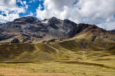
The LaRaya Pass (meaning “The Line” or “Crease”) is a six-mile stretch through the LaRaya Mountain Range northwest of the Peruvian Altiplano and Lake Titicaca and south of Cuzco
After his father’s death, Nephi and his party traveled north away from the site where Lehi landed, passed through what is today the Titicaca Basin, about 240 miles south of Cuzco, and through the La Raya Pass (14,170-feet), along a small river known as Urubamba, from Quechua Willkamayu (meaning “Sacred River”), and upriver it is called Vilcañota from Aymara Willkanuta (meaning “house of the sun”), which originates near the La Raya Pass as a headwater of the Amazon River.
    This ever-widening river flows north-northwest for 450-miles before coalescing with the Tambo River to form the Ucayali River. The Urubamba drops down to Cuzco at 11,154-feet and beyond to Machu Picchu in the Sacred Valley, which is only 7,784 feet.
    Upon reaching the long, narrow valley that was once an ancient glacier lake bed in the center of natural routes through the mountainous peaks surrounding it, which would later become known as Qosqo (Qusqu, from the Aymara qusqu wanka, meaning “Rock of the owl”).
    Here, three rivers, the Huatanay, Tullumayo, and Chunchul join, where Nephi and his party moved to the far end, evidently to be as far from the southern entrance to the valley as possible. The first habitation of settled populations is considered to be around 500 B.C. or earlier, with its main settlement an area today called Chanapata. Today Cuzco, which covers 149 square miles, extends throughout the Huyatnay (Watanay) river valley located on the eastern end of the Knot of Cuzco at an elevation of 11,152 feet. To its north is the Vilcabamba mountain range with mountains reaching 13,000 to 20,000-feet in elevation. About 37 miles northwest of the city is the highest peak, called Salcantay at 20,574 feet.
Two entrances/exits to/from Cuzco Valley; Left: the one in the south leading to La Raya Pass; (Right) and the one in the north, leading to the Sacred Valley

This valley area has a subtropical highland climate (Köppen Cwb) and is generally dry and temperate, with two defined seasons—a dry season from May to August, that has abundant sunshine and occasional nighttime freezes, with July the coolest month (equivalent to January in the northern hemisphere) with an average temperature of 49.5 °F. The wet season is from December to March (with February equivalent to July in the northern hemisphere), with night frost less common, and November averaging 55.9 °F. Although frost and hail are common, the only snowfall ever recorded was in June 1911. Temperatures usually range from 32.4 to 69.6 °F, with sunshine hours peaking in July. In contrast, February has the least amount of sunshine.
    This suggests then that during the dry season is when the Lamanites throughout their encounters and warfare with the Nephites, would have chosen to attack, which would be from about April/May through possibly October—rainfall during this time averages less than two days per month, and humidity is at its lowest. They would have broken off the conflicts and returned back to their highland home around November, to sit out the west season from December through March, when two-thirds of the year’s rain falls, with rain averaging over 15 days a month and humidity at its highest, and when the rivers swell and overflow, mudflats occur, and movement of large bodies of men would have been quite difficult. In fact, Mormon tells us of a continual returning to battle or returning to their homeland of both the Lamanites and Nephites, that they “returned in season” and that they did “arrive in season,” etc. (Alma 25:13, 27:1, 50:35, 52:17, 57:17-18).
    Even from earliest times, Cuzco was busily engaged in mining gold, a very extensive commodity in the valley, as well as agricultural effort with corn, barley, and quinoa. Also, from earliest times, the valley was divided into sections—the first of which was between “Upper Cuzco” (Hanan-Cuzco) and “Lower Cuzco” (Hurin-Cuzco), a division that has puzzled and confused historians for centuries. Toward the southern entrance to the valley was an area called que llamó de Rurincuzco, barrio de abajo del Cuzco, that is, a township of Rurincuzco, considered a suburb below Cuzco. This later became known as Hurin-Cuzco, or the lower valley.
When the Spaniards first arrived, they were astonished at the long, straight streets, organized buildings, and overall beauty of the city’s edifices 

Garcilaso de la Vega states that the people of Cuzco Alto (Hanan-Cuzco) were to be respected and considered as elder brothers, while those of the lower part were treated as younger brothers, which evolves from the belief that Hanan members were vested with the most prestigious status because they belonged to the main royal line (Qhapaq Ayllu) by both parents. They were "legitimate" or "elder" children who opposed the "second" children born of a noble father and a foreign mother.
    Thus, the “halves system” surviving in Inca times, was a hierarchical structure of the descent group based on the binary opposition between the eldest son and the minor son. The former were qhapaq , that is, opulent and of royal descent of father and mother, while the latter were wakcha quncha or poor and orphans, children of ladies without rich ancestry.
    Where this got started is not known, however, when Nephi settled his party in the valley, he chose to do so in what later became known as Hanan-Cuzco, or the upper valley. As the Nephites increased in number, they obviously extended southward in the valley toward its southern entrance, or what became known as Hurin-Cuzco, or the lower valley. Perhaps it is a carry-over from the ancient Hebrew "Law of the Firstborn," or Primogeniture of the Hebrew family that existed in Biblical times providing the bulk of the father's estate to the first born son. In fact, ancient Near East culture has believed that the first born human or animal had the purest and strongest blood, and thus were considered the best representatives of their race, based in part on the fact that the lifespan of Adam and the subsequently shorter lifespan of his later descendants provide an example for the basis of this belief. Thus, in Hebrew culture, the "firstborn" law anointed the oldest son with the assignment of special privileges and responsibilities, being second to his father and had the authority over his younger siblings. We see the result of this when not followed in the case of Laman's anger and hatred by his descendants toward Nephi and his descendants that Nephi was given the birthright (priesthood) privilege of the family, and the cause of most of the Lamanite-Nephite problems over the centuries.
The Collasuyu Road today. Originally it was paved with large, flat stones, and connected the Titicaca Basin with the Cuzco Valley
In the beginning there was a single road built within the valley, what later became known as the Calla Suyu, or Collasuyu, a road that extended into the southern realm of the four-quadrant Inca Empire, moving out of Cuzco to the south and the LaRaya Pass and then into the Titicaca Basin.
    There was also Antisuyu (eastern), a road that stretched eastward toward Pisac and then northward into the Urubamba river valley; Kontisuyu (western) left Cuzco in a southwesterly direction to a place south of Nazca along the coast; and Chinchasuyu (northern), part of the great highland road which stretched from Colombia, through Cuzco, and down to Chile, moving out of Cuzco, in a northwesterly direction and crossing over the Apurimac river by way of a great suspension bridge made of natural fibers woven together creating a strong rope and reinforced with wood creating a cable floor and attached to a pair of large stone anchors on each side of the canyon.
    Much has been written about these as "Inca roads," but the Nephite nation would have built these roads at one time or another, both early on when Nephi and his party arrived and their descendants began expanding and filling up the land (Jarom 1:8), and also later when “there were many highways cast up, and many roads made, which led from city to city, and from land to land, and from place to place” (3 Nephi 6:8).
    It should be noted that when Ammon and his brethren arrived on the hill above Shilom and Nephi, they camped for the night, then Ammon and tree others went down into the land of Nephi below where they encountered the king, who later told them, ”I desire to know the cause whereby ye were so bold as to come near the walls of the city, when I, myself, was with my guards without the gate?” (Mosiah 7:10). Now, as one of our readers, David K., pointed out, “any proposed location for the city of Nephi should claim that the location at least used to be a walled, gated city.” Thus, when the Spanish arrived, they should have found, at least the remains of a walled and gated city.
Map drawn by conquistador Cieza de León, and published in his work, Crónica del Perú, 1553 showing not only the walled city of Cuzco, but a gate for the entrance

In fact, not only did they find such, but it was depicted in a drawing by Pedro Cieza de León, and published in his work, Crónica del Perú, 1553, later translated by Clements R. Markham and published in London in 1883 (Cambridge University Press). The drawing clearly shows a walled city with a main gate. In addition, an engraving by an early artist of the Manco Inca revolt also shows a walled city and a gate.

An early engraving of the 1536 rebellion and revolt of Manco Inca, who marshalled 40,000 Inca warriors that attacked the Spanish-held city of Cuzco, shows a walled city with a gate