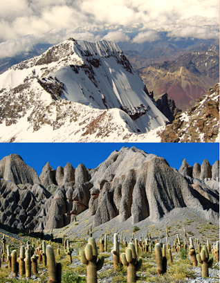
Geologic history shows that certain parts of South America were the only ones above water until the Andes rose up to their great height, which also brought the Amazon Basin and most of the eastern portion of the land up out of the water. At the same time, the Panama Isthmus rose up to connect Central and South America.
The geologic history of South America can be summarized in different developmental stages, and was characterized by a complex series of amalgamations and dispersals of stable blocks of protocontinental crust called cratons. The second stage coincides time the cratons and material accreted to them which contributed to the formation of continents. The third stage was the development of continents themselves.
As an example, in South America the duration known as Louis Aivew are known in the Amazonia, Luis Alves, and São Francisco cratons, although precisely dated rock samples are scarce. Ages older than 3 billion years have been reported in the Imataca Complex of Venezuela and in the Xingu area of Brazil, both in the Amazonia craton. The oldest rocks found so…
Cratons are the building blocks of continents
There are five cratons—Amazonia, São Francisco, Luis Alves, Alto Paraguay, and Río de la Plata—that represent the core of South America, and (with the exception of the Alto Paraguay craton) those now appear as upwarped massifs arrayed from north to south in the immense eastern portion of the continent; a number of other crustal blocks were also accreted along the margins of South America over geologic time.
The lofty ranges and intermontane plateaus of the Andes rise along the entire western margin of the continent and represent the collision of the Pacific and South American plates brought about by the opening of the South Atlantic. Finally, vast, down warped, sediment-filled basins are found between the cratons and along the entire eastern margin of the Andes. The term craton is used to distinguish the stable portion of the continental crust from regions that are more geologically sactive and unstable.
The present tectonic framework of South America consists of three fundamental units: the ancient cratons, the relatively recent Andean ranges, and a number of basins. The term craton is used to distinguish the stable portion of the continental crust from regions that are more geologically active and unstable. Cratons can be described as shields, in which the basement rock crops out at the surface, and platforms, in which the basement is overlaid by sediments and sedimentary rock.
This means that the craton is typically elevated enough to be seen above the surface and appears as small or large islands in the midst of the sea. These stable fragments of continental crust, which are an old and stable part of the continental lithosphere that consists of the Earth's two topmost layers, the crust and the uppermost mantle. Having often survived cycles of merging and rifting of continents, cratons are generally found in the interiors of tectonic plates, and are characteristically composed of ancient crystalline basement rock, which may be covered by younger sedimentary rock. They have a thick crust and deep lithospheric roots that extend as much as several hundred miles into the Earth's mantle.
In South America, these ancient cratons that rose along the eastern borders of the continent, called the Brazilian craton and the Guiaha craton, have often survived cycles of merging and rifting of continents, cratons are generally found in the interiors of tectonic plates. They are characteristically composed of ancient crystalline basement rock, which may be covered by younger sedimentary rock.
In Ecuador lies one of the best episodes ever found where a sedimental layer is deposited over preexisting rock, and where two units were juxtaposed by a fracture on which the fracture has slid.
All of this leads one to understand what geologists have long told us—that the Amazonian Basin was long submerged until it surfaced in recent geologic times.
Best road cut ever? Quite possibly. Fall out from several episodes of activity at Chimborazo volcano, Ecuador
In geology, basement and crystalline basement are the rocks below a sedimentary platform or cover, or more generally any rock below sedimentary rocks or sedimentary basins that are metamorphic or igneous in origin.
The Amazonian Craton is a geologic province located in South America. It occupies a large portion of the central, north and eastern part of the continental base and only the Guiana Shield and Central Brazilian Shield (Guaporé Shield) constitutes respectively the northern and southern exhumed parts of the basement craton.
It should also be noted that the extensive central cratons of continents may consist of both shields and platforms. A shield is that part of a craton in which (usually) basement rocks crop out extensively at the surface. By contrast, in a platform the basement is overlain by horizontal or subhorizontal sediments.
This means that in the past, when South America was mostly submerged, there were a few areas that were above water, i.e., the western shelf from Colombia to middle Chile (Santiago), and from the west coast inland to what is now the eastern slope of the Andes Mountains. At the same time, there were shields above the surface along other east areas of the continent—Brazilian and Guiana.
As for the Panama knot, the Glomar Challenger deep sea drilling rig confirmed this understanding when it showed that Panama, at one time in recent history, was not connected to South America. In addition, as many geologists now recognize, the Andes mountains rose suddenly, also in recent history.
The fact is, that the western strip, or Andean area, of South America—that land west of the Andes—has always been considered as separate and generally referred to as the Andean Plateau or just Peru. Consequently, the word Peru is generally used by archaeologists to include not only the modern Republic of Peru, but also the highlands of Bolivia and often the northernmost part of Chile as well, although some historians and scholars have also included all of Ecuador in this term and almost all of Chile, while still others include southern Colombia.
This cultural area shared a common tradition of long duration and is often called by archaeologists the Central Andes. It extends westward from the Andes to the Pacific Ocean and from just above the equator to about 35º south latitude. Further south, the land does not offer an agreeable living climate.
It is the agreement of those who have traveled the Chilean coastal lands that this narrow fringe of western land hangs from the Andes Cordillera, second only to the Himalaya in height, like a gray balcony over the largest of oceans. The desert at the northern boundary with Peru, the natural frontier of the Andes with Bolivia and Argentina, and the sea in the west and south give Chile the psychological character of an island; which certainly fits the description given by Jacob and Nephi about their land of promise being an island (2 Nephi 10:20).
Basement Rock rises to form hills and mountains
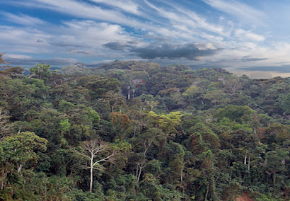
To the east of the amazing Andes Mountains lies the Amazon basin, which at one time was entirely underwater and even today, is rarely more than 14 feet above sea level, with much of it at or just below sea level. It is the largest river basin in the world, covering an area of about three million square miles, making it more than twice the size of the next largest river basin, with the river having eleven times the volume of the Mississippi.
The Amazon used to flow westward into the Pacific until the Andes Mountains rose up to block its westward flow, causing it to become a vast inland sea. As the eastern continent rose up out of the water, it became a massive swampy, freshwater lake and eventually a river outlet to the receding Atlantic Ocean, with a vast near-continent wide river basin about the size of the United States. This amazing river is as large as the next 8 world rivers combined, and the volume of water flowing from the basin into the sea is about 11% of all the water drained from the continents of the earth.
The greatest flow occurs in July, and the least in November. While there are many rivers flowing through the basin, the most important and well known is the Amazon. The width of the Amazon ranges from about one mile to as wide as six miles, and during flood season, as wide as twenty-two miles. However, the Amazon is only about 20 to 40 feet deep, and runs westward for 1000 miles, the river itself rising only 144 feet compared to the Mississippi, which drops 1475 feet. Geologists agree that in times past, this vast basin was submerged until the rising of the Andes, which brought this basin and the land surrounding it up out of the water to form the continent of South America as we see it today.
When taking all of this into consideration, it is not hard to visualize that the entire basin area east of the present-day Andes was once under water as Jacob said and Nephi recorded (2 Nephi 10:20).


