Tuesday, November 30, 2021

Matching the List of Descriptions in the Scriptural Record – Part I

When reading the various theories of Lehi’s landing site and the home of the Nephites for a thousand years, most theorists have a list of items they feel need to be met for a Land of Promise location to be determined. These lists vary from five or six to ten or twelve—but many, if not most of these lists contain items that are either not in the scriptural record, mis-interpreted or mis-understood by the theorist(s), or inadequately addressed or do not demonstrate what the theorist(s) think they do, or is not evident from what Mormon or the others say, or that reason suggests they are being mis-used. In fact, most items on these lists are not listed with the scriptural reference given us by Mormon, Nephi, Jacob, or Moroni. As an example:

Sorenson’s map of his Land of Promise where Mormon’s “west” is Sorenson’s “North” and Mormon’s “South” is Sorenson’s “East”


1. John L. Sorenson trying to show why Mormon did not use the cardinal directions we know, but a different understanding of directions he claims were known to the Hebrews, but does not show a scriptural reference to support his conclusion of using west instead of north and east instead of south n both land and sea locations;

2. Some theorists’ list includes a record of writing in post Nephi times that show the Nephi writing is still being used—unrelated to the geography but important to some modelers is current evidence of ancient writing, which they claim there are only two regions in the Americas showing the high degree of ancient civilization required by the text of the Book of Mormon.

One of these locations is centered in South America in the region once occupied by the Inca civilization. The other is centered in Mesoamerica in the region once occupied by the Maya and the Olmec civilizations. They claim that of the two, only the civilizations in the Mesoamerican region are known to have had a sophisticated form of writing (Michael D. Coe, The Maya 6th ed., Thames & Hudson, New York, 2002, p13).

While that is the opinion of the Mesoamerican theorist(s), it is not accurate—there are several examples of ancient writing found in Andean Peru that is at least on a par with Mesoamerica. The difference is that it was not used by the Inca—whose accredited talents and achievements were not accomplished by them, but by an earlier civilization. Regarding post-Nephite writing, Rongorongo writing of Easter Island that was transported there from Peru, has defied interpretation and translation by numerous linguists who have made the attempt;

Two different Narrow Necks of Land on one Heartland map


3. Some lists show that their Narrow Neck of Land is the Niagara Peninsula, which runs east and west (not north and south as Mormon describes)—others claim there are as many as five narrow necks and narrow passes scattered over their models, one being between the Black Swamp of Lake Erie and the Grand Kankakee River marsh and Lake Michigan;

4. Mesoamericanists list the Narrow Neck of Land running east and west—their Isthmus of Tehuantepec—at between 130 and 144 miles in width—obviously, not possible for a Nephite to cross in a day-and-a-half;

5. Heartlanders use modern-day prophecies, statements, and even opinions, rather than rely initially on a scriptural Book of Mormon reference and state it as such. As an example, of the 32 statements in the Appendix of Porter and Meldrum’s book Promises and Prophecies, only 3 are referenced to the Book of Mormon—15 are newspaper articles, 3 are letters, and 4 are articles in various formats;

6. Mesoamericanists claim that the limited geography models are the result of the text of the Book of Mormon—and to be realistically interpreted as an historical document, the events described must be limited to an area of several hundred square miles (Bruce H. Porter and Rod L. Meldrum, Prophecies and Promises: The Book of Mormon and the United States of America, Digital Legend Press and Publishing, New York, 2009, p13);

7. Mesoamericanists and Heartland models have very different climates. First, Mesoamericanists associate climate only with the warmth of the Land of Promise and the wearing of loincloths; however, what is far more important about climate is the growing of seeds brought from Jerusalem which they planted in the location of Lehi’s landing.

In 600 BC, seeds grew well only in the same climate as that in which they were developed, and since Jerusalem has a Mediterranean Climate, Lehi had to have landed in an area with a Mediterranean Climate for his seeds to have grown exceedingly and produced an abundant crop (1 Nephi 18:24).

Example of the Köppen-Geiger-Pohl Climate Classification. Over many years, they have succeeded in mapping the entire world in their very popular climate categories


Jerusalem’s Köppen-Geiger-Pohl Climate Classification is Csa or Csb—dry summer climate characterized by dry summers and mild, wet winters (The difference is Csa: hot, dry summers or Csb: cool, dry summers). However, Mesoamerica’s Köppen-Geiger-Pohl Climate Classification is CwbOceanic Subtropical Highland Climate, and also Aw—Tropical Savanna Climate, neither of which would have provided a growing climate for Lehi’s seeds “brought from Jerusalem, which is a dry summer climate is characterized by dry summers and mild, wet winters

Secondly, Heartland theorists claim they have a similar climate with that of Jerusalem since they are on the nearly same latitude—Jerusalem is 31.7º north Latitude; Apalachicola, Florida is 28.7º Latitude; and 30.4º for Tallahassee, Florida; while Crystal River, Florida is 28.9.

The problem with this is that Mediterranean Climates outside of the Mediterranean basin are found along the western coasts, not the eastern or southern coasts in the southeast United States.

The climate classification for Apalachicola, Florida, is Cfa, “humid subtropical,” with short, mild winters and hot, humid summers. In addition, the proposed landing site of Lehi at Crystal River, Florida, also has a Cfa classification, “Humid subtropical climate,” and found on the eastern sides of the continents between 20º and 35º N and S latitude; besides, there is significant rainfall throughout the year in Crystal River—even the driest month still has a lot of rainfall.

Other than the Mediterranean Sea area itself, all Mediterranean Climates are located on the western coastal area of continents


On the other hand, in South America, Coquimbo and La Serena, Chile, are on the western coast of the continent at 30º south latitude in South America, and have a Mediterranean Climate. As Nephi said of their landing site: “we did put all our seeds into the earth, which we had brought from the land of Jerusalem. And it came to pass that they did grow exceedingly; wherefore, we were blessed in abundance” (1 Nephi 18:24).

8. Metallurgy (Ether 10:7,27), gold and silver (1 Nephi 18:25; Helaman 6:9), did not exist in the Heartland and Great Lakes during Jaredite or Nephite times. While there was plenty of copper in the Great Lakes area, and very limited scattering of gold and silver east of the Rocky Mountains, full metallurgy as described in the scriptural record was unknown. In Mesoamerica, metallurgy of any kind was not known until sometime between 600 and 900 AD.

However, Andean Peru was known for its full metallurgy from the Jaredite period onward  without interruption. To show the extensiveness of these ores in Andean South America, today Chile and Peru are world leaders in copper, gold and silver reserves and world exports of these precious metals .

(See the next post for more information and comparing of the three popular theories against Andean South America)


Monday, November 29, 2021

The Apurímac River—River Sidon?

It has been difficult for most people knowing the scriptural record to consider South America as the Land of Promise, believing the erroneous and nefarious concept of Uniformitarianism, i.e., changes occurring over millions of years, rather than cataclysmic events, which can change suddenly.

After all, as geologists know, that in weakened places the magma can rise quickly, which is how the many volcanos of the cordilleras in Andean South America came into existence—there have not only been disastrous eruptions in recent times, but very fast landform changes. What the effect these changes  have had on rivers over time is unknown, especially dating back into pre-crucifixion times in the far away Western Hemisphere (Christoph Stadel, The Andes: A Geographical Portrait, Springer International Publishing, Switzerland, 2015, p35).

As an example, today the Apurímac River begins at 18,363 feet in the snow-fed mountains of Mismi in the western cordillera of the Arequipa Province, which has been determined to be the most distant source of the Amazon. Nevado Mismi is 10 miles northward from Chivay, 100 miles west of Lake Titicaca, 435 miles southeast of Lima, and 195 miles south of Cuzco—it is one of the highest points of Colca Canyon.

The Apurímac  River, “Main River” of Peru


Apurímac is taken from the Quechua apu, meaning “divinity,” and rimaq, meaning “oracle or talker.” Thus, the “Talking River,” or more accurately, “The Divine Talking River,” or “The Divine [God] Talks”—and of the latter, over time this became “the gentleman talks.”

This overall name was given because the sound of the river through much of its course is very loud, especially as it roars along, first north-easterly, then north-westerly, past Cuzco to the mouth of the Perené tributary. Anciently, it was believed that God spoke in the loud roar of the river as it passed.

Narrow Gorge of the Apurímac River Canyon


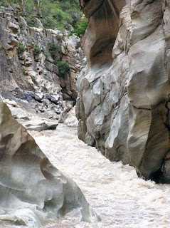
The course through narrow gorges with depths of up to 9,850 feet, nearly twice as deep as the Grand Canyon, with its course interrupted by falls and rapids. According to the Inca Garcilaso de la Vega, the Apurímac River was also called Capac Mayu, which means “Main River,” in order to highlight its importance over the rivers or streams—a similar tendency of Mormon highlighting only the River Sidon.

This tendency is also seen in the writing of the Spanish chronicler and conquistador Pedro Pizarro, regarding the Apurímac River, and the place this river occupied in the Andean worldview—much like Mormon’s placement of the Sidon River.

Pizarro wrote an extensive chronicle under the title Relación del descubrimiento y conquista de los reinos del Perú (“Relation of the discovery and conquest of the kingdoms of Peru”), that he finished in 1571, in which he stressed the importance of the river—again a similar tendency of Mormon highlighting only the River Sidon.

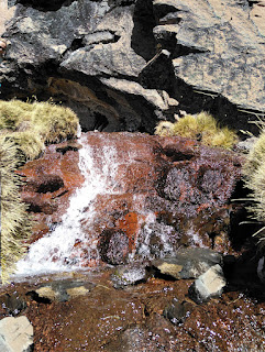
The meager beginning of the Apurímac River and, ultimately the Amazon


Mt. Mismi is 18,363 feet high, beginning with the small brook called the Carhuasanta, which is considered the source of the Amazon River; however, the source of the river changes continuously over time because of shifts of the weather and its impact on the countless micro-climates of the region.

In the wet season the mountains and altiplano (Andean Plateaus) are covered in snow; in the dry season they resemble a desert. The same might be said of the source of the river between pre-crucifixion and post-crucifixion times, thus a current map is no guarantee a river or mountain range in the Land of Promise existed in that format before the crucifixion.

Owing to its lengthy Andean tributaries, the Apurímac River is currently the farthermost source of the Amazon River, that in its current format, the small river Carhuasanta joins with the Quebrada Apacheta, becoming the Rio Lloqueta that eventually joins with three other rivers near the small mining town of Caylloma, which lies near the junction of these four rivers seven miles away that form the Apurímac River. The river has several more name changes before it becomes the Apurímac River—from Caylloma, it flows first north-easterly, then north-westerly past Cuzco to the mouth of the Perené tributary, thence east and north to its junction with the Ucayali. 


The Apurímac Ucayali, Ence rivers flow south to north through the entire area of the Land of Promise in Andean South America—it turns eastward at Iquitos, which would have been the coast of the Sea East


It is known as the Apurímac only down to the mouth of the Mantaro tributary 1325 feet, having dropped several thousand feet. From there it flowed to the mouth of the Perené (984 feet) to where it is known as the Ené, and from that point to its junction with the Ucayali (859 feet) as the Tambo.

Thus, the river flows from south to north until it joins the Amazon, the longest and largest river on the planet based upon the speed of its flow—certainly a requirement to send thousands of dead bodies all the way to the sea. In fact, of the six attempts so far to travel the Apurímac in its full length by three different types of rafts: oar boats, paddle boats, and inflatable kayaks (“duckies”)—only two have been successful

The valley of Apurímac, one of the three most important valleys in Peru (Hemisphere (Christoph Stadel, The Andes: A Geographical Portrait, Springer International Publishing, Geography, Switzerland, 2015, p7). It starts near the town of Pichigua in Peru, 160 miles due south of Cuzco and the Apurímac canyon in Checa, forming a rugged and extensive territory clear to the Pachachaca River, 145 miles due east of Cuzco, 10 miles west of Abancay—placing this rugged, elongated and narrow steephead valley or canyon with steep cliffs between mountains—in Mormon’s location—in the Narrow Strip of Wilderness between the city of Nephi (Cuzco) and the city of Zarahemla (Lima/Pachacamac).

This rugged and difficult configuration has different entrances and exits, all formed by the drains of the lakes that make interconnecting channels forming valleys, platforms and narrow spurs that end on steep slopes and fast and stormy waterfalls over the river.

Even today, this valley of Apurímac in the narrow strip with its constricted and reduced places is not suitable for population settlements—they are therefore suitable niches only for shelters, temporary hiding places and rugged and difficult escapes to the other side of the mountain range.

The maximum altitude of the populated territory reaches 11,811 feet and drops over 7,000 feet to its lowest point of 4593 feet, at the mouth of the Pachachaca River. This area provides three types of climates: puna, inter-Andean valley and wooded mountain. The mountains that are located to the west of the river exceed 13,123 feet, to the east of the valley is the Vilcaconga mountain range. 


The Vilcabamba Mountain Range that would have been in the Narrow Strip of Wilderness certainly not conducive to settlement in Nephite times or today


The Apurímac and Urubamba rivers are located on both sides of the Vilcabamba Mountain Range and constitute the natural geographical boundaries of the provinces of Abancay (Apurímac) and Cuzco. Today the Apurímac River source is the department of Arequipa, where it is called Chilla far south of Cuzco; It then travels north through part of the department of Cusco and to the border of Apurímac, Arequipa and Ayacucho. The Vilcanota River originates in the heights of the Raya, runs north and around Urcos becomes Urubamba, thus giving birth to the beautiful and fertile Sacred Valley of the ancients, between the towns of Pisac and Ollantaytambo. It has a journey of 172 miles between its origins and its confluence with the Ucayali, descending from 14,167 feet.

It is unknown how these rivers and mountains were configured prior to the crucifixion, when mountains became valleys, and other valleys became mountains “whose height is great” (Helaman 14:23).  Obviously, some changes were inevitable because when mountains—which are where river sources are located—change, the source of rivers changes, and likely a portion of their course is altered or disappears. Such might well have been the case width the Apurímac River, with its course ending in the new mountains rising to the northwest of Cuzco in the Abancay region.


Sunday, November 28, 2021

The Andean Uplift and the Apurímac River – Part II

Continuing from the previous post regarding the Andean Uplift and the Apurímac River and how they relate to the Land of Promise in the scriptural record.

Co-author with Dr. Sev Kender (previous post) was Kara Bogus (left) of Texas A&M University’s International Ocean Discovery Program, who served as the expedition project manager, adds: “This discovery is significant because one of the biggest questions remaining in plate tectonics is how subduction zones initiate. It’s half the story in plate tectonics. We understand well the other half (how the plates move apart from each other and create new crust), but we are just beginning to understand this half. Overall, our results mean that we need to modify our subduction inception models.”

This is because the initiation of tectonic plate subduction into the mantle is poorly understood. If subduction is induced by the push of a distant mid-ocean ridge or subducted slab pull, we expect compression and uplift of the overriding plate. In contrast, spontaneous subduction initiation, driven by subsidence of dense lithosphere along faults adjacent to buoyant lithosphere, would result in extension and magmatism. The rock record of subduction initiation is typically obscured by younger deposits, so evaluating these possibilities has proved elusive. In analyzing the geochemical characteristics of igneous basement rocks and overlying sediments, the uppermost basement rocks are very widespread and are supplied via dykes. They are similar in composition and age—as constrained by the biostratigraphy of the overlying sediments—to the geochemical characteristics of the basement lavas, which indicate that a component of subducted lithosphere was involved in their genesis, and the lavas were derived from mantle source rocks that were more melt-depleted than those tapped at mid-ocean ridges. It is proposed that the basement lavas formed during the inception of subduction in a mode consistent with the spontaneous initiation of subduction (Richard J. Arculus, et al., “A record of spontaneous subduction initiation,” Nature Geoscience, vol.8, 2015,pp728-733)

According to Eric Debayle (left), French National Centre for Scientific Research, “Continental stability may be linked to a shallow, buoyant mantle layer, and the deepest craton roots can be destabilized and removed by mantle plumes.” In fact, the great antiquity of craton keels implies that the deep roots of the continents are stable and have largely been preserved from the erosive influence of mantle convection since their formation. However, the recent report shows that the deepest cratonic lithosphere can be removed when perturbed by mantle upwellings, challenging the classical view of stable cratonic roots.

A Craton is an old and stable part of the continental lithosphere, which consists of Earth's two topmost layers, the crust and the uppermost mantle. Having often survived cycles of merging and rifting of continents, cratons are generally found in the interiors of techtonic plates. This suggests that the long-term stability of cratons is due to the shallower buoyant lithosphere (Eric Debayle, “When Plume Tickle Continents,” News & Views, Nature Geoscience,” Vol.11, Macmillan Publishers, London, February 2018, pp150-154).

What this means, in brief, is that during the period of the crucifixion, the destruction resulting from the incident triggered by the cataclysmic episode caused the lower levels of the earth around what is now western and coastal South America, due to these craton roots either being removed or modified by mantle plumes, creating a buoyant and shallow cratonic lithosphere (Jiashun Hu, et al., Modification of the Western Gondwana Craton by Plume,” Nature Geoscience, U.K., Vol.11, 2018, pp203-210).

Mountains rose in the course of 3 hours “to a height which is great” (Halaman 14:23). For comparison the houses and llama herd is in the foreground


Thus, the South American continent rose higher from this fast-moving subduction, that forced mountains to rise out of level ground, previously just beneath the surface, into ranges “whose height is great,” as Samuel the Lamanite described the event.

In a period of only three hours, God slammed tectonic plates into one another beneath this area, forcing the Andean Uplift or orogeny that rose sharp, angled breaks upward into 45 lofty heights of 20,000 feet to 22,000 feet peaks in Peru alone, and 251 over 18,000 feet in height along the entire Andes range.

Indeed, the Lord put it in Samuel’s heart to describe this event as: “And behold, there shall be great tempests, and there shall be many mountains laid low, like unto a valley, and there shall be many places which are now called valleys which shall become mountains, whose height is great” (Helaman 14:23, emphasis added).

Now consider that there were already mountains of some degree in the Land of Promise before this time, for Samuel said, “there shall be mountains laid low, like unto a valley,” and Nephi said of his vision: “and I saw mountains tumbling into pieces; and I saw the plains of the earth, that they were broken up” (1 Nephi 12:4); consequently, we can understand that the Land of Promise was made up of valleys and mountains prior to the crucifixion. 

The largest river and water source begins with a trickle, usually in a small creek somewhere in the heights of a mountain


Mountains, of course, from snow melt and mountain lakes cause rivers to flow, and as we understand before the crucifixion there was at least one river, the Sidon, in the Land of Promise. In fact, in Alma alone, “River Sidon” was mentioned 28 times, “Waters of Sidon” was mentioned 7 times, and “Head of Sidon” mentioned once, or 36 references to the Sidon were given.

Thus, we can also suggest that the mountain arrangement that existed before the crucifixion, covering about 630 years of Nephite existence, caused a certain path or course for the River Sidon, which flowed or ran by the land of Zarahemla (Alma 2:15), in the Valley of Gideon east of the river Sidon (Alma 2:26-27), where the City of Gideon was loated, which was east of the river Sidon (Alma 6:7). In addition, the Hill Amnihu was also east of the river Sidon (Alma 2:15,17), and on the west of the River Sidon was a west valley (Alma 43:32). This is all important, so we understand that the River Sidon did not run past the city Zarahemla itself, as most theorists claim, but in the borders of the land some distance to the east “in the borders of the land.”

In addition, we find that according to Mormon’s description, as we have repeatedly covered in past articles, the head of the River Sidon was located “in the narrow strip of wilderness” (Alma 22:27) between the Land of Nephi to the south and the Land of Zarahemla to the north. However, for those who are still not convinced, consider the meaning in this scripture:

“And it came to pass that the [Lamanite] king sent a proclamation throughout all the land [Land of Nephi], amongst all his people who were in all his land [Land of Nephi], who were in all the regions round about, which was bordering even to the sea, on the east and on the west, and which [Land of Nephi] was divided from the land of Zarahemla by “a narrow strip of wilderness”—an area today referred to as the Chicón Mountain in the Cordillera Urubamba Range, an 18,000-foot high series of mountains—which ran from the sea east even to the sea west, and round about [i.e., curved] on the borders of the seashore, and the borders of the wilderness which [narrow strip of wilderness] was on the north [within the narrow strip of wilderness] by the land of Zarahemla, through the borders of Manti [in this narrow strip of wilderness], by the head of the river Sidon [in this narrow strip of wilderness], running from the east [East Sea] towards the west [West Sea] -- and thus were the Lamanites and the Nephites divided [by this narrow strip of wilderness].

The Narrow Strip of Wilderness, in part, is in the Urubamba Mountain Range


Consequently, this narrow strip of wilderness, evidently a mountainous range running from sea to sea, separated the Land of Nephi from the Land of Zarahemla, with the wilderness (that is, unoccupied land with no permanent buildings, structures and agriculture) turned northward along the east shore and the west shore, and in those wilderness areas along the shore were the more part of the idle Lamanites encamped in tents.

Now in this range, which held the headwater of the River Sidon, at least up until the crucifixion, of which Samuel the Lamanite prophesied, the mountains would be laid low into valleys, while other mountains in other valleys would rise to great heights. This would have changed the headwater of the Sidon, perhaps pushing it further south to where higher, snow-capped mountains began draining their snowmelt into what became a river, or series of rivers, that gained momentum as they flowed downward from many thousands of feet in height to lower levels.

This could have (speculatively) resulted in what we now see as the Apurímac River, that flows northward from the Nevado Mismi mountain height in the Chila Mountain Range along a winding course all the way to the Amazonian Basin, which is barely above sea level even now, and into the Amazon River in its 4,000-mile flow to the Atlantic.

While this is speculative about the Sidon, the science surrounding the idea is all factual, and could be the answer to the present location of the Sidon River. Only time, and more geologic studies and knowledge, will tell.


Saturday, November 27, 2021

The Andean Uplift and the Apurímac River – Part I

Because of the Andean Uplift (see the ast two posts), many changes took place in the narrow western area of Andean South America. One of those changes would have been rivers which would have flowed from the original mountains down to the sea but with the flattening of those mountains and the rising of new mountains “whose height is great,” would  have changed the origin points of most rivers, or at least changed the direction of flow toward the sea.

Recently, Sandra Villacorta (left), a Research Fellow, College of Engineering, Charles Darwin University with a Ph.D in Modelling and Environmental Risk Analysis, and an MSc degree in Geological Engineering, has completed extensive field work for the Polytechnic University of Madrid (Universidad Politécnica de Madrid). She and her colleagues, who studied the dynamic geologic processes of the Apurímac Region, including the crustal tectonic rock cycle, completed extensive mapping and georeferencing of the processes involved with the Apurímac River—referred to by locals as the Divine River, or the River of Divinity.

This work referenced the vulnerable areas for mass movements, especially in the Abancay, Andahuaylas or Chalhuanca districts in the area west of Cuzco, and extending south between that city and Ayacucho—an area of steep canyons, a strong river, and mountains. In other words, a narrow strip of wilderness.

Red Circle: The Abancay, Andahuaylas and Chalhuanca Districts where the georeferencing processes are located, making this entire area a critical geologic zone, where major slides, flows and mountain movements have occurred


In this Apurímac region, thirty-two critical zones of direct geologic hazards of severe earth and mountain movement have been identified by Ingemmet, using geologic studies, satellite photography and extensive field work. While current work in the study is meant to relocate and prevent future loss of life from severe geologic damage, it is important to consider the overall area of geologic weakness as a historic factor in understanding the region roundabout the Apurímac River. This area of ancient removal deposits and unstable rock masses that underlie the current concerns for future damage to the area rests in the unstable area dating back into pre-historic times, no doubt clear to the period of the Andean Uplift.

The geologic structural properties that make up this region may well have been permanently eroded due to the changes that took place during the Uplift some two thousand years ago, leading to the continuing and worsening instability of the region today. It should also be noted that the north and central parts of the Apurimac Region (shown in the red circle on the map above), are more likely for the occurrence of landslides and earth movement today as a result of till movement and colluvial and till materials, mostly with steep slopes and substrates formed by slates, phyllites, limestones, sandstones with interbedded shales, siltstones and mudstones, and conglomerates, tuffs and pyroclastic rocks.

Change in some rivers could result in a change in the Sidon River as a result of mountains changing


It should be noted that, according to geologists, subduction orogeny (subduction zones developing belts of deformation in the overriding plate’s crust, which in part leads to mountain building, has been occurring since the establishment of the continental area of South America). These subduction zones, the area where an oceanic plate is being forced down into the mantle by plate tectonic forces, causing enormous friction between the plates, has resulted in a continuous movement of the continental area, both those parts above the surface and those beneath, throughout pre-historic times, as well as the more modern historic period.

When the tectonic plates collide the underlying plate is consumed into the Earth’s mantle, creating a hot magma that erupts from volcanoes on the surface of the overlying plate. These volcanoes form a volcanic arc—a chain of volcanoes, at a depth of about 60 miles and hundreds to thousands of miles long, that form above a subduction zone, that is, an island volcanic arc forms in an ocean basin via ocean to ocean subduction

When two oceanic plates collide against each other, the older and therefore heavier of the two subducts beneath the other, initiating volcanic activity in a manner similar to that which occurs at an oceanic-continental convergent plate boundary and forming a volcanic island arc.

Showing that tectonic plate subduction is an ongoing process of learning, Dr. Sev Kender (left), a Research Fellow from the School of Geography at The University of Nottinghamin in Britain, stated: ““We found the crust to be much younger than expected, a stunning discovery indicating that we needed to readjust our ideas of how the subduction zone formed. The crust has chemical characteristics indicating it was formed at the time the subduction zone started, rather than much earlier. The crust may have formed in an extensional setting through seafloor spreading, in some ways similar to that formed at mid-ocean ridges today, although in this case near the newly-formed subduction zone.”

With this understanding, Kender went on to say: “We found that in plate tectonics, as opposed to the previously believed theory of long-time (millions of years) development of subducting crusts being induced, found that the crust can form spontaneously along a previous line of weakness without previously being uplifted, thus suggesting an immediate development of subduction not previously understood (Richard J. Arculus, et al, “A Record of Spontaneous Subduction Initiation,” Nature Geoscience Vol.8, 2015, pp728-733).

Mid-ocean ridges, which are found in all ocean basins, are where fresh new oceanic crust is formed and are the opposite of subduction zones. There are numerous ‘transform faults’ near ridges today, enormous fractures through the crust that form due to the spreading plates interaction with the curvature of the earth.

Such understanding shows a remarkable change in thinking by scientists about the time involved in the subduction process. The Mantle Plume forms and as it rises, and drives the mantle upward, lifting the surface of the land upward—with the spontaneous movement, this can result in sudden rising of the surface, quickly forming mountains. The larger the plume that falls away, the higher the mountain-building.

While it is understandable that the uninformed observer of geography considers landforms to have been fairly constant throughout history, these subductions occur because Earth has limited surface areas, convection and conduction of heat from the core as the Earth cools off means that denser basaltic ocean plates have to subduct until the oceanic crust is under a high enough pressure and temperature that minerals start to melt.

This, of course, has caused the altering of plate tectonics, the continents, mountains, and topography of the Earth in general. Some areas, especially along the Pacific Rim where subduction occurs more readily, resulting in earthquakes and volcanic action, are far more active, and thus, far more altering than areas, such as Europe, Asia and Africa. Obviously the subduction Zone Physics, that is the sinking of the oceanic lithosphere (sediments, crust, mantle), by contrast of density between the cold and old lithosphere and the hot asthenospheric mantle wedge, while not the only one, is the strongest force to drive plate motion and is the dominant mode of mantle convection.

(See the next post regarding the Andean Uplift and the Apurímac River)


Friday, November 26, 2021

The Andean Uplift that Changed the Whole Face of the Land (3 Nephi 8:12) – Part II


South America as it is today: 6.9 million square miles


Continued from the previous post regarding how uninformed individuals have overlooked South America as the Land of Promise because they look at the continent as it appears today, not as it appeared prior to the crucifixion.

It is interesting, though, that initially in the 1830s, with the publication of the Book of Mormon, early members thought of the Land of Promise as North America being the Land Northward, South America being the Land Southward, and Central America being the Narrow Neck of Land. Then with the controversy over Frederick G. Williams note of Lehi landing at the 30º South Latitude in Chile, followed by the advent of the limited Land of Promise theory promoted by FARMS and scholars at BYU, South America was disregarded and the Land of Promise was shrunk to be just Mesoamerica.

Today, of course, there are numerous theories that disregard Andean South America because as mentioned earlier, they assess it as it is today—not as it was before the crucifixion.

Geologic studies show that in antiquity, the Andean Belt (Andean Shelf Uplift) was above the water line, with ancient seas creating an island; today, with the full formation of the Andes, they are the longest continental mountain range in the world


Prior to the crucifixion, South America was a series of one large island, a few smaller islands, solid shields, and the Andean Belt or Shelf. Then, with the crucifixion: “the face of the land was changed, because of the tempest and the whirlwinds and the thunderings and the lightnings, and the exceedingly great quaking of the whole earth” (3 Nephi 8:12,emphasis added), “and thus the face of the whole earth became deformed, because of the tempests, and the thunderings, and the lightnings, and the quaking of the earth” (3 Nephi 8:17, emphasis added). In fact, the Disciple Nephi emphatically stated: “And there was also a great and terrible tempest; and there was terrible thunder, insomuch that it did shake the whole earth as if it was about to divide asunder” (3 Nephi 8:6).

Now, in 1828 the word “asunder” meant: “Apart; into parts; separately; in a divided state,” and the word “divide” meant: “To part or separate an entire thing; to part a thing into two or more pieces.” “Asunder” is used 22 times in the Bible, 13 in the Old Testament and 9 in the New Testament.

Thus the Disciple Nephi uses “divide asunder” to meant “to break apart or separate the entire Earth (all of the Land of Promise) into parts—which is the same meaning these words “divide asunder” have today.

Consequently, the destruction brought about by the relentless quaking of the whole Earth (entire Land of Promise) over a three-hour period (3 Nephi 8:19) was so constantly persistent that Nephi felt it necessary to compare the destruction to the breaking up into pieces of the entire land. This is even far more severe when we compare the longest earthquake on record of “about 10 minutes” in Santiago, Chili, on May 22, 1960, with the three hours recorded by Nephi (3 Nephi 8:19)—and the 4 minutes and 38 second Alaskan earthquake, the longest quake in North America; however, compare that to the 10 to 30 seconds that most earthquakes last3 hours would be a horrendously l-o-n-g time.

In a paper published in the Earth and Planetary Science Letters, Carmala Garzione (left), a professor of earth and environmental sciences at the University of Rochester, and colleagues, explains that the Altiplano plateau in the central Andes—and most likely the entire mountain range—was formed through a series of rapid growth spurts. According to Garzione: “This study provides increasing evidence that the plateau formed through periodic rapid pulses, not through a continuous, gradual uplift of the surface, as was traditionally thought—in geology terms, it’s the blinking of an eye” (Carmala Garzione, et al., “Andes Mountains Formed by Growth Spurts,” Earth and Planetary Science Letters, University of Rochester, New York, April 21, 2014, emphasis added).

According to Garzione: “In geodynamics, delamination refers to the loss and sinking (foundering) of the portion of the lowermost lithosphere from the tectonic plate which it was attached and occurs when the lower continental crust and mantle lithosphere break away from the upper continental crust” (Carmala Garzione, “Mountain Ranges Rise Much More Rapidly than Geologists Expected,” Earth and Planetary Science Letters, University of Rochester, New York, 2008).

This “breakaway” causes the upper crust to shoot upward like a cork that is released below the surface in water. Depending how large the lower continental crust and mantle lithosphere are before breaking away from the upper crust, determines how far the upper crust ascends. While geologists talk in millions of years, to the Lord this took place in a very short time and likely in surging outbursts as the valleys shot up into mountains, whose height was great, over a three-hour period (3 Nephi 8:19).

Evidently and normally, without the Lord being involved, it has been understood that the Andes mountain range has been growing as the Nazca oceanic plate slips underneath the South American continental plate, causing the Earth’s crust to shorten (by folding and faulting) and thicken. But that left two questions: How quickly have the Andes risen to their current height, and what was the actual process that enabled their rise? However, at the time of the crucifixion, this changed. In a three-hour period, the most violent earthquake ever known struck the Land of Promise eliciting extreme comments by the Disciple Nephi as he recorded the events following the mortal death of the Savior.

To better understand the changes that have taken place in the area of Peru as a result of the Andean Uplift, it is important to consider the geomorphology or study of the origin of landforms of the Region—that is, the scientific study developed in the late 19th century by the geologist who is often called the “father of American geography”: William Morris Davis (left), a Harvard graduate and American geographer, geologist, geomorphologist and meteorologist.”

Davis was a founder of the Association of American Geographers, and heavily involved with the National Geographic Society in its early years, writing a number of articles for the magazine. His works have dove-tailed compatibly with modern studies in tectonic theory, especially where tectonics are “cataclysmic”—that is, relating to or denoting a violent natural event, such as "a cataclysmic earthquake,” as opposed to a slow, millions-of-years events.

In addition, his findings led to an understanding of the origin and evolution of topographic and bathymetric features created by physical, chemical or biological processes operating at or near the Earth's surface. Obviously, when the Uplift occurred in Andean Peru, it changed the entire surface of most of western South America and the Andes Shelf area, as described by Nephi, Samuel the Lamanite and the disciple Nephi in the scriptural record.

Just as obviously, this science of landforms that has an emphasis on their origin, evolution, form, and distribution across the physical landscape would be essential to better understand what took place in Andean Peru, especially during the cataclysmic events outlined in 3 Nephi that affected the entire landscape. This knowledge and the studies behind it would be essential to the understanding of the physical geography of Andean Peru, and in a small way, of being better able to pinpoint, or at least intelligently consider, what happened to the landscape and what those results might have been.

As the map at the beginning of this article shows, geology has found evidence of an ancient South America divided into islands and stable shields, which matches Jacob’s settlement in the temple when he taught the Nephites that they were on an island. This island is long and narrow running north and south, matching Mormon’s description of the various lands and their directions in the Land of Promise (Alma 22:27-34). To be certain, neither Mesoamerica, Heartland or the Great Lakes match Mormon’s writing on these points—but Andean South America that forms a continuous highland along the western edge of South America does match Mormon’s descriptions.