Friday, August 31, 2018

Have They Found Where Battles Were Fought Around Cumorah? – Part II “Fort Stanwix and Other Forts”

Continuing from the previous post regarding the fallacy that ancient Nephite forts have been found in upstate New York along the Butternut Creek and the area of Onondaga.
Onondaga Indian lands in Onondaga County, New York, just west of Palmyra, showing (red dot) Jamesville, New York. To the left (red circle) Webster’s Farm and location of the “square fort” (about where the blue arrow point is located)

Now, regarding the so-called Nephite forts built in North America around the Great Lakes region, specifically in the area of Onondaga, in the year 1798, on the west part of Webster’s farm (see previous post), afterwards occupied by Gilbert Pinckney, could be seen a trench, about “ten rods long” (165 feet), three feet deep, and about four feet wide at top, on the border of a steep gulf and parallel with it, apparently a place of defense. Arrow heads, spear-points and knives of flint, also stone axes, and other Indian implements, have been found, and several burial places were known to the early settlers. In the spring of 1815, on the farm of Deacon Joseph Forman, at Onondaga Hollow, an oaken pail was plowed up containing about four quarts of leaden bullets, supposed to have been buried during the Revolutionary war. 
    There is every appearance of an extensive burying ground on Judge Strong’s premises, indicated by the following circumstances: “in excavating a cellar to his house in 1816, a full grown skeleton of a man was thrown out. Another was disinterred by a Mr. Carpenter, while digging post holes back of Judge S’s house. Six other graves were opened, having in them the skeletons of full grown persons. The bones were in an advance stage of decay. They were found about a foot and a half below the surface, and those thrown out were gathered together and buried. From appearances this spot must have contained several hundred graves. Webster informed Judge Strong, that the Indians had a tradition, that in one of their battles with the French in the Hollow, which had been protracted and severe, the French removed their wounded to this spot, and here buried such as did not survive.”
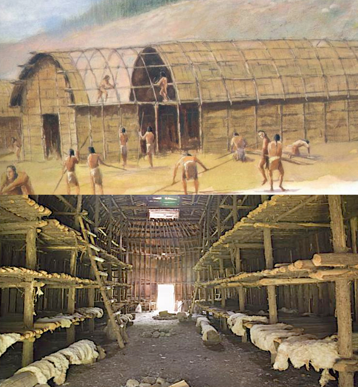
    On the west hill, a mile south of the village was a clearing called the Webster orchard, and another called the Lewis orchard.  The Young’s farm had a clearing of one hundred and fifty acres. There were several other smaller clearings at the Hollow, some of them covered with grass and clumps of wild plumb and cherry trees. At the Hollow, south of the village, was an Indian burying ground. In earlier times, when the great annual councils of the Five Nations, were held at Onondaga, they concluded each with a war dance, bade emotional farewells that were extremely affecting, and the open ground away from the area would literally become crowded with moving Indians, especially the Senecas and Cayugas, accompanied to a point by the Onondagas who invariably attended their friends, for the purpose of taking leave. 
The bloody Battle of Oriskany, where American Patriot General Nicholas Herkimer rallied the Tryon County militia and friendly Oneida Indians to battle the American loyalists and allied Indians, including the Mohawk and Seneca and the Six Nations, about 40 miles east of Onondaga lands—it was the beginning of the Iroquois and Six Nations aligning themselves with the British, while the Oneida fought with the Americans

Regarding the ruins and artifacts found in Western New York claimed to possibly have been Nephite or Lamanite relics, it should be noted that New York has hundreds of Revolutionary War sites ranging from major fortifications to key battlefields, from Ticonderoga to Oriskany, the latter forty miles from Onondaga lands, where on August 6, 1777, the Battle of Oriskany was fought, one of the bloodiest battles in the North American theater of the American Revolutionary War and a significant engagement of the Saratoga campaign. It should be noted that nearly one third of all the battles fought during the American Revolution were fought in New York State, with not only Oriskany in western New York, but also the battle at Fort Stanwix in Rome, New York;
Fort Stanwix, built in 1758 during the French and Indian War by British General John Stanwix in Oneida County, New York, and abandoned in 1828

Fort Ontario, overlooking lake Ontario, about 25 miles north of Onondaga; the Newtown Battlefield near Elmira; old Fort Niagara on the eastern bank of the Niagara River in Youngstown; Madison Barracks which is north of Onondaga on the shores of lake Ontario. There was the Bennington Battlefield, Fort William Henry, the Battle of Flockey, Fort Ticonderoga, the Old Stone Fort, and the Saratoga Battlefield, all in western New York just east of the Onondaga lands. In addition, the French had six forts in New York, and there were 27 colonial forts in New York and 48 overall.
    Therefore, it might be correctly assumed that whatever remains of forts that someone might want to claim, it is likely part of the French trappers and military installations or that of the American military from the French-Indian wars to the Revolutionary war.
    In addition, regarding the so-called Nephite artifacts, in the area around Onondaga, there are large quantities of horn stone imbedded in the slate rock of the Hamilton bedrock equivalent to Millboro Shale, the oldest strata of the gas shale sequence. This slate is in the south part of the town of Onondaga, along the road to Otisco from South Hollow. Now, hornstone, or hornblende slate, is a clay-slate that abounds with mica and form the connecting chain of minerals form hornblende to granite. It is extremely hard, and especially flinty slate is a gray, siliceous stone, which was anciently used for chipping or “knapping,” such as in making arrowheads, or in making either “flake tools,” or “core tools,” by knocking off large or small flakes from the stone in percussion flaking using a “hammer stone.”
    For greater precision of the flakes, the “hammer” was made of wood, bone or antlers. Sharp edges for blades (thin stone, twice as long as wide, sharpened on both sides, and hafted to handles) were achieved through “pressure flaking” by skilled stone knappers.
Knapping is the shaping of flint, jasper, agate, chert, quartzite, obsidian or other conchoidal fracturing stone through the process of lithic reduction to to make stone tools

In addition, since all stones are not the same—sandstone and marble were too soft to take an edge; granite was inconsistent in its hardness and would also not hold an edge; so hard, dark, fine-grained chert, flint, or where available, obsidian, were used. On the other hand hornstone or slate, like coarse-grained metamorphic schist and hard sedimentary limestone, were difficult to flake, and ancient toolmakers pecked the rock into the desired shape, then finished the tool by grinding and polishing into tools, which were mostly tools for woodworking, making axes, chisels, and adzes (Christopher J. Ellis, "Paleoindian and Archaic Hunter-Gatherers" in Before Ontario; The Archaeology of a Province, McGill-Queen's University Press, Montreal, 2013, p41).
    Along the banks of the Onondaga Creek are found a number of sulfur springs. In the town are numerous hopper-formed depressions, in shape like a potash kettle, from two to four rods (33 to 66 feet) across at top, and from ten to forty feet deep. These are on the south part of Mr. Thomas Dorwin’s farm. There is an abundance of petrifactions (organic matter changed into a stony substance) in this town, north towards the town of Camillus, and along the Onondaga valley, and several deposits of calcareous Tufa (limestone). In the West Hill are large bodies of conglomerate rock, and a split rock (limestone) quarry furnishes an inexhaustible material for building purposes, commencing near Mickles’ furnace, running westerly into the town of Camillus.
The number of forts in western New York is staggering, with more than 55 in the state, and almost 30 revolutionary period forts

It should be noted, however, that while this area abounds in historical lore—in stories of French invasion, of Jesuit missionary visitations, of the existence of forts, fortifications, and Indian orchards, of the discovery of ancient relics, tools, utensils, and implements or appurtenances of war, and of the remains of Indian burial grounds and human skeletons, none are deemed to be far into the past. In fact, almost all of these aeas, artifacts and forts are since gunpowder and bullets were developed, and there is nothing in any of them to suggest the periods of Nephite and Lamanite wars and battles.
(See the next post, “Have They Found Where Battles Were Fought Around Cumorah? – Part III,” for more on the so-called Nephite forts built in North America around the Great Lakes region and specifically the Onondaga lands)

Thursday, August 30, 2018

Have They Found Where Battles Were Fought Around Cumorah? – Part I “Tons of Arrowheads Found in Western New York?”

It is interesting how some people think. Not long ago a reader of this blog sent me in a copy of an article from the website JosephKnew.com – The Book of Mormon in America’s Heartland.”  In an article under “Is There Evidence of Great Battles Near the Hill Cumorah,” the author stated: “The Great Lakes area of the United States is covered in ruins that match the cities and fortresses of Cumorah and described in the Book of Mormon. Unfortunately many of those ruins have been destroyed or covered over in the last 200 years.”
    He goes on to quote a statement Governor DeWitt Clinton made before the New York Historical Society in 1831: “I have seen several of these works in the western part of this state. There is a large one in the town of Onondaga, one in Pompey, and another in Manlius; one in Camillus, eight miles from Auburn: one in Scipio, six miles, another one mile, and one about half a mile from that village. Between the Seneca and Cayuga Lakes there are several—three within a few miles of each other. Near the village of Canandaigua there are three. In a word, they are scattered all over that county.”
    On the surface, the blog’s author appears to be on to something; however, when one digs deeper into the actual history of this area, a different story appears. So let’s first take Onondaga (from an Iroquois word “onõtáge,“ meaning “on top of the hill,” which was the name of their principal village). The name Onondaga means “people of the hill.”
    Jean de Lamberville, a French Jesuit priest to the Onandagas, and highly respected by chief Garakontie because of his medical knowledge and treatments, wrote that main Onondaga village was situated along the east bank of the Butternut Creek about a mile south of present day Jamesville, in the valley now flooded by Jamesville Reservoir.”
33-mile long Butternut Creek is a stream that runs from just south of the marshy waters of Apulia Station, through Jamesville, intersects the old Erie Canal near DeWitt, and continues north from Onondage and joins Limestone Creek near Minoa east of Syracuse and continues north through Bridgeport and into Lake Oneida

He also indicatred that “After clashes with French colonists in the early 1700s the Onondaga moved south into the hill country from the valley of the Kasonda, and along upper Butternut Creek near Jamesville, known also as Kasoongkta, Kashunkta, Kiechioiahte, and Ohjeestwayana, before being forced west to the Onandaga Creek during the 1720s.” A mile or two from Jamesville, at the time of its first settlement, were the ruins of a square fort, with extensive sub-lines marking an enclosure, on the elevated grounds on the right bank of the marshy area of the Butternut. To the west was Lake Newbury on the east end of the hills between the butternut and Onondaga Creek valleys, the original traditional and central lands of the Onondaga people.
    Ephraim Webster, the second settler of the original town and the first of the Indian traders to reach the area after the Revolutionary War, opened a trading post along Onondaga Creek, married an Indian woman and had s son: Arotarhos (Harry Webster).
    The first settlement of the Onondagas, who claim this site of Teuaheughwa, afterwards called Onondaga Hollow—founded by Major Asa Danforth, the pioneer of the town and founder of Onondaga civilization under Chief Cawhicdota and Tawhisquanta, the former calling Danforth Hatecolhotwas“ (he plows the ground”), was one of the earliest points of settlement, prior to the era of the Onondaga establishing their council fire there.
Oren Lyons, Faithkeeper of the Turtle Clan, Onondaga Council of Chiefs of the Haudenosaunee, holding George Washington’s famous Wampum belt
 
The act creating this town authorized the first town meeting to be held at the house of Dr. Allen Beach, but instead was held at Major Danforth’s home, who presided, in April, 1798, though the town was first settled in 1786 when the land was transferred from Indian to state ownership. The town of Onondage, created four years later, formed parts of the civil towns of Marcellus, Pompey and Manlius. Onandaga Hollow also known as Onandaga Hill were the original site, but was later renamed Onandaga Valley in 1849. The Indians called the Hollow Teuaheughwa, meaning “where the path crosses the road.”
    As early as 1795 William Laird became the first settler there, on lot 114, where he also opened a tavern. Jabez Webb and Nehemiah Earll located on the Hill in 1796, the latter building a large dwelling that was afterward occupied by William P. Walker, a lawyer, and more recently by Oscar Britton, who became the first postmaster in 1800. His brother, Jones, was a merchant in the old stone store there, and served as county sheriff, canal commissioner and State senator—both were very prominent in the early life of the town as well as the town of Skaneateles.  In 1798, Ephraim Webster was the first elected supervisor at the first election, and in 1815, Onondaga had its first Academy.
    It should be noted that though the history of this area is extremely well defined, (contained in the Onondaga’s Centennial records in the Boston History Co., 1896, Vol I, pp836-866), there is not a single mention of any former site of the area other than a square fort of some type. Nor is there any suggestion as to when this fort had been standing except in the early days of the Onondaga Indian settlement. In addition, the township had no villages within it, tough having 13 hamlets, 9 populated places, 1 reservation, 1 location and 1 valley.
    Unlike most towns in the county, the town of Onondaga formed no part of the two million acre of the great Military Tract, which was 28 townships of land set aside to compensate New York’s soldiers after their participation in the Revolutionary War, covering the counties of Cayuga, Cortland, Onondaga, and Seneca as well as parts of Oswego, Tompkins, Schuyler and Wayne. The Tract did, however, cover the major portion of the original Onondaga and Salt Springs Reservation.
Iroquois “long house” that houses twenty or more families and considered the main structures of the Iroquois people
  
Originally, the Onondaga town site guarded the western entrance to the "long house" of the Iroquois, which long houses were built to house 20 or more families, and which once included the site of their principal village. It should also be noted that the Iroquois Indian tribe was actually a confederacy of six Indian nations: Mohawk, Oneida, Onondaga, Cayuga, Seneca, and Tuscarora.  They were a very powerful and prominent Indian tribe, and though called Iroquois by their neighbors, the Algonkian people, and European settlers, they called themselves “Haudenosaunee,” which meant “people who live in the extended longhouses.”  
    The Iroquois lived in a type of dwelling known as a longhouse.  A longhouse is a long, narrow single room often regarded as the earliest form of a permanent structure. While the longhouse may have reached lengths over 300 feet, they were generally never wider than 16 to 23 feet. They were quite dark inside, having no windows, though there were  holes in the high roof to let out fire pit smoke, but they provided very little natural light. There were doors at each end that were usually covered with animal skins during the winters to keep out the cold.  Each of the 20 or more families that occupied the longhouse would occupy a booth on either side of the hallway, which held a wooden platform for sleeping.
    We might want to keep in mind that this was the construction of what was considered the most advanced peoples in ancient North America.
Lists of hundreds of writings made by early settlers of Onondaga, New York 

Returning to Onondaga, according to the New York Historical Society microfilm of Onondaga: “A Series of Historical Sketches Relative to Onondaga,” Vol.II, #135, among the antiquities of this town “on the farm of Mr. Hessy was the remains of an old fort.  When the first settlers came, there were some of the pickets still standing, and the places visible where others had stood.  At the corners were evident marks of a chimney and fire places, and also the ruins of a blacksmith’s shop.  Cinders and a variety of tools belonging to the trade have at times been plowed up.  A portion seemed to have served for a burying ground, as human bones were frequently disinterred by the plow.  A large and excellent anvil was also plowed up.” The statement concluded with: “Major Danforth once received a letter from an old Frenchman, stating, that not far from his (Danforth's) house, in the bank of the creek, he would find a complete set of blacksmiths' tools as ever were used.” A search was made for them but they were never found.
    As to this square fort the author of the blog claims was built during Nephite times, we need turn to the history surrounding this.
(See the next post, “Have They Found Where Battles Were Fought Around Cumorah? – Part II,” for more on the so-called Nephite forts built in North America around the Great Lakes region)

Wednesday, August 29, 2018

Ancient Settlement Complex Near Imbabura

Seventeen miles south and a little west of the Cerro Imbabura, considered to be the Hill Cumorah of the Nephites and Hill Ramah of the Jaredites, is located an immense Archaeological Park and scientific research area called Cochasquí (meaning “divided water” or “half a lake,” or more understandably, “water from the front of the half,” in Quitu-Cara, in reference to the agricultural aspect of the pyramids).
Cochasquí pyramids are located 9 miles south of Lake Mojanda and the smaller Lake Chiquita along the Malchingui-Mojanda road west of Tabacundo, about 400-feet west of the Archaeological Park

At 10,170-feet above sea level, this extensive 208-acre site provided a 240º visibility from where ancient inhabitants could see such nearby elevations, mountains and valleys as: Pambamarca Pichincha, Cerro Puntas, Cotopaxi, Cayambe, Ilinisas, El Quinche, Los Chillos, San Antonio de Pichincha and others, including both the hills Shim and Cumorah. This geographical position suggests to archaeologists that the people inhabiting these ancient pyramids would have been well-prepared for any attacks, and likely a warrior people, or people expecting invasions from surrounding communities.
The Cangahua blocks of one uncovered pyramid at Cochasquí; made of sedimentary rock of volcanic origin, with a non-foliated, porous texture and low compaction that occurs in the intermediate depression of Ecuador and southern Colombia

Built of a volcanic rubble formed into adobe blocks called cangahua, these pyramids, which took 353 pounds to build, used stone that was first softened with water and then cut with harder volcanic rock tools. It is believed to have been built before the Iron Age, that is before 1200 to 1000 BC., putting it clearly in the Jaredite time frame. The multi-pyramid complex was formed by fifteen quadrangular, truncated pyramids, nine having long ramps that ran to the top. There are also 21 funeral mounds within the complex. Today most of this area is still covered by earth, grass and primary vegetation, deliberately left that way to protect the highly sensitive cangahua blocks of the pyramids from the harsh equatorial weather. The main pyramid has no dome, is flat at the top, with a very long ramp, which is a form reproduced in the site’s ancient jewelry.
    According to the publication Archaeology, the site was known as an historic area by locals, and excavations in 2006 revealed a large ceremonial pool stretching approximately 33 feet by 55 feet. It was uncovered four to five feet below ground level, and had three-foot-high walls around it. Both the walls and floor of the pool were composed of precisely cut and well-fitted stone.
    Georadar (ground-penetrating radar) studies show that there were people living at the site long before the pre-Inca Quitu Cara culture, where pyramids and sacred animals patiently remind us of very ancient Ecuadorian archaeology, which holds more secrets than most people recognize. Such debates, however, rage on in Ecuadorian archaeology over whether Cochasquí was an astronomical observatory, a fortress, a sanctuary, or a combination of functions.
Top Left: The covered pyramids of Cochasquí from ground level; Top Right: Aerial view showing the largest pyramid in the complex; Bottom: Aerial view of th3e large west complex

Considered in part as an ancient observatory, it was built as a defensive complex, it also formed the basis of the lunar agricultural calendar along with Cerro Catequilla and Mitad del Mundo in determining the prevision of the sowing, harvest, tides, and phases of the moon. Located in one of the coldest and windiest areas in the north of the country, the complex is in a quiet and serene area, set far away from any surrounding villages, and it is not a small site—Pachacamac (Zarahemla) in Peru is less than three times larger, and Tiwanaku only twice as large.
    There are 15 flat-topped pyramids predominantly constructed out of volcanic tuff (lacing the consistency of stone or the malleability of earth) of considerable resistance, which is used in these pre-Columbian constructions through geometric shapes that have one higher base and one smaller base. In that way a truncated pyramid is created with its sides in the form of trapezium, which completes the quadrangular prism. The ramps, which run south to north, with its side also a trapezoid shape. Among the architectural elements found in the pyramids are also highlighted, walls, terraces, artificial lakes, canals and roads
An artist’s rendition of the Cochasquí site with restored pyramids

Archaeological investigations have taken place on and off since 1933. The most well-known archaeologist to study the site was Friedrich Max Uhle, a German archaeologist whose work in Peru, Chile, Ecuador and Bolivia at the turn of the Twentieth Century had a significant impact on the practice of archaeology of South America. Considered the “Father of Peruvian Archaeology,” by his American successors, he is highly regarded and his work heavily studied, though there tends to be a limited amount of his publications, and the many omissions in his work does cause some difficulties.
    When first seeing the sight Uhle claimed Cochasquí was a ritual site and not a community settlement. Following Uhle’s partial excavations in 1933, German archeologist Udo Oberem, with the help of a team of Ecuadorians, in 1964 furthered the original studies. The archeology team determined that the edifices date from as far back as 850 BC to the arrival of the Spanish Colonists. There are no signs that the Inca ever came to this place.
    In addition, these scientists from the University of Bonn, after conducting studies and excavations in the pyramids and funnery mounds, confirmed that Cochasquí was a housing site because the structures “had rooms in circular shape (bohíos: hut) for rulers and platforms of terracotta, called floors of houses; likewise, they were able to determine the structural form of the pyramids.”
    In 1986, Valentín Yurevich, an astronomer from the Russian Academy of Sciences, and Director of the Quito Astronomical Observatory in Ecuador, conducted archaeo-astronomy studies and concluded that there was “possible astronomical significance,” saying that “Cochasquí was an ideal place to observe the stars and constellations that influence the Earth.”
In Ecuador, little is still known about the history of Cochasquí, now converted into historical and archaeological attractions. However, historians and anthropologists agree that this area is an archaeological representation of a warrior town, and it is estimated that the people who lived there belonged to a communal society whose organization was based, mainly, on lands ruled by a leader (cacicazgos), called ethnic manors, by anthropologist, which organized the lands integrated by the ayllus—an Andean community. This consolidation and growth of diverse populations led to the appearance of a figure (ethnic lord) on which the subsequent foundation of the manors was to pivot. The lord and his people were united by alliances or by the wars that they maintained with each other, with smaller units (ayllus), governed by the chiefs or principals. These ethnic lordships had a complex political organization, belonged to the same family group, and had territorial control. In any case, the leader had to be recognized by all as such in order to maintain the stability of the manor.
    Considered to be one of the most important pre-Inca culture, the Cochasquí settlement pattern is seen as quite different from those of Mesoamerica and the Peruvian Andes. Anthropologists believe that socially Cochasquí was a fairly hierarchical organization, with different economic levels and power. At the top of the pyramid was an elite formed by the lord, with his relatives also part of this upper class. Next were merchants and artisans who received preferential treatment and were not considered labor, so they were exempt from paying tax. Below these were the working population, which formed the "llactakuna." This manner workforce paid a tribute to the servants who depended on the lords and with restrictions on their freedom.
    While the structure of scientists sometimes gets far too complicated for simple understanding, this all sounds a lot like the Jaredite community, or kingdom, we find in the Book of Mormon.

Tuesday, August 28, 2018

The Mysterious Fortress of Waqrapukara

At the top of Kenter mountain south of Cuzco in the Acomayo Province, is an impressive and powerful appearing, impregnable archaeological site high on a mountain within endless mountains that span so far they are lost in the horizon. Nestled sinuously on a rocky outcrop along the southern plateau of the Apurímac Valley, the fortress was built around two horn-shaped, towering mountain peaks amidst a never-ending forest.
Waqrapukara (Stronghold of the Horn) is situated atop a mountain between two natural peaks south of Cuzco, and one of the most formidable fortresses in ancient Peru
 
Known as Waqrapukara (Waqra Pukara, meaning” Horn-shaped Fortress,” or “Stronghold of the Horn” in Quechua), it is above eight walled terraces, steep retaining walls and stone stairways overlooking the dizzying heights 13,500 feet above the Apurímac River Valley below.
    Built strictly for defense, this enigmatic near hidden, rectangular shaped stone fortress of gigantic rock formations with its niches and double and triple jamb doorways, also served as a sanctuary and astronomical observatory. At one end are additional enclosures, one of which is an E-shaped structure, flanked by a longitudinal wall with trapezoidal niches. Its shear, defensive walls that could not be breached, enclosed a serpentine complex overlooking the deep raving to the Apurímac River valley, and had an underground channel that provided water to the fortress.
    This archaeological site was linked to astrological observation and rituals for the development of agricultural activity, since the structures of this site are oriented towards the sunrise. Like the 2½ square-mile complex observatory at Chankillo, another ridgeline observatory to the south along the west coast, these are oriented to the rising and setting positions of the sun over the year, showing when the winter and summer solstices occurred for planting and harvesting.
The circular and rectangular houses and structures of Mauk’allaqta, whose niches and triple door jambs, like those of Pachacamac, are found at Waqrapukara

Mauk’allaqta Within the stone structure are vaulted niches with three jambs, a rare detail found elsewhere only in the architecture of Pachacamac and Maukallaqta (Mauka Llactta, Mauk’allaqta, meaning “Ancient Place”)—with over 200 structures, it is the largest pre-Columbian site in the Pacariqtambo region.
    The landscape surrounding Waqrapukara is breathtaking, and one of the most beautiful sites in the Andean area, and as an archaeological site, one must add the scenic impact of the surroundings and the spectacular rock formations. This altiplano páramo is interrupted by the edges of an immense canyon where fierce bursts of wind ascend the abyss forming capricious cloud figures on the heights of the gully, along with sudden altering temperatures, which changes from near minus temperatures at dawn to the heat of midday.
    The structure itself dominates the landscape without transforming its spectacular appearance, as the curves in the terraces of carved stone seem to hold the Waqra (horn), which resembles a double-peaked crown atop the mountain.
    As the experienced archaeologist Miguel Cornejo Guerrero of the University of Peru has stated: “Waqrapukara is an ancient sanctuary of the first order, which denotes immense political and religious power that has not yet been deciphered. The whole natural environment warns from afar that a special, unusual site of an incomparable beauty in this spectacular vision of natural formations, where the ancients molded or inserted a wonderful ceremonial architecture, merging and making all the natural creation with the best of its artistic architecture.” Coupled with Tambopukara, Yactapukara and Ayapukara, Waqrapukara forms an area of sites that are relatively unknown today, even by the locals who live nearby.
Views of Waqrapukara, an enigmatic structure whose full purpose has not yet been understood by archaeologists, though it obviously served as a defensive position 

Waqrapukara was obviously built with painstaking care, constructed of stacked small boulders and cut stone, about a two-hour hike from the town of San Lucia, atop Kenter Mountain and the cliffs along the east bank of the Apurímac River, across from the towns of Omancha and Accha, and about 15 miles west of Pomacanchi and 18 miles from Pomacanchi and Pampamarca lakes.
Waqrapukara in the Kenter Mountain above the Apurímac River Canyon north of San Lucia and across from the towns of Omacha and Accha

Today this area is considered off the beaten path, being south of the main tourist areas of Cuzco and the Apurímac  River Valley, and obviously when anciently constructed was meant to be a hideaway sanctuary for either seclusion, hiding or making a stand against an enemy as shown by the defensive walls and nature of the structures.
It is one of the most difficult fortresses or settlement to reach in the ancient Andean world and other than being a fortress sanctuary and observatory seems to have little other purpose, yet its defensive structure is extensive

It was obviously built with painstaking care, constructed of small boulders and cut stone  
    In an area that today is considered off the beaten path, obviously meant to be a hideaway sanctuary for either hiding or make a stand against an enemy as shown by the defensive walls and nature of the structures.
    It was constructed later than Cuzco, or the city of Nephi, and in the opposite direction from Cuzco than the Urubamba River Valley fortresses of Ollantaytambo, Urubamba, Calca and Pisac. Along the ancient road between Cuszo and Puno at Lake Titicaca, Lake Pomacanchi is about 40 miles from Cuzco, then nearly 20 miles through mountainous wilderness to Waqrapukara. It would not likely have served as a defensive position against Lamanites moving northward through the La Raya Pass, about 90 miles south of Pomacanchi, nor would there have been much chance of it being attacked in the Nephite era since it was so isolated from the main movement along the canyon direct from La Raya to Cuzco.
The Apurímac River flows through canyons and valleys on its way down from Mismi Ridge toward Cuzco. Note the area of passable land along the river’s banks within the canyon where a dedicated band of warriors might have braved the difficulty to launch an attack against the Nephites in Cuzco (city of Nephi)

On the other hand, it could have been a defense against enemy advances up the Apurímac Valley, or possibly down the Apurímac rive from Arequipa, skirting the canyons, which eventually flowed past Cuzco, the original Nephite stronghold before Mosiah left with the more righteous to settle in Zarahemla.
    Certainly, its very defensive construction and location, though used as an observatory, would not have been built just for that purpose since an observatory would not need to be defended in such a manner—though its location on top of a mountain would be ideal for observing the stars. Nor would it simply have been a sanctuary where people could retreat to for rest and relaxation since it is so difficult to reach. No, its purpose was to defend against something or someone, but its location does not suggest a strong answer to what or who.
    Thus, having defied the best minds trying to figure out its true purpose, the difficulty has earned it the title of enigmatic and mysterious.

Monday, August 27, 2018

In Search of Cumorah – Part VII

Continuing with the 12 points or criteria used in the scriptural record to describe the physical arrangement and facts surrounding the scriptural hill Cumorah (Jaredite Ramah) as described by Mormon and others. The first five points were covered in the previous post, we continue here with point #6:
The Lake District with lakes, rivers, streams and estuaries surrounding Cerro Imbabura

6. Land of Many Waters, rivers and fountains (Mormon 6:4);
    The area immediately around Imbabura is called “the Lake District,” and in a country of abundant water resources, this area is popularly known as the Province of Lakes because it holds more water reserves than any other province in the country. It is also an area of natural beauty that extends northward and westward into the northern jungle, which is often referred to on the west as “The Esmeraldas,” a lush, labyrinth of vegetation and water, estuary-filled streams and rivers, a region of mangroves and flooded tropical forest with wild and remote inland areas often accessible only by canoe along its many small and large waterways.
Some of the many rivers and streams that make their way through “the Lake District” and the Esmeraldas in the vicinity of Imbabura

7. Large area to support hundreds of thousands of Nephite and Lamanite warriors (Mormon 6:5; compare 5:6)
    The area around Mount Imbabura is part of the Chota Valley, and certainly capable of supporting hundreds of thousands of people, with fresh, clear, drinking water from nearby lakes (Cuicocha, Quilotoa, Imbacocha, Pinan, Hyaguarcocha, Cristococha, Mojanda, Caricocha and El Cajas to name a few), rivers (Mira, Chota, Ambi, Llurimagua, Taguando, Urcuqui, Itumbe, Chorlavi, Pimampiro and Jatunyacu to name a few) and streams, and a land so fertile both at the base of the mount and for some distance up its slopes that numerous crops could have been sewn and harvested, providing abundant grain for food during the four years the Nephites were there drawing in all the Nephites for battle.
Even today, this area of extensive croplands appear as a patch-quilt of farmlands, abundantly providing for the entire region

8. Large enough for a battle involving at least 230,000 Nephites and perhaps 300,000 Lamanites (Mormon 6:7-8)
    The entire Chota Valley and the surrounding plains around Mount Imbabura was of sufficient size for a major battleground involving hundreds of thousands of people. The Valley’s mere size stretches through three provinces: Imbabura, Esmeraldas and Carchi.
The plains around the Cerro Imbabura is by far large enough to have had upwards of half a million warriors engaged in battle

The lakes, rivers, and streams around Imbabura might well have provided some advantage to Mormon’s army as the Lamanites attacked in full force with their overwhelming numbers that when “they came to battle against us, and every soul was filled with terror because of the greatness of their numbers” there was plenty of room for fighting.
9. Large enough for 24 survivors to hide for the night (Mormon 6:11)
    One of the problems with the hill Cumorah in New York would be for any survivors to have survived upon it in the face of 300,000 or more crazed, blood-thirsty warriors looking to kill any Nephite. But at Imbabura, the mountain is sufficiently large that any number of survivors could have found hideouts from any number of Lamanites looking for them.
The view from the mount would show the entire battlefield of hundreds of thousand dead strewn over the countryside

10. High enough to see tens of thousands of dead bodies (Mormon 6:11)
    The summit of Mount Imbabura is about 5,00 feet above the surrounding valley,whose elevation is about 10,000 feet. It has high altitude meadows above the tree line where cattle graze today, deep crevices, and rocky slopes providing plenty of cover for hiding or just not being observed.
11. Located in a volcano and earthquake land with tall mountains (Helaman 14:23) 
    The Land Northward had more damage from earthquake and volcano eruptions (3 Nephi 8:6,12,17,20).
    Mount Imbabura sits at 15,000 feet elevation, with a 5,00 foot prominence above the surrounding valley. The mount is on the Ortavalo-Umpailá fracture zone, one of the deep seismically active fracture zones in Ecuador and northern Peru (eight of which are in Ecuador), and is full of deep fissures caused by cracking and slitting. In the valley around is a large caldera, as well as the Cotacachi volcano (Mount Shim) nearby.
12. The non-scriptural but reasonable fact that the mountain would have held spiritual and ritual significance to local residents.
    Keep in mind that more than a couple of hundred thousand people died in 385 BC, and a million or more 1000 years earlier around this mountain in two major battles about, with the dead bodies left to rot on the surface of the land. In addition, this mount and area was the scene of a tremendous, unparalleled Lamanite victory over a 1000-year-long hereditary enemy, as well as the site of thousands of Lamanite dead.
Even the Inca, 1000 years later were making pilgrimages to the site and conducting ritual ceremonies there

There can be no question that this mountain would have been revered by the Lamanites for centuries afterward, and no doubt become a site of religious and ritual significance for many generations. It is not a stretch to think that this memory continued down through the passage of time in numerous factual and fictional stories surrounding the mysticism that would have built up about it in word-of-mouth passage from general to generation.
    Today, Mount Imbabura holds such a local image to all the people of the region, as mentioned earlier.
    Where the Hill Cumorah of the scriptural record is will no doubt be a debate that will go on for some time; however, whatever location one chooses to place it in, the site should meet these eleven scriptural criteria as well as the twelveth criteria of a lasting monument to the death of so many hundreds of thousands of people and the site of the final Lamanite victory over the Nephites.

Sunday, August 26, 2018

In Search of Cumorah – Part VI

Continuing with the 12 points or criteria used in the scriptural record to describe the physical arrangement and facts surrounding the scriptural hill Cumorah (Jaredite Ramah) as described by Mormon and others.
    First of all, before outlining these points with a specific location, let us just briefly show why the Mesoamerican, Heartland and Great Lakes theories location for their Hill Cumorah does not meet the scriptural criteria:
    Mesoamerica: One very important fact is that the Jaredite Omer, who was the king in Moron, “departed out of the land with his family, and traveled many days, and came over and passed by the hill of Shim, and came over by the place where the Nephites were destroyed, and from thence eastward, and came to a place which was called Ablom, by the seashore, and there he pitched his tent” (Ether 9:3). That is, he traveled many days from Moron to Ablom; the latter being near the east seashore. While we do not know how long “many days” travel would be, or the distance that would cover, we can assume it was not a short distance, about 68 to 87 miles, that the hill Vigia in Veracruz is from the so-called narrow neck of land (Isthmus of Tehuantepec) of Mesoamerican theory. Secondly, their hill Cumorah (Cerro Vigia) is only four miles from the Gulf of Mexico (their Sea East); however, Mormon suggests a much further distance between the hill Cumorah and the place called Ablom, which was by the seashore, but not necessarily on the seashore.
Hill Cumorah in New York, note (yellow arrow) how short the hill is and how gentle the slope up is, and how little viewpoint it provides to a vast surrounding area

Heartland/Great Lakes: The hill Cumorah in New York where Joseph Smith found the plates is a drumlin hill and far too small to meet Mormon’s criteria. First of all, for 23 adults to hide upon it and not be observed by hundreds of thousands of blood-thirsty Lamanites seeking their death is unrealistic, especially when this is a rounded hill and easily ascended; nor could these survivors have seen all the dead from the summit, which is only 1.7 miles long and 0.4 miles wide, and about 110 feet high; nor is there a sea anywhere to the east for 340 miles; it is neither a prominent hill to be singled out in antiquity or now, nor is there another hill around significant enough to be singled out as the hill Shim, since Cumorah is within what is called a drumlin swarm or field, where these hills are all very similar in appearance and size, almost all less than 120 feet in height.
    So, based on the criteria laid out for us in the scriptural record, let us consider the mountain site in northern Ecuador, near the most northern part of the Land Northward.
The stratovolcano mountain Imbabura in northern Ecuador—a major dominant topographic feature in the region

In the northern part of Ecuador stands a mountain called Cerro Imbabura, which is of significant importance to the local culture that involves a spiritual relationship with the land, and is often personified locally as Taita Imbabura, or “Papa Imbabura,” being a sacred protector of the region. Anciently, it was referred to as Achilly Pachacamac, “supreme god,” having hurled stones, according to local legends, across the valley during ancient eruptions. The mountain slopes and base are especially fertile, with cloud forests beyond, and extensive farmland around the area. Six miles to the north is the capital city of Ibarra, with Imbabura about 45 miles north of Quito.
Location of Cerro del Imbabura, or the Hill Cumorah, in Ecuador (Land Northward)

Imbabura features a warm-summer Mediterranean climate because of the its elevation in the Ecuadorian Andes that provides cooler temperatures and a seasonal rain-shadow characteristic in the Intertropical Convergence Zone, and the highlands around the mountain are classified as mild all year round.
    The mountain is by far the most dominant geographic feature of the area, is important to the local cultures and represents a highly treasured location, said to be enchanted, and has a huge fresh-water lake (Laguna de San Pablo, a former volcanic crater that filled with water eons ago) and streams all around to provide drinking water for such a gathering of warriors and their families for four years, as well as plenty of forage of birds, amphibians and invertebrates throughout this inter-Andean valley surrounding the mountain. And as mentioned before, this area is extremely fertile where crops could have grown for the four years the people gathered and prepared to do battle with the Lamanites.
Top: Imbabura not only is the most dominant feature in the area, but also has enormous space around it for half a million people or more to do battle; Bottom: the mountain would provide numerous hiding places for the embattled survivors of the first day and is certain high enough to see out over many square miles of battleground below

There are more legends surrounding this mountain and area than nearly any other location in Ecuador, suggesting in history something of importance marked the location that was handed down over the centuries and formed into myths and legends about this particular mountain.
Omer’s journey from Moron to Ablom, passing both the hill Shim and Ramah/Cumorah known today as Imbabura

1. Distance from Moron to Ablom (Ether 9:3)
    Mormon points out that this journey or distance took “many days,” which typically suggests a long distance in connection with simple language like “and from thence to a place which was called Ablom” or “and he came up unto the land of Moron where the king dwelt,” or “he returned to the city Nehor,” or “he came over by the place where the Nephites were destroyed.” This distance from the area of Moron (Riobamba) to Imbabura is about 200 miles.
2. Cumorah, Shim, Ablom and the East Sea (Ether 9:3)
    From west to east, the Cotachi (hill Shim) to Imbabura (hill Cumorah) is 15 miles; the distance from Imbabura to the place called Ablom was about 12 miles, and to the ancient east seashore (Cabeceras Cofanes-Chingual) about 15 miles. This ancient seashore is now within the Cuenca Chingual mountain range of the Andes and one of the last intact mountainous regions in Ecuador, in which its hydrology, geology, soils, vegetation and flora, amphibians and reptiles, birds, mammals, archaeology, and current communities have been surveyed (Ecuador, ed. Corine Vriesendorp et al., University of Chicago Press, Field Museum of Natural History, 2010).
3. The hill Cumorah was a significant landmark the Lamanite king would know (Mormon 6:3);
    This mountain stands out and can be seen for miles around the region. Given the slightest direction and the hill can easily be reached. It sits in the midst of the huge Chota Valley. Along with Cotachi Mountain, is distinct in its appearance.
4. Beyond the Land of Desolation (Alma 22:30)
5. Located in the Land Northward, north of the narrow neck and Desolation (Mormon 4, 5:3-7)
    The narrow neck of land ran along the east bank of the Gulf of Guayaquil, from there the Land of Desolation stretched northward across the Central Oriental Occidental, where the Plains of Agosh were located, then the Valley of Gilgal and north of that was the lake district of the Plains of Imbabura, which stretch northward into the Cerro Imbabura in an area of “many waters.”
(See the next post, In Search of Cumorah – Part VII,” for the last seven points of the 12 criteria used in the scriptural record to describe the physical arrangement and facts surrounding the scriptural hill Cumorah/Jaredite Ramah)

Saturday, August 25, 2018

In Search of Cumorah – Part V

Continuing with David A. Palmer’s book, In Search of Cumorah and his location for the hill Cumorah in Vera Cruz, Mexico, why his nominated Cerro Vigia is not the hill Cumorah, and where exactly the hill Cumorah was really located.
    In addition, Palmer also states in his book (p96) that Cumorah was “only about 15 kilometers [9 miles] from the coast,” though in the scriptural record, the only description of the hill Cumorah and what is around it is found in Mormon’s statement “I, Mormon, wrote an epistle unto the king of the Lamanites, and desired of him that he would grant unto us that we might gather together our people unto the land of Cumorah, by a hill which was called Cumorah, and there we could give them battle… we did march forth to the land of Cumorah, and we did pitch our tents around about the hill Cumorah; and it was in a land of many waters, rivers, and fountains” (Mormon 6:2,4, emphasis added).
Palmer’s map showing Cumorah very close to the narrow neck of land (Isthmus of Tehuantepec) and two narrow passages into the Land Northward
 
Again, Palmer (pp96-99) places Ripliancum near Cumorah and along the east sea with no such suggestion from the scriptural record; he decides that Cumorah is near a seacoast though none is mentioned; he decides Cumorah is on a coastal plain and possibly near other mountains and valleys; he claims that “the abundance of water must provide a military advantage” where no such comment is written or suggested; and has an escape route to the Land Southward.”
    Consequently, Palmer places his hill Cumorah in the southeastern part of the state of Veracruz near Santiago on a mountain named Cerro El Vigia (Lookout Hill), which is an isolated part of the Tuxtla Mountain chain near the Gulf of Mexico.
    This area is between 68 and 87 miles from the Isthmus of Tehuantepec (Palmer’s Narrow Neck of Land, which is not a “narrow neck” at all, but merely a narrowing of land). This is the same area that John L. Sorenson places his hill Cumorah, with with Sorenson, his map shows “the Land of Many Waters” over three hundred miles away from his hill Cumorah, though Mormon saying that the land of Cumorah was within the Land of Many Waters. And since the bones and destruction of the Jaredites and their hill Ramah where the final battle took place, which was discovered by Limhi’s 43-man expedition, saying they “traveled in a land among many waters [and] discovered a land which was covered with bones of men, and of beasts, and was also covered with ruins of buildings of every kind” (Mosiah 8:7, emphasis added),we can see that Sorenson is also one prone to make up his own scenarios about the hill Cumorah.
    At this point, it should be noted that the hill Cumorah, in the land where the people had been destroyed, was far north of the Land of Desolation. In fact, Mormon tells us that:  “the land which they called Bountiful...bordered upon the land which they called Desolation, it being so far northward that it came into the land which had been peopled and been destroyed” (Alma 22:29-30), thus, the hill Cumorah was “so far northward” from the narrow neck of land, that it could not be “near the narrow neck” as Mesoamerican theorists always claim.
Cerro del Vigia, in the Tuxtla Mountains of Veracruz, Mexico

In addition, Cerro Vigia is 2700 feet in elevation, rising 1500 feet above the surrounding farmland, and an extinct volcano composed of eroded basaltic lava flows, and is sporadically covered with semi-tropical vegetation, extending almost to the top. Several archaeological studies have been completed on the area including the most recent one that was an archaeological survey of the entire surrounding area, which determined that:
1. There is no archaeological evidence that this was a battleground in 385 AD;
2. While Mormon gives the impression that the Cumorah area was an uninhabited region, however, Vigia was continuously occupied early on until  the conquest and there is no evidence that there was a depopulation at any time around 385  AD;
3. There should have been evidence of abundant weaponry such as arrow points, knives, axes, etc., but this was not the case;
4. The mountain is composed of basalt, there is a lesser likelihood that there would be natural caves in the area;
5. There is no evidence of fortifications or large, short term, habitation sites;
6. This mountain is about six miles from the major Olmec center of Tres Zapotes, which existed at the time of the final battle at Cumorah, and not only unaffected by the Lamanite victory (or the final Jaredite battles a thousand years earlier).
    Thus, it seems clear that the hill Vigia in Vera Cruze does not meet the criteria of the hill Cumorah, which Mormon has described for us. So if that is not the hill Cumorah, what is?
    First of all, there are certain things we know for certain about the area of Cumorah in the Land Northward:
1. The hill Cumorah was many days travel from the Jaredite city of Moron (Ether 9:3);
2. Cumorah was west of the Jaredite hill Shim and a place called Ablom, which was by the East Sea (Ether 9:3)
3. The hill Cumorah was a significant or impressive landmark that the Lamanite king would know where it was and how to get to it (Mormon 6:3);
4. Located “so far northward” beyond the Land of Desolation (Alma 22:30);
5. Located in the Land Northward and north of the narrow neck of land, and north of the land of Desolation (Mormon Ch. 4, 5:3-7).
6. Located within a Land of Many Waters, rivers and fountains (Mormon 6:4);
7. Large enough area to support at least 230,000 Nephite warriors, and their wives and children for four years (Mormon 6:5; compare 5:6);
8. Large enough for a battle to take place involving at least 230,000 Nephites and perhaps 300,000 Lamanites or more (Mormon 6:7-8)
9. Large enough mountain for 24 first day survivors to hide for the night without being detected by the Lamanites (6:11)
10. High enough for Mormon and his survivors to see the next day from the summit tens of thousands of dead bodies (Mormon 6:11);
11. Located in a volcano and earthquake land, with tall mountains “whose height was great” (Helaman 14:23)—the Land Northward had more damage from earthquake and volcano eruptions (3 Nephi 8:6,12,17,20).
12. We also might add, that since at least a couple of hundred thousand people died in and around this mountain, it might be assumed and rightfully so, that this area, and even this mountain, would have held some significance to later generations, no doubt some spiritual relationship or ritual value. Keep in mind, that this mountain would have been the scene of a tremendous, unparalleled Lamanite victory over a 1000-year-long hereditary enemy, as well as the site of thousands of Lamanite dead.
    These eleven descriptive scriptural references and one clearly defined premise give us an understanding of the hill Cumorah as well as providing the means by which to determine its whereabouts.
(See the next post, In Search of Cumorah – Part VI,” for more information these 12 points or criteria used in the scriptural record to describe the physical arrangement and facts surrounding the scriptural hill Cumorah/Jaredite Ramah)

Friday, August 24, 2018

In Search of Cumorah – Part IV

Continuing with David A. Palmer’s book, In Search of Cumorah (“New Evidences for the Book of Mormon from Mexico”), in which the author provides his readers with some of his erroneous views of the scriptural record, and leads away from finding Cumorah with his flagrant disregard to actual scriptural wordage.
    Also, in a case where one almost has to wonder if Palmer actually read the scriptural incident of which he writes, he claims a surprising lack of knowledge when Morianton fled to the northward land (Alma 50:29-30):
    Palmer: “The strategic importance of that move is not explained nor is the reason why the Nephites forcefully prevented the migration.”
Moroni races to cut off Morianton and his army of rebels before they get to the narrow pass and into the Land Northward

Response: The problem is, this is a complete misstatement of the facts, for Mormon answers both questions completely and clearly when he tells us:
1) that Morianton and his people were fleeing from Moroni’s army when he states that Morianton was: “exceedingly fearful lest the army of Moroni should come upon them and destroy them. Therefore, Morianton put it into their hearts that they should flee to the land which was northward, which was covered with large bodies of water, and take possession of the land which was northward” (Alma 50:28-29), and
2) Moroni did not want an enemy rebel group on his northern border as well as the Lamanite enemy on his southern border where he would have to fight two enemies in different opposite ends of the land, as Mormon stated it: “Moroni, feared that they would hearken to the words of Morianton and unite with his people, and thus he would obtain possession of those parts of the land, which would lay a foundation for serious consequences among the people of Nephi, yea, which consequences would lead to the overthrow of their liberty” (Alma 50:32).
    Thus, both “the strategic importance” and “the reason why the Nephites prevented an enemy or defector from getting into the Land Northward” are completely described and clearly understood.
    In yet another misunderstanding of the scriptural record, Palmer states that:
Palmer: “the whole epic [of migration] left such a lasting impression that centuries later the Nephites and Lamanites were still arguing over who wronged whom during their migration (Alma 20:13 and Mosiah 10:12-16).”
    Response: However, as Nephi makes it quite clear the argument was not over who was in the wrong, but over the ancient Hebrew and Biblical directions of the birthright of the first born (1 Nephi 16:38), called the law of primogeniture as acknowledged in Deuteronomy 21:17: “But he [the father] shall acknowledge…the firstborn [son], by giving him a double portion of all that he hath: for he is the beginning of his strength; the right of the firstborn is his.” That is, the firstborn son was entitled to a double share of the assets that were muchzak, meaning actually “in holding” by the father at the time of his death, that would be used for the care of the entire family and place the first born son in charge of that unit.
    Thus, the Lamanites were angry that the Nephites had anciently, upon Lehi’s death, stolen the birthright from Laman (and Lemuel) who were older and, as a result, entitled to the land, not Nephi, the youngest.
    Why is all this misinformation important? Because when theorists begin telling us where things are, such as where Cumorah is located, but have a track record of completely misunderstanding and misrepresenting the scriptural record and what it so clearly states, it is difficult to accept their unsupported and contrary ideas, including the location of Cumorah (being near the narrow neck) etc.
    As an example, in another type of attempt to change the narrative of the scriptural record in the Book of Mormon, Palmer makes the attempt to validate his opinions and models through comparisons that really are not valid, though he obviously thinks so. Take the instance of his using an example of John Lloyd Stevens, the American explorer, writer and diplomat who was pivotal in the rediscovery of the Maya civilization in 1840-1841, and later wrote the book Incidents of Travel in Central America, Chiapas and Yucatan, which had an impact on Joseph Smith.
Mayan Stela typically are tall and narrow engravings of designs and very formal. In fact, the definition of a stela is “an upright stone slab or column typically bearing a commemorative inscription or relief design, often serving as a commemorative of some great battle or achievement.” They certainly were not just a large stone to write on as Coriantumr’s stone is depicted

During Stevens trip through Mesoamerica, he traversed, according to Palmer, the same distance he believes Alma covered in his flight with his converts away from the Lamanites and Amulon. He states (p183):
    Palmer: “John Lloyd Stevens made a trip which traversed similar territory and in similar amount of time…covering the distance in 12 days that Alma did in 21 days.”
    Response: While Palmer claims Stevens’ trip was comparable to that of Alma, in order to show a definite correlation, what he doesn’t seem to understand is that Alma, who was running with his people for their lives away from the Lamanites and Amulonites after being warned of the Lord to flee, took, according to Palmer, 75% longer (21 days instead of 12) to cover that same distance. That is hardly a comparison.
    The problem is that theorists get so enthralled with their ideas, beliefs and models, that they fail to accurately compare their views with Mormon’s descriptions and narrative to see if there truly is a comparison, or something they can use as one. A 21-day travel period when fleeing from an enemy that means to do you harm or worse cannot be compared with a leisurely trek through Mesoamerica looking for and studying ancient artifacts and cultural footprints in which Stevens was involved. If the days were reversed, such as Alma taking much less time than Stevens, then at least there might be grounds for some type of comparison, but fleeing for 21 days does not equate to leisurely traveling for 12 days, covering the same distance. Nor do any of the other examples stated in his book match the intent, wordage, and descriptions of the scriptural record.
Thus, the entire idea of Palmer’s “In Search of Cumorah,” falls far short of believability. As another example clearly points out: On pages 31-34, Palmer tries to sell the idea of two narrow passes into the Land Northward form the Land Southward—one along the Gulf Coast Side and one along the  Pacific Coast Side, yet Mormon’s statement about the narrow pass being in one location, and the narrow neck through which it ran was quite narrow, is extremely clear when he wrote: “they did not head them until they had come to the borders of the land Desolation; and there they did head them, by the narrow pass which led by the sea into the land northward, yea, by the sea, on the west and on the east” (Alma 50:34, emphasis added). How much clearer does Mormon have to be than to tell us that this narrow pass ran by the sea, the sea being on both the left (wet) and the right (east).
    It there were two passes, what value was blocking just one? Especially when these two passes are about 120 miles or more apart.
    Palmer also (pp41-42) also tries to show that “Mormon’s Cumorah was probably within a few days journey of the Isthmus of Tehuantepec.” He justifies this by trying to determine a time frame (pp42-43) of battles and ten years later, after a four-year hiatus while Mormon gathered together his people, in which the battle at Cumorah took place. His rationale is based on having Mormon fighting along one coast and then having to retreat to “cities used as havens” along the other coast. However, there is nothing suggested in the scriptural record about being near either seacoast, which covers these battles (Mormon 5:3 to 5:7), and the Nephites eventually arriving at Cumorah (6:1 to 6:4). In fact, the word “sea” is used only three times in the entire book of Mormon’s personal writings: 1) the city of Joshua was by seashore (Mormon 2:6); 2) the fight at the city of Desolation, where they “cast their dead into the sea” (Mormon 3:8); 3) the city of Teancum lay in the borders by the seashore and it was also near the city of Desolation (Mormon 4:3). Thus, Palmer makes up his own topographical scenario and then makes judgements based upon his beliefs.
(See the next post, In Search of Cumorah – Part V,” for more information on why Cerro Vigia could not be the hill Cumorah, and where the actual hill Cumorah was really located)