Sunday, June 30, 2019

The Land of Promise – Part III: Path of the Glaciers in the Land

Continued from the previous post regarding why we need to understand the writings of the early prophets regarding the geographical setting of the Land of Promise to better understand the application of the scriptural record today.
    The area of the Great Lakes is the result of glacial action, when the continental ice sheets retreated. During glacial periods, snow accumulates up to thousands of feet thick, with the bottoms turning into ice, which erodes the bedrock as he glacier moves across the land. The continental glacier that covered Canada and most of the Midwest and the northern United States. Up to two miles thick, it was so heavy and powerful it gouged out the earth’s surface to create the lake basins. As the glacier began melting, the sediment it had accumulated from gouging out the ground dropped to the bottom, accumulating in the trough of the earth with the ice melt forming lakes on top of it.
The glaciers that once covered most of North America, including Canada and northern U.S., was widespread 14,000 years ago and extended into Lake Chicago and Lake Maumee as they melted

By 7,000 years ago, these extended lake areas had disappeared and the present area of the lakes was far from filled

By 4,000 years ago, the lakes were as they are seen today, except that Lake Huron was larger ,incorporating Georgian Bay and the islands in between, with Lake St. Clair between Erie and Huron mostly a low swamp area

The point is, long before the Nephite period, these lakes were pretty much as they are seen today, and what is considered by these Theorists as the narrow pass between lakes Michigan and Erie, did not really exist in a form as described by Mormon. As the glacier retreated, it left large ridges and low-lying hills of ground-up rocks and glacial debris,  that formed moraines.
    Once again, a moraine is a mass of rocks and sediment carried down and deposited by a glacier, typically as ridges at its edges or extremity. The area between Lake Michigan and Lake Erie, southward from the former and southwest of the latter, is filled with moraines deposited by the southerly glacial movement, and left as low-lying hills throughout this area when the glacier receded.
    The Valparaiso Moraine forms part of the St. Lawrence River Divide, bounding the Great Lake Basin. Water on one side of the moraine flows into Lake Michigan, through the Gret Lakes and eventually into the Atlantic Ocean via the St. Lawrence River, while water on the other side flows into tributaries of the Mississippi River, which eventually flows into the Gulf of Mexico.
    It should also be noted that the depth of a glacial lake is determined by the thickness of the ice at the time of glaciation, with the farther north the lobe of ice the thicker it was. Consequently, lakes get more shallow in the southern great lakes region, with Lake Superior at 1333’, Michigan 925’, Huron 725’, Ontario 383’, and Erie 212’.
    Obviously, as the glaciers melted, a number of inland lakes and wetlands resulted. More than 11,000 inland lakes are largely the result of water accumulating in depressions left by passing glaciers. Much of the swamp land of Michigan was drained for agriculture. This accounted for the loss of 50% of Michigan’s wetlands. 
The Valparaiso Moraine north of Valparaiso, Indiana, which formed a large “U” around ancient Lake Michigan. As can be seen, this land could easily have been crossed by an army bent on attack

The area between lakes Michigan and Erie both northward and southward was the path of the glaciers that covered North America. Thus, this land is flat, having been carved out of the earth by the heavy ice, and presents little problem of movement across, both north and south and east and west.
    On the south side of the moraine, where the elevation drops, the meltwaters eroded away valleys, carrying sand and mud with them. As the muddy meltwater reached the valley where the slope lessened, the water slowed down, depositing the sand on the outwash plain. This created a smooth, flat, and sandy plain. Before its draining, the Kankakee Marsh, located on the outwash plain, was one of the largest freshwater marshes in the United States (Kenneth J. Schoon, Calumet Beginnings, Indiana University Press, 2003, p24, emphasis added).
    The largest unit of outwash is along the Kanakakee River, from South Bend to the Illinois border, a 15 to 20-mile wide, which includes the Kankakee Marsh and the surrounding and and gravel plains (Claude A. Malott, Handbook of Indiana Geology, Publication No.21, Department of Conservation, Division of Geology, 1922).
    That this would be the site of the Narrow Pass or Passage Mormon describes is far from factual. Though theorists on this matter like to throw in the ancient lakes, swamps and marshes, it can easily be seen that this area was low and basically level, with streams, creeks and pools left over from the retreating icea, and would not have been a difficult area to pass through by either a Lamanite army or that of a group of defectors.
    Obviously, any waters gathered in this area would have been shallow, creating standing marshes, which for the most part are rarely blockages to an invading army, even for transportation. That it would have been narrowed to 40 miles, let alone 25, is simply foolhardy to believe in light of all the study that has been put into this area and the surrounding lakes drainage basin.
    Portage City in Porter County, thirty-one miles southeast of the Loop, was initially an Indian village and was originally called Twenty Mile Prairie because it was 20 miles from Michigan City. The area of the township had been visited by a succession of Native American tribes and, subsequently, travelers using a stagecoach path linking Detroit and Fort Dearborn. When the Europeans arrived, they settled in areas then called McCool, Crisman and Garyton, which was covered with extensive farms on which they raised milk, livestock, produce and even sand to sell to Chicago buyers.
    Some North American Theorists have postulated that Portage, Indiana, received its name because the early French traders in the area considered this path through Portage as a means to get from one fur trapping waterway to another and carried their canoes overland through the site now called Portage to substantiate their claim to a narrow passage. However, according to the History of Portage Township taken from the History of Porter County Indiana, (The Lewis Publishing Company, Chicago-New York 1912), the area then referred to as Twenty Mile Prairie, and involving three settlements named McCool (named after a pioneer family), Crisman (named after B.G. Crisman), and Garyton, were incorporated into a single township called Portage, which was named after Portage county, Ohio.
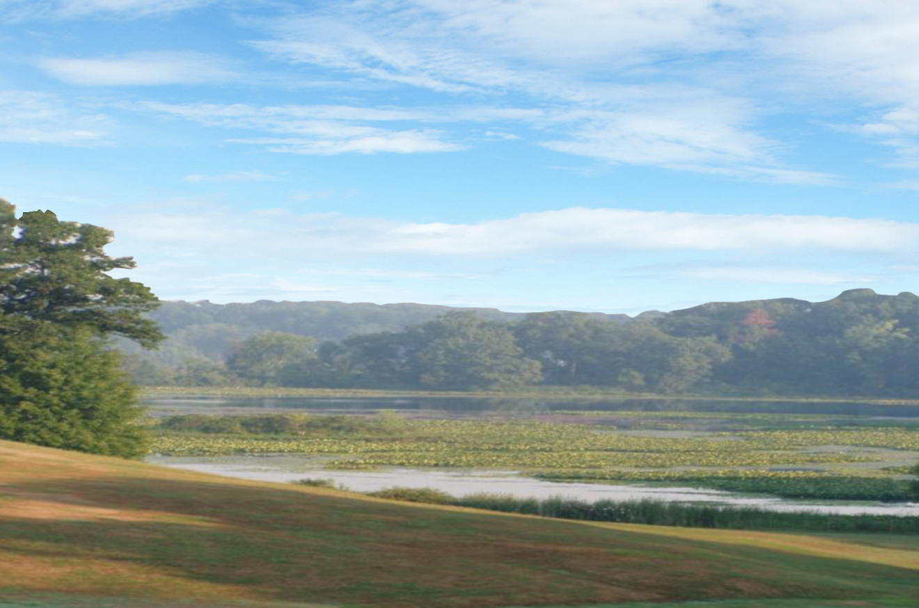
The lands around southern Lake Michigan and the entrance into the Lower Peninsula

In fact, the name Portage was not applied to this area until the incorporation of the city in 1836, long after any fur traders had left the area, which was in 1763 following their defeat in the French Indian wars. By then, the area was filling up with people who were constantly moving westward.
    This township was created by the general order of the board of county commissioners, April 12, 1836, which divided the county into ten civil townships, situated in the northwest corner of the county. It is bounded on the north by Lake Michigan; on the east by the townships of Westchester and Liberty; on the south by Union township, and on the west by Lake county. It is four miles wide from east to west on the northern boundary, and five miles in width on the southern. Its greatest length from north to south is a little over eight miles and its area is about thirty-six square miles. In the northern part are the sand hills common to the shore of Lake Michigan in that region.
    South of the sand hills lies the valley of the Little Calumet river, which contains some swamp lands, and still farther south is a level prairie, with a rich soil, well adapted to agriculture. This prairie is watered by Salt creek and its numerous small tributaries. Large quantities of sand have been shipped from this township to Chicago, and near Crisman there is a fine grained clay that has been used quite extensively for molding, calking boilers, etc. Some bog iron ore has been found, but the deposits are small and have never been developed.
    Before the Europeans arrived, this was the home of the Sauk and Potawatomi Indian tribes, who moved through this area on well-worn trails. The Potawatomi ranged from the Calmuet Dunes on the east of Lake Michigan as far as Detroit and around to the northwest area of the Door Peninsula. When the Europeans arrived, they established stagecoach routes through these Indian lands because of their importance in movement across the Lower Peninsula and around Lake Michigan. The Potawatomi history goes back centuries in which there is no indication of this area being a narrow passage but a wide-open, free-flowing area with rich soil and plenty of game.
    Of course, at one time, this entire area was beneath the ice sheets as the advancing glaciers scooped out large holes across the land that eventually filled with sediment and settling waters as the glacier melted and eventually retreated northward. As far back as they know, this area was the homeland of the Potawatomi, and part of a long-term alliance, called the Council of Three Fires, with the Ojibwe and Odawa (Ottawa). They remained in this area until the 19th century, when the Relocation or Indian Removal program relocated them to Nebraska, Kansas, and Indian Territory (Oklahoma).
(See the next post, “The Land of Promise: An Understand of the Land – Part IV,” for more on why we need to understand the writings of the early prophets regarding the geographical setting of the Land of Promise to better understand the application of the scriptural record today)

Saturday, June 29, 2019

The Land of Promise – Part II: An Understanding of the Land

Continued from the previous post regarding why we need to understand the writings of the early prophets regarding the geographical setting of the Land of Promise to better understand the application of the scriptural record today.
    As covered in the last post, the word “land” should be understood as “the part of the earth's surface that is not covered by water, as opposed to the sea or the air,” and when Moroni used the term, he was referring, as his statement implies, to the entire connected land mass which was being uncovered by the water. As Moroni wrote: “off the face of this land” (Ether 13:2) regarding the land exposed after the waters of the Flood had receded. However, when Lehi refers to his land of promise, as “a land of promise” (2 Nephi 1:5) he was referring to an isolated area or portion within the overall land. It might also be noted that when Nephi used the term when seeing his vision of the Gentiles arriving, he stated: “who were in the promised land” (1 Nephi 13:12), referring to a land separate from where he was located (in North America).
As the waters receded, cutting canyons and channels on the way down to low ground and the newly formed oceans, the land was revealed

Obviously, when the waters of the Flood receded from off the face of the earth, the world was broken into continents. The continent of the Americas was isolated from the rest of the world, which was clustered into one continuous land from north to south and east to west. More importantly, this new land was not connected in any way with the Old World, or the lands which are covered in the Bible. This was a new land, and unoccupied land, a land separate from the rest of the Earth’s land mass.
    Thus, Lehi could say that “behold, it is wisdom that this land should be kept as yet from the knowledge of other nations; for behold, many nations would overrun the land, that there would be no place for an inheritance” (2 Nephi 1:8, emphasis added). Which is also a confirmation that the land promised to Lehi and his posterity, was only a part of the overall land, for when the other nations learned of it, and over ran it, there would be no portion or place for an inheritance—which is exactly what happened after Columbus discovered the Western Hemisphere.
    Theories, like the Heartland Theory, or the Great Lakes Theory, simply do not allow for such conditions. Each, and almost all other theories, claim that only a portion of the land was the Land of Promise, i.e., that area of the United States surrounding the Mississippi Valley or the Great Lakes region, being meant by the “Land of Promise.”
    As an example, some of the works often cited regarding support of the so-called “Heartland Theory,” or the “North American theory,” are the books Hagoth, by Wayne May, Moroni’s America, by Jonathan Neville, and the seminars, tours, and writings of Rod Meldrum, as in Exploring the Book of Mormon in America’s Heartland.” The entire common thread of these and other North American claims, theories and writings is they center around the Mississippi River Valley to Western New York state. They also tend to use watercourses, such as the Mississippi River, St. Lawrence River, and other inland water ways to travel from the ocean (Atlantic or Gulf of Mexico) to get to their inland areas of settlement, such as Tennessee, Illinois, and Ohio/Pennsylvania/New York areas. And as we have pointed out numerous times, none of these waterways were sufficiently deep enough for any deep sea ocean vessel to ascend upriver against the currents, especially one “driven forth before the wind” as was Nephi’s ship.
    Of course, all of these locations require an Atlantic Ocean crossing for Lehi and the ship Nephi built. It is interesting that just recently a lengthy article appeared entitled “Hagoth and Polynesia” outlining much of this thought surrounding the ship builder Hagoth. Since one of the features Mormon tells us separated the Land Northward from the Land Southward, was a narrow pass or passage (Alma 50:34; 52:9; Mormon 2:29; 3:5), these theorists try to create narrow passes where no such pass exists, then or now.
    Take the area between the southern end of Lake Michigan and the western end of Lake Erie, a distance of about 215 miles. Now anciently, there was an extension of Lake Michigan, in what was called Lake Chicago. There was also an area from Fort Wayne to Toledo referred to as the Great Black Swamp.
View of the Great Black Swamp from the old settlement in Hancock County, Ohio, just West of Findlay, about 65 miles southwest of Lake Erie, along the southern demarcation of the former swamp and ancient Lake Maumee. In the distance, a completely flat expanse of agricultural land extends to the horizon where the swamp once stood

In viewing the area of the Black Swamp, in the distance is a completely flat expanse of agricultural land extending to the horizon. In the foreground a ditch used to drain the swamp is visible. This ridge was formed at the southern shore of the ancient lake, whose narrow area between Lake Michigan and Lake Erie is believed to have existed 14,000 years ago, but by 9,000 years ago had completely disappeared.
Theorists claim the distance of the narrow pass is 25 miles wide, however the distance between the two edges of the lakes from east to west in Indiana, between the claimed extended Lake Maumee and Lake Chicago is actually 40 miles as the crow flies.
The Width of the area between the two marshes or swamp lands was 40 miles

Now it was through this narrow pass that people had access to the Land Northward, and it was this pass the Nephites guarded against to keep Lamanites or dissenter groups from passing through into, and then controlling, the Land Northward (Alma 50:33).
    The problem with the theorists’ location is that beyond their narrow pass, there is no land mass to speak of, i.e., it is the lower peninsula of what is now the State of Michigan, which flat lands of the lower peninsula are completely surrounded by water on all sides except its southern border.
    It is only 195 miles wide from east to west, and 277 miles long and ranges from 571 feet in elevation (the level of Lake Erie) to 1705 feet (Briar Hill), or a difference in land form of only 1201 feet overall height. Thus the area is smaller than Southern California, yet was home to the entire Jaredite kingdom of millions of people scattered over the land. Nor was there any West Sea nearby from which Hagoth could have launched his ships. To compensate for this, the Theorists moved Hagoth’s shipyard and launch area to Southern Lake Michigan, which is the nearest area of actual water to their narrow pass, 75 miles away—about the distance from Provo to Ogden; or 85 miles skirting the Grand Kankakee Marsh.
The area north of the theorists’ narrow pass, leads into a land-locked area surrounded by lakes and water ways with no reason to enter into in the first place

In addition, Mormon tells us that Hagoth’s shipyard was “on the borders of the land Bountiful, by the land Desolation” (Alma 63:5, emphasis added); however, these North American Theorists have Alma’s shipyard 50 miles from their border for Bountiful, or over 100 going around the Kankakee Marsh, and within the land of Desolation.
    Now the word “on” means “being in contact with, placed or lying in contact with; upon,” not a hundred miles away. And the word “by” means “near, close, nearness, closeness or presence.”  
    As for the Grand Kankakee Marsh extending along the southern edge of Lake Michigan, for thousands of years, the Kankakee River meandered from the area that would in time become South Bend across the northwest corner of Indiana and into Illinois. This lazy river nurtured the largest inland wetlands in the United States—the Grand Kankakee Marsh. Before European settlement, local peoples enjoyed its bountiful resources and shelter. It contained a hardwood forest fed by seasonal rains that caused the Kankakee River to overflow and seep into the surrounding lowlands, creating the marsh, which began near South Bend, sprawling westward for miles on either side of the meandering Kankakee River, before finally petering out at the eastern edge of Momence, 20 miles south of Gary at the southern edge of Lake Michigan.
A marsh along the edge of a small river. As can be seen, a marsh is hardly a deterent to a military movement or even individuals who want to cross the area

Tangled skeins of shallow waterways threaded their way through sandy islands covered with vegetation. Thousands of muskrat mounds and beaver lodges rose out of bogs and ponds. At times, huge flocks of birds rose into the sky, blotting out the light of the sun. It was a paradise for trappers and hunters, and a hideout for those hunted by the law.
    The point is, it was not a deterrent to northward movement and allowed for easily bypassing the narrow pass of these North American Theorists, negating this area as a match for Mormon’s “narrow pass” (Mormon 50:34) or “narrow passage” (Mormon 2:29). In fact, when Mormon wrote “that they did not head them until they had come to the borders of the land Desolation; and there they did head them, by the narrow pass which led by the sea into the land northward, yea, by the sea, on the west and on the east” (Alma 50:34, emphasis added), it is obvious this area claimed by theorists could not have been the area Mormon described.
    Now a “sea” is not a wetlands, i.e., “marsh” or “swamp,” which were the two areas on either side the theorists’ narrow pass. That is, the word “swamp” is defined as “an area of low-lying, uncultivated ground where water collects; a bog or marsh,” it cannot be described as a “sea.” The same is said of the word “marsh,” which is defined as “an area of low-lying land which is flooded in wet seasons or at high tide, and typically remains waterlogged at all times.”
     In Noah Webster’s 1828 American Dictionary of the English Language, the word “marsh” was defined as “a tract of low land, usually or occasionally covered with water, or very wet and miry, and overgrown with coarse grass or with detached clumps of sedge; a fen. It differs from swamp, which is merely moist or spungy land, but often producing valuable crops of grass. Lowland occasionally overflowed by the tides, is called salt marsh.” At the same time, “swamp,” is defined as “spungy land; low ground filled with water; soft wet ground.”
    Clearly, there was no sea on either side of the narrow pass which Mormon describes, though claimed by these Theorists. This obviously negates their entire concept of this land for their map
(See the next post, “The Land of Promise: An Understand of the Land – Part II,” for more on why we need to understand the writings of the early prophets regarding the geographical setting of the Land of Promise to better understand the application of the scriptural record today)

Friday, June 28, 2019

The Land of Promise -- Part I: It’s Beginning and Fate

We are continually asked our opinion and thoughts on the mounting popularity among members of the theory that Lehi landed in North America and that only the area of the United States is the Land of Promise. While we have covered this idea numerous times, especially over the past year or two, North America has an appeal to some people, especially those who feel this land is superior to all others, and to those who think that much has been claimed by Joseph Smith and modern Church leaders to acknowledge this area as Lehi’s Land of Promise, that we still find ourselves trying to get the record straight for those who have yet to understand the scriptural references embodied.
    As an example, the deeper meaning of the simple statement made by Moroni: “after the waters had receded from off the face of this land it became a choice land above all other lands, a chosen land of the Lord; wherefore the Lord would have that all men should serve him who dwell upon the face thereof” (Ether 13:2). The questions one should ask before jumping to a conclusion about meaning are: 1) What waters, 2) What land was “this land,” 3) What is meant by “Upon the face thereof.”
In its simplest form, “This Land” would apply to where Moroni was located, as opposed to the land that was disconnected from “this land,” or the separation from the “New World” from the “Old World,” which then became a choice land above all other lands, a chosen land of the Lord”

Perhaps to better understand this, we need to think in terms of the statement within this verse that states: “After the waters had receded,” which obviously refers to the Great Flood. Before that Flood, all the waters of the world were in one place (“Garden of Eden,” Relief Society Magazine, vol.3, No.1, Lesson 1, January 1916, p718). This means that all the Earth was connected since the waters had been gathered into one place (Abraham 4:9). Thus, there were no continents originally, and all the land was interconnected, forming one large land mass on the Earth.
    However, when the Flood ended, we find that there were continents, or that the lands were separated by waters (oceans and seas). Thus, when Moroni makes this statement when he was abridging the record of Ether sometime between 385 and 421 AD (Moroni 1:1), his reference to “this land” had to do with the land upon which he lived. And that land, the Americas, was one massive land mass, unoccupied, virgin land with no boundaries, nations, or people.
    At this point, Moroni, living more than 2500 years after the Flood waters receded, was referring to a land that had been occupied by the Jaredites, who had been led to it by the hand of the Lord, causing Moroni to state: “the Lord would have that all men should serve him who dwell upon the face thereof” (Ether 13:2). When the Jaredites failed to do so after 1500 years, they were removed from the land and replanted with others led there by the Lord, i.e., Lehi and Mulek. Finally, after 1000 years, these too, were removed for failing to serve the Lord.
    That is, it was to be “the place of the place of the New Jerusalem, which should come down out of heaven, and the holy sanctuary of the Lord.
The Land of Promise in the Americas was like the Land of Promise in the Middle East—certain areas were carved out of other lands to form certain areas within the Land of Promise

Now upon this overall land called the Americas, there were certain areas set aside for different purposes. First, it would be “the place of the New Jerusalem, which should come down out of heaven, and the holy sanctuary of the Lord” (Ether 13:3); it would be the home of Lehi and a land promised to him and his posterity, that is, as he told his children before his death: “notwithstanding our afflictions, we have obtained a land of promise, a land which is choice above all other lands; a land which the Lord God hath covenanted with me should be a land for the inheritance of my seed. Yea, the Lord hath covenanted this land unto me, and to my children forever, and also all those who should be led out of other countries by the hand of the Lord” (2 Nephi 1:5).
    Lehi also prophesied “that there shall be none come into this land save they be brought by the hand of the Lord” (2 Nephi 1:6).
    It is interesting that so many North American theorists claim that he Land of Promise is the “land of liberty,” which of course it is, however, they seldom consider the promise attached to that promise, which is: “this land is consecrated unto him whom he shall bring. And if it so be that they shall serve him according to the commandments which he hath given, it shall be a land of liberty unto them; wherefore, they shall never be brought down into captivity; if so, it shall be because of iniquity; for if iniquity shall abound cursed shall be the land for their sakes, but unto the righteous it shall be blessed forever” (2 Nephi 1:7).
    Therefore, in order for this land to be a land of liberty, the people have to live righteously. The land was dedicated to be such a land, however, when the people are disobedient and embrace evil, the land will be cursed for their sake, but unto the righteous it shall be blessed forever. Thus, this land is a land of liberty for and to the righteous—people who trust in God and obey him and live righteous (as best they can) lives. Therefore, if there is any part of the Americas that is not a “land of liberty,” then it is due to the inequity of the people living there—that land is dedicated as a land of liberty, but people have to keep it that way!
    Under King George, the original thirteen colonies from England in the Americas believed they were no longer free—there was no liberty in their lives because they were under the thumb of a king who was mistreating the colonies. Thus, they rebelled. The same is true of other areas than the thirteen colonies, i.e., in South America, people rebelled and threw off the yoke of kings and established freedom, as the original thirteen colonies did. These groups are called themselves by different names, but overall, there was, at one time, liberty throughout the entire Americas.
Washington (left) defeated the British under King George III (right) and gained freedom and independence for the United States
Simón Bolívar (left) defeated Joseph Bonaparte (right), king of Naples (Spain) to gain independence and freedom for several South American states

Kings at one time ruled the Americas until the Revolutionary War for the North American colonies and the South American colonies, fought for their independence in the Spanish American wars of independence from 1808 to 1826. Little by little despots, dictators, and otherwise evil men sought to gain control of different areas within the Americas, within this Land of Promise, and the people suffered until they were able to rise up and correct the problem, either through battle or by vote.
    In addition, Moroni wrote: “And behold, it is wisdom that this land should be kept as yet from the knowledge of other nations; for behold, many nations would overrun the land, that there would be no place for an inheritance” (2 Nephi 1:8). There can be no question that this entire Western Hemisphere was kept from the knowledge of other nations for almost 4000 years, with the descendants of Lehi occupying the land.
    But only for a time. Several hundred years following the wars between the Lamanites, the Lord readied the world for others he would bring to this Land of Promise. As Lehi prophesied, “Yea, he will bring other nations unto them, and he will give unto them power, and he will take away from them the lands of their possessions, and he will cause them to be scattered and smitten. Yea, as one generation passeth to another there shall be bloodsheds, and great visitations among them” (2 Nephi 11-12).
    Obviously, from history we can see the results of Columbus’ discovery (he may not have been the first to reach these shores, but his voyage opened the doors for others to follow). Thus, the land was soon overrun and became possessed by many other nations. First came the Spanish and Portuguese, then the English, French and Dutch, until all of the Western Hemisphere had been lost to the indigenous people who once occupied it, and now became hunted and killed or made slaves in their own land as Lehi had proclaimed.
    The entire Western Hemisphere, the entire Land of Promise, was affected, as Lehi had prophesied.
    Lehi further stated: “Inasmuch as ye shall keep my commandments ye shall prosper in the land; but inasmuch as ye will not keep my commandments ye shall be cut off from my presence” (2 Nephi 1:20). And thus the Lamanites, descendants of Lehi, and those who joined them over the centuries, were disposed from their lands and the lands were given to others—the “many nations” Lehi foresaw.
(See the next post, “The Land of Promise: An Understand of the Land – Part II,” for more on why we need to understand the writings of the early prophets regarding the geographical setting of the Land of Promise to better understand the application of the scriptural record today)

Thursday, June 27, 2019

Was There a Written Language in North America When the Europeans Arrived?

The Iroquois, long understood to have a written language, lived in Longhouses (a good home for people who intend to stay in the same place for a long time). The longhouse was large and took a lot of time to build and decorate, and many families of the same clan—as many as 60 people—lived together in the same longhouse. The houses, like those of their Algonquin neighbors, were built similar to wigwams (wigwôm), and made of saplings covered with sheets of elm bark—called wickiups in the southwest. The Algonquin referred to them as wiigiwaaws or miigiwaams.
Traditional Iroquois Long House had a door on each end and during the winter were covered with animal skins to keep some of the cold air out

To build the Iroquois longhouse, the Indians set poles in the ground, with horizontal poles supporting them. By bending a series of the set poles, the Iroquois were able to create an arc shaped roof for the longhouse.  The frame of the Iroquois longhouse was made by sewing bark and using that as shingles. These longhouses had no windows making it very dark inside, and had a single door at each end, which were usually covered with animal skins during the winters to keep some of the cold air out. 
    The only light was provided by fires built in pits along the hallway and shared by families, with the smoke exhausting through openings in the ceiling. These longhouses had no windows, just the doors at each end and the fire holes, none of which provided much light. In fact, early missionaries wrote about how dark the inside of the houses were. 
    Each Iroquois longhouse was designed so as many as twenty families or more could live in it. Mats and wood screens divided the longhouse into separate rooms, or booths with a single family occupying a booth on either side of the hallway. Each booth having a raised wooden platform forming a second story for sleeping. The Iroquois were farming people who lived in permanent villages, though the men sometimes built wigwams for themselves when they were going on hunting trips, but women might live in the same longhouse their entire life.
    The Iroquois have six nations today, though originally there were only five until the Tuscarora tribe joined the federation, and they speak six languages: Seneca, Oneida, Onondaga, Cayuga and Tuscarora. The languages are different enough that speakers of the six languages cannot easily understand each other. However, these languages are all related to one another just as the European language of Spanish, French and Italian are all related to each other.
    The indigenous Cherokee people were native to the southeast—Georgia, Alabama, and Florida, as well as North Carolina. They spoke a Cherokee language called Tsalagi Gawonihisdi, which was one of the Iroquoian family of languages.
    The Iroquois, who lived in the northeast woodland area, originally called themselves the Kanonsionni, meaning “people of the longhouse,” and today call themselves Haudenosaunee or Six Nations. They were skilled woodworkers, steaming wood so it could be bent to make curved tools, with beadwork, basketry and wood-carving the most common crafts.
    The Iroquois Language is bigger than just one tribe, and has a long history among several Native American tribes claimed to date back 4000 years. While considered a language in and of itself, Iroquoian is a family of languages, including at least ten other sub-languages or dialects. Iroquoian is also related to other Native American language families including Siouan and Caddoan, however these language families are different enough that it is difficult to recognize most words due to differences in pronunciation and usage.
 
According to Dr. Joshua Sipper, who holds a PhD in Education, a Master's of Education, and a Bachelor's in English, with his work in post-secondary education, the Iroquois people, along with the Iroquoian language is divided into two parts, with the northern dialects spoken by the Mohawk, Oneida, Onondaga, Cayuga, Seneca, and Tuscarora. The southern dialect includes only Cherokee, still spoken widely among the Cherokee people today.
    Contrary to popular belief, the northern Iroquois, who are the better known by name, did not have a written language, only the southern Iroquois, or Cherokee, and the only Indian tribe in North America, possessed a written language. However, this language did not have a vocabulary of one letter meaning and several letters making up a word (like English and the vast majority of languages), but had a syllabary, where each symbol or character represented a syllable. Other such languages are Japanese, Vai, Yi (eastern Asia), Creole, Ndyuka, Shaozzhu Tuhsua.
    As an example, the letter “B” has a singular meaning in English and has to be connected to other vowels or consonants to form a word (Bee; Baby, Beautiful); however, a form of the letter “B” as a syllable represents the sound “twe.” As such, a syllable represents for the most part a sound or idea.
The Iroquoian Leader Sequoyah who developed the only writing system for indigenous (Indians) in North America

It was Sequoyah (Sequoia), a Cherokee Leader in the early 1800s, who organized the Cherokee language into written sounds that, when combined, created words. Born in North Carolina in 1775, he was the son of a white Virginia fur trader and an Indian mother named wuh-teh of the Paint clan in Tennessee country. He was an accomplished silversmith, painter, and warrior, serving with the U.S. Army in the Creek War in 1813-184. He was raised by his mother and never learned to speak English, or to read and write. However, over time he became convinced that the secret of what he considered the white people’s superior power was written language, which enabled them to accumulate and transmit more knowledge than was possible for a people dependent on memory and word of mouth. Accordingly, about 1809 he began working to develop a system of writing for the Cherokees, believing that increased knowledge would help them maintain their independence.
    Sequoyah convinced his people of the utility of his syllabary by transmitting messages between the Cherokees of Arkansas (with whom he went to live) and those of the east and by teaching his daughter and other young people of the tribe to write. The simplicity of his system enabled pupils to learn it rapidly, and soon Cherokees throughout the nation were teaching it in their schools and publishing books and newspapers in their own Cherokee language—the first Cherokee Phoenix newspaper, printed completely in Cherokee, appeared on March 6, 1828.
In the Iroquoian Syllabary, the two sounds “li” and “hi” can be combined to form the word “lehi”

By way of example, the way to write the name of Lehi, is shown above using the sounds for the English name of Lehi (however, it is not a word in Iroquoian since these characters have sound meanings and not letter value.
    Today there are approximately 22,000 Cherokee speakers out of more than 300,000 tribal members. It is the only Southern Iroquoian language and differs significantly from the other Iroquoian languages. In addition, Iroquoian Cherokee is a polysynthetic language and uses a unique syllabary writing system.
    The point is, this syllabary was created in the early 1800s and had no similarity with either Reformed Egyptian, in which the Book of Mormon was written, or in Hebrew, which the Nephites spoke. Even so, it did not exist in any written form before 1809. In addition, no other written language of any Indigenous people of North America existed or is known to have existed at the time the Europeans arrived, nor since been discovered. Lastly, the entire concept is based on sounds, not letters, and therefore is limited in its scope unlike Egyptian or Hebrew.
    As can clearly be seen, the fact that some claim the Iroquois had a written language when comparing the North America location to the Book of Mormon Land of Promise, are inaccurate and totally without merit.

Wednesday, June 26, 2019

One More Time: Rounding Africa

When we deal with the North American theorists, they glibly say that Lehi sailed around Africa and into the Atlantic Ocean, then across and landing along the north coast of the Gulf of Mexico on the southern border of northeastern Florida. The glib way they pass off rounding Africa is remarkable, considering they obviously know nothing about this area.
    Despite our repeated comments and illustrations of the currents involved, the location of the currents and capes, and lists of the difficulties, as well as the horrendous experiences early Portuguese sailors encounter, these theorists continue to doggedly work that bone of belief back and forth until they accept it without question and submit their ideas to us constantly.
    However, the difficulties of such a voyage are legend. Nor can they be understood sitting in an easy chair in a home or office. Men have been sailing that route since the late 1400s in the early stages of what is now known as the Age of Sail. What these early Portuguese sailors found was an area off the capes of South Africa that were constantly filled with storms—and not just simple storms often found at sea, but gigantic storms that could easily swamp a ship.
The conflicting currents coming from the east and west as they meet south of the African capes, creating severe weather conditions and has over the centuries been the cause of some 3000 wrecks now laying at the bottom in what the early Portuguese sailors called the Graveyard of Ships

Their experiences over time finally led to the rounding of this cape from west to east, but the return trip proved to be far more difficult, from east to west—the route North American theorists claim Lehi took.
The Currents. As an example, After Bartholomew Dias successfully sailed the treacherous intersection of the Benguela and Agulhas current Cape of Good Hope, it took three separate Portuguese voyages between 1486 and 1497 to learn to navigate successfully through the Agulhas current, traveling in the opposite direction. In fact, to sail north against the Agulhas Current is far trickier than sailing with it. Portuguese boats had to tack back and forth in a narrow band of water between the Agulhas current and the shore. For part of that journey submerged sharp rocks abound and modern shipping trawlers with sophisticated navigational instruments still wreck today.
    In this area there are two unexpected and unusual strong currents
Gale Force Winds. In addition, there were Gale Force Winds up to 112 miles per hour accompanying cyclones which are extremely common in the area. To put this into perspective, very experienced sailors in today’s modern fully equipped boats, consider a sustained 34-knot, Force 8 blow (39 miles per hour) is a serious blow that can make it difficult to stand on deck. Even a sustained 30-knot wind—sustained is the key word here, not a few gusts—can build a significant wave height of 20-feet, which means that there are a few monsters waves around of 30-feet or better; and that’s without the influence of a current like the Gulf Stream or the Agulhas Currents, which can turn such seas into truly dangerous breakers. Add to the need to steer in big seas with the tiller constantly manned and you have a tough situation that will tax even the strongest and most experienced sailors.
    Add to that the two powerful ocean flows in this area, in which rounding the Cape Portuguese sailors had to move against two powerful ocean flows: the Agulhas and Benguela currents.
    It should be understood that in a gale at sea, a sailor must learn how to move in concert with the forces arrayed against the boat. As the wind increases and the seas grow more chaotic, he must discover how to set aside personal desires and surrender to the agenda that nature has prepared, seeking a safe compromise with the conditions at hand. Many storms cannot be outrun and requiring heaving to and parking the boat at sea, a feat that only very experienced mariners attempt. Some sailing vessels manage best under such conditions when they’re brought head to wind with a drogue or sea anchor fastened to the bow. Others ride most comfortably when they’re left to lie ahull, drifting on their own in the trough of the swell with all the sails removed. And still others are best served when they’re allowed to run off, powered by a tiny patch of sail to maintain steerage and dragging warps from astern, if necessary, to keep from running too fast down breaking seas and tripping over the bow.
    Of course, the Lord could have shown Nephi via the Liahona what to do in such cases, but carrying out the instructions would have taken a considerable amount of experience Nephi and the others simply did not possess.
The Madagascar and Agulhas Currents, which ensues undue difficulties for sailing south along the African east coast before ever encountering the Agulhas Current 

In addition, the Agulhas current is the second swiftest current in all the world's oceans, and is deadlier than the swiftest current (the Gulf Stream) because the Gulf Stream moves through open waters of the Atlantic. But the Agulhas travels swiftly between two bodies of land--Madagascar and Mozambique). Further more its waters flow in the opposite direction from which Portuguese ships needed to travel.
    In nearly a thousand years of crossing the Indian Ocean, neither the Arabs nor Persians nor the fifteenth-century Chinese Star Fleet had ever navigated the Mozambique channel south of Sofala, even though they were sailing with the wind in the Agulhas Current.
Rouge Waves. Add to that the problem with spontaneous rogue waves that appear suddenly at sea. The south-east coast of South Africa is on the main shipping route between the Middle-East and Europe/the U.S. and several large ships sustain major damage because of rogue waves in the area where these waves occasionally can reach a height of 100 feet. Some 30 larger ships were severely damaged or sunk by rogue waves along the South African east-coast between 1981 and 1991 (B. Forsberg and M. Gerber, M. (2012). “Rogue Waves: Is Forecasting Possible?” (2012) 
Rocky Shores and Shoals. Add to that the rocky shores and submerged rocks when sailing against the Agulhas Current, which is even trickier than sailing with it. Portuguese boats that were capable of tacking, still had to tack back and forth in a narrow band of water between the Agulhas current and the shore. For part of that journey submerged sharp rocks abound and modern shipping trawlers with sophisticated navigational instruments still wreck today.
Magnetic Storms. Another factor is when rounding the southern coast of Africa in the 1480s and 1490s, Portuguese navigators discovered one point where magnetic north and true north were virtually identical. They called this place the Cabo das Agulhas, or "Cape of the Needles" because around 1500 all compass needles used here pointed to true north. In fact, on ancient maps as early as 1516, Cape Agulhas was clearly marked with the compass needle pointing due north, showing that Portuguese sailors knew this so well that they had it on all their maps!
    As to the importance, Earth’s Magnetic Field results from electric currents in the earth's spinning molten iron core. As a result, magnetic north is constantly changing, more or less pointing  to magnetic north. Moreover, magnetic north is close to, but not exactly, north. Sailors call the difference between true north and magnetic north "magnetic deviation,” while it is today called "magnetic declination."
    In the earth's regular magnetic patterns are sometimes suddenly disrupted by sudden magnetic storms caused by energy flaring out of the sun. The earth's magnetic fields sometimes trap huge plasma bubbles traveling at 500 miles a second from the sun. These bubbles interact with the earth's northern magnetic field to produce the brilliant light curtain called the aurora borealis or Northern Lights. On the down side, the storms cause power outages and radiation exposure. They can interfere with communication from satellites (including Global Positioning Satellites) and cause inaccurate magnetic readings even from simple compasses.
The Natal Pulses (red dot) show their unwittenly in the Agulhas Current, adding to the difficulty of sailing these waters. Yellow arrows: Eddies, Swirls and Ring that cause disruption of water, waves, and winds 

Natal Pulses. As the Agulhas Current flows south along the African east coast, it tends to bulge inshore frequently, a deviation from the normal path of the Agulhas current. These bulges are followed by a much larger offshore bulge, known as Natal pulses, which is the collective name for large, solitary meanders that progress downstream along the east coast in the Agulhas Current. These pulses originate north of the Natal Bight as cyclonic, trapped lee eddies. They progress downstream consistently at high velocity until the shelf broadens at Algoa Bay, where they slow down. On average, they extend offshore to about 105 miles, and as they move downstream they show continuous lateral growth. Inshore of the Agulhas Current, are intermittent coastal counter currents believed to be caused by these Natal pulses (Johann Reinder Eriers Lutjeharms, Agulhas Current, Springer, 2006, p329; H. Roberts, 1988: “The Natal pulse: An extreme transient on the Agulhas Current,” Geophysical Journal International, 93, Oxford, 1988, pp631–645).
    A trapped cyclonic eddy is topographically induced in the Natal Bight and is energetically driven by the Agulhas Current. Spasmodically, these eddies escape and progress down the inshore edge of the Agulhas Current, which triggers the spawning of Agulhas rings once they reach the retroflection region. They force the core of the Agulhas Current offshore developing offshore weather conditions as well as on the global climate, as coastal rainfall is related to the distance between the coast and the core of the current.
The Agulhas Current flows down the east coast of Africa and is narrow, swift and strong. The Benguela Current is the broad, northward flowing ocean current that forms the eastern portion of the South Atlantic Ocean gyre. Depending on the strength of winds creating strong pulses that bring the Benguela’s upwelling currents of cold water and nutrients to the surface 

All of these issuers are of great significant when sailing these waters, especially in a ship “driven forth before the wind.” However their effect is relatively unknown to most people, yet they play a very important factor in the area around the Capes of Africa, which led to the early Portuguese calling the area “Cabo das Tormentas,” or Cape of Storms.
    It should be about time to lay to rest this idea that Lehi said, around the capes of Africa into the Atlantic Ocean and then across to the Gulf of Mexico. It simply would not have been possible for Nephi and his crew of brothers to have made such a voyage.

Tuesday, June 25, 2019

Urban Sprawl of Ancient Zarahemla – Part V

Continued from the previous post regarding the vast number of architectural sites in the greater Lima area that once made up a sizeable sprawling complex covering a thousand square miles.
Huaca Puruchuco in the Ate District of Lima

Huaca Puruchuco:
On the northern edge of Lima lies the Huaca Puruchuco (“Feeather Hat”), in the Huaquerones section of the “Land of Pyramids.” The complex has ramps that contain one of the largest cemeteries in the region, and nearby are the pyramids of Pariachi and Huaycán. Sitting in a valley within a sprawling shantytown called Tupac Amaru lies the pre-Hispanic site, known to archaeologists as Puruchuco-Huaquerones that once was a main ceremonial center. During archaeological investigations the archaeologist Guillermo Cock discovered the extent of the hidden settlement.
    It appears that the elite were buried here, together with common people who probably lived in the nearby hills. Bodies from ten different social classes were found. 500-year-old bodies of more than two thousand men, women, and children were excavated from the large Inca graveyard.
    It is estimated that the area may contain the human remains of up 10,000. Also recovered with the mummies were nearly 60,000 artifacts, valuables, food and everyday utensils. The well-preserved mummies, the rich textiles and other pieces recovered are for archaeologists the base to discover more details about the early Peruvian culture and the daily life of the people themselves.
    As the archaeologists recovered the bodies, they found many of them in so called "mummy bundles," large cocoons that contained up to seven individuals and weighed 397 pounds. Some of the bundles held adults and children together, wrapped in layers of raw cotton and exquisite textiles. About 40 of the large mummy bundles were decorated with false heads, known as "cabezas falsas.” This type of heads was attached to mummy bundles of members of the Inca elite. One of the most important discoveries was the one of "El Rey del Algodón" (the Cotton King). He was wrapped in 330 pounds of finest cloth and had a "Feather hat." Wrapped and buried with him were an infant and numerous archaeological important objects, including food, ceramics, furs and other items.
    The investigations and excavation works of the biggest cemetery found so far, have uncovered a lot of evidence that will help to understand this culture much better. The mummy bundles and the amazing artifacts wrapped with them brought many new findings about the life and cultures of the ancients that have toppled a lot of old theories.
The Huaca Huantille in Lima

• Huaca Huantille:
This is one of many archaeological sites neglected or destroyed by Lima’s major city sprawl. Fortunately, this district has been instrumental in changing the long period of neglect to this site, and the huaca was restored, though at one time it was green farmland on the outer edge of the Maranga complex.
    This pyramid, now nearly gone, was the main part of the Señorío de Magdalena, a complex that included five other huacas which have been destroyed. The site was found to have only one third remaining of a once large complex once it was excavated after the families live on the grounds were relocated elsewhere, tough the loss over time was immeasurable. From its top, the pyramids of Maranga would  have been visible in antiquity.
Archaeologists have recently discovered dozens of artifacts such as ceremonial vases and intact mummies yet covered in fine textiles. At the present time it is under excavation by archaeologists who are working to prepare it for tourists.

A mud-brick pyramid, mostly demolished from city sprawl, sits in San Borjo, in an area next to San Isidro

• Huaca San Borja                                              
There were two pre-historic pyramids in the area of San Borja, the huaca Limatambo and the Huaca San Borja, though the former is closed at the moment undergoing archaeological studies. In these pyramids, built on mud foundations, there are inside enclosures, passages and uneven levels that was formerly called Surco, in this upscale area.
    Other huacas in the area that have since been destroyed or built over are: huaca Makatampu, a pyramid on the outer edges of Maranga in the Lurin Valley, which is one of the oldest pyramids in the entire region, and Huaca Manchay Alto, an ancient pyramid said to be 3000 years old, older than nearby Pachacamac.
• Huaca Balconcillo
Another pyramid complex existed on the northern edge of San Borja in the area of Limatambo known as Huaca Baloncillo in an area once referred to as Huaas de Lince. The site was fed by the Guacta (Huatica) canal that was built by the ancients and the area was the main settlement of the area, only slightly smaller than the city of Maranga.
The restored ruins of Santa Catalina, an ancient complex on the northern edge of San Isidro and San Borja

Huaca Santa Catalina:
This huaca was an administrative and religious centrr connected by water channels and roads, and dates from the time of the early Lima Culture. It was built in the style of the time with adobe bricks and smoothed over with plaster. It is located on the southern fringe of the area cllaed Limatambo, south of the Huaca Balconcillo. Built with adobe bricks and plastered over to form a series of smooth-faced walls, many of which were three-feet thick. It was extensively remodeled in the early AD period, and partially restored in the 1970s and made to look as it did during its earliest period. Numerous ceramics, textiles and tool artifacts have been found there. Many of these are housed in a small room of the site serving as a museum.
    A narrow front staircase that rests on each of the platforms climbs up three terraced levels to the top. In the penultimate platform, the staircase is wide and without walls along the  sides, and at the end the platform flows down  toward an altar with small and narrow stairs and rooms. It is thought that this altar was the place where the curaca—a member of the nobility often acting as administrator or ruler over an ayllu or group of ayllus, received the important subjects of the local leader or chief, where some religious right or service was carried out. The top two colcas (granary) were for the storage of food and supplies for the services conducted there.
    The point of all this is that in the greater Limarea, there are more than 360 known huacas and some may still be undiscovered. They're scattered throughout the city, hidden on residential streets and sandwiched between small businesses. The huacas are not concentrated in one part of Lima. Rather, huacas can be found across the city. They can be found everywhere, and obviously show a very extended ancient complex of pyramids and buildings, temples and palaces, outlying structures and homes that once nearly covered the entire greater Lima area in a single sprawling series of structures, denoting a huge population and thriving city and government life. For those understanding the growth that would have taken place following the period when Mosiah I and the Nephites discovered Zarahemla, this gigantic size of growth over hundreds of years of the Nephite nation shows a very credible comparison to the ancient complex from Pachacamac to Lima.

Monday, June 24, 2019

Urban Sprawl of Ancient Zarahemla – Part IV

Continued from the previous post regarding the vast number of architectural sites in the greater Lima area that once made up a sizeable sprawling complex covering a thousand square miles.
    Continuing with the list of huacas or religious centers in Maranga, we come to the Huaca San Miguel:
Aerial view of huaca San Miguel, sandwiched in between high rise apartment buildings on three sides of the complex. We do not know how many other 

• Huaca San Miguel:
Intensive studies, investigations and preservation of the "Huaca San Miguel" (Parque de las Leyendas) in the years 2003 and 2004 revealed an impressive building constructed of mud bricks. Further studies and restorations in 2006 led to the assumption that the "Huaca San Miguel" originally was an important administrative center. Impressive are the huge enclosures with sidewalks, the elegant plastering of the floors and walls, and huge stairs of 518 feet long and 5½ feet wide.
    San Miguel is one of 53 archaeological monuments found in this area, including monument, administrative buildings, temples, palaces, walls, and roads, and formerly known as the Curacazgo de Maranga. The 2,000-year-old site is situated along the coastline, the site is bordered by Callao to the north and Magdalena del Mar to the south. Large portions of San Miguel district are taken up by the sprawling Parque de la Leyendas and the campuses of Universidad San Marcos and Pontificia Universidad Catolica del Peru.
    At one-time San Miguel was abandoned by its population and later reoccupied with huge enclosures and silos to store agricultural products were added. At the end of this "reoccupation" period the complex was also used as a burial ground, with archaeologists finding a 30 to 40-year-old tattooed man (El Personaje Tatuado), a 25 to 30-year-old woman (La Dama de los Batanes - the Lady of the walk-mill) and a mummy bundle containing an infant. Today, the archaeological investigations, the conservation and the reconstruction of the huaca are still taking place.
The Huaca Tres Palos aspart of the Maranga Archeological Complex in Lima Peru

• Huaca Tres Palos:
Situated about two blocks from the famed zoo in Tres Palos, and dwarfing the zoo’s walls, the 66-foot tall ancient site of Huaca Tres Palos, also called Huaca Pando or Huaca La Campana, it is an observatory of truncated pyramidal structure, with plastered walls painted in ocher white and yellow colors. The highest platform has 96 astronomical wells, forming a system for measuring time, seasons, and tides—knowledge applied in the organization of agriculture and fisheries. 
    The complex functioned as a temple, and along with Huacas La Cruz, San Miguel and Cruz Blanca, forms an architectural ensemble which today rests in the Parque de las Leyendas. On the west side is a lagoon or pond that in its time was supplied with water by a canal beinging water from the Rímac river.
Huaca La Cruz within the Parque de las Leyendas in the archaeological complex of Maranga

Huaca La Cruz:
Similar to the Huaca Tres Palos, and built at the same time, was also used as an administrative center. It is located within Parque de las Leyendas, or Park of Legends (Legends Park), which was built once the major walls around Lima were torn down in the 1870s, and today one of the most emblematic and favorite places for any Peruvian or foreign visitor who wishes ot connect with nature and cohabitate for a few moments with the biodiversity of Peru’s representative ecosystems. Unfortunately little is known about the Huaca La Cruz, but investigations of this complex are still ongoing.
The Huaca La Palma 

Huaca La Palma:
This was the principal building of the city of Maranga and presently the last of the major buildings on the grounds of the Parqaue Leyendas. This building was the principal administrative site and contained three platforms connected with two ramps. The base is surrounded by sidewalks and walls with small niches; unfortunately, the pyramid deteriorated a great deal before archaeological investigations began on it. Fortunately, some amazing friezes were discovered, preserved and restored in. They are the “Aves Piquero” and the “Cruces Escalonadas.” In fact, the "Huaca La Palma" is one of the few historical sites in the Lima area where archaeologist could discover and save amazing friezes (a band of decoration running along the wall).
    In addition, there are important Huacas that are part of this great ancient city of Maranga that are not in the park but are on private property. Two examples are, the Huaca San Marcos and Huaca Concha on property owned by the University of San Marcos. Unfortunately the monuments, complexes and pyramids built of adobe bricks and mud walls are quite deteriorated and continuing to do so.
    The "Huaca La Palma" is one of the few historical sites in the Lima area where archaeologist could discover and save amazing friezes ("frieze" = a band of decoration running along the wall). In 2001 the unique friezes of the "Aves Piquero" and of the "Cruces Escalonadas" were preserved and restored.
One of the four huge terraced pyramids at Mateo Salado Ruins in Miraflores on the southern outskirts of Lima and once part of the great Maranga city built at the end of the first century BC

Mateo Salado:
Found at the Plaza de la Bandera where the district of Pueblo Libre meets Breña and Lima Cercado, the ruins of five pyramids that make up this Lima Culture complex, called Huaca Mateo Salado, tower over the surrounding modern houses.
    The complex was named after a Frenchman called Matew Salé who lived there in the 1550s when the area was ancient farm land. It was once connected to and formed part of the great Maranga city that was built by the Lima culture or their predecessors. There was a long road running between the pyramids with a wall at either side. The Mateo Salado monuments were constructed and used at the same time as the new huacas were built in Maranga, those that now stand in the Park of Legends.
    Little now survives of the road that connected these ruins with Maranga, nor does much survive of the great number of ancient buildings and homes that covered the area. All has been built over by modern development in the 1800s and 1900s, and builders are still tearing down pyramids to build modern housing.
(See the next post, “Urban Sprawl of Ancient Zarahemla – Part V,” for more on the vast number of architectural sites in the greater Lima area that once made up a sizeable sprawling settlement covering a thousand square miles, but now mostly covered over by building expansion of Lima area.