Thursday, June 30, 2016

Almas’s Flight Into the Wilderness

After Alma’s conversion by Abinadi and his fleeing from king Noah and his evil priests, of whom Alma had been one, he secretly mingled within the city (City of Lehi-Nephi) and taught the words of Abinadi (Mosiah 18:1). Eventually, he gathered a following and left the city to hide in an area called Mormon (Mosiah 18:4), where he eventually baptized his converts in the Waters of Mormon (Mosiah 18:8,12). 
   This area was just outside the city, perhaps a half a day journey or a little further. And as many as believed in him followed him out to this area. Here Alma stayed, while many of his converts traveled back and forth to the city where they also spread the word and the small group grew from 205 baptized members to 450 (Mosiah 28:35). However, though this was done in the borders of the land and those who returned from time to time back to the city were careful, the king discovered the movement among the people and sent his servants to watch them, and on that day when they assembled themselves at the Waters of Mormon, the king’s guards discovered there whereabouts (Mosiah 18:32)
Lake Huaypo, about 12 to 13 miles north of Cuzco as the crow flies and about 18-20 miles on foot, this small lake is nestled behind the large hill that screens the lake from the south where Cuzco is located. Before man settled here, this entire area was covered with trees, including the hill
    Now, this area of Mormon was infested at times or at seasons, by wild beasts (Mosiah 18:4), and must have been some distance from the City of Nephi—but likely no more than a day at most. We have already given our reasoning for believing it to be to the northwest, since that would make it closer to Zarahemla and fit the distance factor of the 21 day’s overall journey. Thus, northwest of the City of Nephi (Cuzco) lies the setting of a small lake called Huaypo, and its adjoining forest, about thirteen miles away as the crow flies across a wilderness that can be reached via two routes, the first about 17 miles along what is today highway 3S to Izcuchaca, and then north and around to the backside or northwest side of the lake (an area that cannot be seen from the south because of the hill on the south side of the lake); the other starts out the same along today’s 3S for about 5 miles, then branches north just past Poroy on the present road toward Chinchero, winding through the mountains and then branches off to the northwest and around to the backside of the lake.
    This second way would be perhaps two to three miles further, and more difficult because of the mountains in between, but more secure from being seen and providing much more protection from wandering guards who might be out looking for them.
Huaypo Lake has a large reed area at one end filled with Tortora Reeds, similar to the ones found in Lake Titicaca around Puno
    In addition, the lake is a favorite fishing area, with trout and a perch-like fish at an altitude of 11,000 feet, and both birds and ducks frequent the totoras areas (a local prolific and dense-growing reed plant found in the lake shallows and provides numerous rushes and grasses, the favorite habitat for fish and ducks, whose roots are very edible, and whose flowers can be brewed into a hot drink, likely providing Alma and his people with both food and drink while in the area.
The backside or north side of Lake Huaypo. The trees on both bills and in the foreground were ancient a large forest, and the hill to the left (south) blocked view of the lack and forest from then south or from the approach from Cuzco (City of Nephi)
    If this is correct, which seems to fit quite well, then Alma would have been in the forest area of Lake Huaypo, which puts him about 100 miles to the southeast of Machu Picchu, which we have suggested before would be Amulon, or the location of the evil priests of king Noah at this time. Along with Alma were 450 baptized converts (Mosiah 18:35), and they traveled for eight days (Mosiah 23:3), where they came to a very beautiful and pleasant land, a land of pure water, where they pitched their tents (Mosiah 23:4-5).
    This was probably in the area of Vilcabamba, west and a little south of Machu Picchu, where many tropical plants grow in profusion, including ground orchids, wild strawberries, bamboo plants, sugar cane, begonias, and other flowing trees and plants. Many endemic flora and fauna grow here that you can see only in this part of the world. Numerous rivers of pure water from snow melt flow through the wild Vilcabamba Cordilleras.
    Alma evidently traveled up the gorge to the west of Machu Picchu intoVilcabamba, covering 20 miles per day, or 160 miles in their eight-day journey, where they settled in an area he called Helam (Mosiah 23:19). This city might have been the area later further founded by the Inca, called Vilcabamba (see below). In any event, a more apt description could not have been given it than Momron’s “even a very beautiful and pleasant land, a land of pure water” (Mosiahg 23:4).
Vilcabamba Region. The change from the harsher mountains to the east, when entering Vilcabamba area make it seem like a very beautiful and pleasant place
    Indeed a “very beautiful and pleasant place” (Mosiah 23:4-5) among ferns and lichen in the montane rainforest (today called the “global epicenter of biodiversity”) and is the richest and most diverse of Earth’s biodiversity areas covering some 781 square miles where some 20,000 plants found nowhere else and at least 1500 animals, including vertebrates, a spectacular array of birds and amphibians.
    There is an interesting later history of this area involving the Inca after their so-called defeat at the hands of the Spanish. At this time, the last Inca rulers left for some city in the jungles where they lived from 1536 to 1573. The name of the city was Vilcabamba. Spanish friar and chronicler Fray Martin de Murúa describes this place in his Historia General del Pirú (General History of Peru) as follows: “...the Incas enjoyed almost the same luxuries, greatness and splendour of Cuzco in this distant, or, rather exile land. For the Indians brought whatever they could get from outside for their contentment and pleasure. And they enjoyed life there.”
    The Spanish could visit these places and describe them in chronicles, but then the location of Vilcabamba was forgotten after the final defeat of the Inca at Sacsahuaman in 1573. Researchers and travelers have been trying to find this place for many years. In 1911 the scientist from Harvard Hiram Bingham visited Peru with the same intention. He found Machu Picchu and believed that it was the fabled Vilcabamba. But further research and comparisons of Vilcabamba with Machu Picchu proved Hiram Bingham wrong.
Espíritu Pampa, believed to be the fabled city of Vilcabamba, which might also be the original site of Alma’s city of Helam
    Most probably, the legendary Vilcabamba is associated with the Espíritu Pampa, which is located in the jungles about 300 miles north from Cuzco, well beyond Machu Picchu. Hiram Bingham also discovered this place in 1911 but evidently did not realize its significance and size. During the centuries after disappearance of the Incas, the tropical forest almost completely covered the city. Hiram Bingham only discovered several small buildings and did not pay too much attention to them. This discovery belongs to American explorer Gene Savoy. He and his Andean Explorers Club expedition discovered the real size and evidently solved the mystery of Espíritu Pampa – ancient Vilcabamba in 1964.
In this fertile land, they prospered exceedingly, planted and harvested, and because of their industry, they built a city and named it Helam and evidently spent much time there. However, a Lamanite army appeared that had earlier stumbled on Amulon (Machu Picchu, not very far to the east of where Helam was settled), and among them were the evil priests of Noah and their Nephite leader, Amulon. We are not told how long the Lamanites and Amulon controlled Alma and his converts, but long enough to show the Lord their patience in living under the heavy hand of Amulon and the Lamanites.
    Eventually, though the Lord provided a means for their escape, and Alma and his people traveled a day into the wilderness and pitched their tents in a valley they called Alma (Mosiah 24:20, but that stay was cut short when the Lord told them to leave again and they took their journey into the wilderness (Mosiah 24:24), this time traveling 12 more days before they reached the Land of Zarahemla (Mosiah 24:25).

Wednesday, June 29, 2016

Finally, Insights into South America

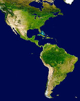
As we have been showing all along, the entire Western Hemisphere is the Land of Promise, Zion, the Land of Liberty, etc., and that certain portions of it have been set aside by the Lord for His various purposes. As an example, at least the western area of Andean South America is that portion promised and given to Lehi and his descendants, and the area in which the Book of Mormon events unfold.
    In addition, what is now known as the United States is that portion the Lord has set aside to govern this Land of Promise, and specifically, the areas of the Rocky Mountains and Missouri. What other portions the Lord has in mind, or has already dedicated to different parts of his plan, appear unknown to us at this time. But we do know that the entire Western Hemisphere was held in reserve by the Lord after the Flood waters receded (Ether 13:1), and that this entire land was dedicated by him for his wise purposes.
Until recently, it was difficult to find in the archaeological world a lot of understanding about the development of both western, or Andean South America, and the area known as Mesoamerica. While LDS archaeologists have long pushed the belief that the Olmec were the so-called mother culture of the Americas, the idea has been met with growing controversy by non-LDS archaeologists who have been digging in the ground in South America for more than 200 years and have found an entirely different story—that is, that South America was settled long before Central America, and long before the Olmec.
Of course, this runs so contrary to the ideas of accepted overall archaeology and anthropology which have long held that man crossed the so-called Siberian Land Bridge and then moved south through the Americas to finally reach the tip of South America. As fallacious an idea as that is, numerous scientists still cling to it since to accept that South America was settled first and moved northward, would require their acceptance of a power beyond science as being instrumental in that development--something most scientists have said time and again they cannot accept.
    However, as we are now learning, archaeologists, ethnohistorians (the study of cultures and indigenous customs by examining historical records as well as other sources of information on their lives and history), and linguists in recent years have amassed data demonstrating beyond question that for at least four thousand years people, materials, and ideas have moved fluidly between the two American continents, and from a south to north migratory direction. This gives us an avenue for understanding how elements of the localized Book of Mormon civilization could appear over the entire hemisphere.
    For example, a late Peruvian people like the Incas (prominent in the fourteenth to sixteenth centuries A.D.), while having no direct connection with Book of Mormon events a thousand years earlier, can be safely assumed to incorporate genes and cultural elements from Book of Mormon peoples.
    In fact, data that prove this longstanding cultural interaction can be found in many sources. Stephen de Borhegyi, a long time researcher in “Middle America” (Mexico to Panama) has identified scores of cultural parallels linking Mesoamerica and Ecuador. (Stephen F. de Borhegyi, Middle American Research Records 2, nos. 67 (New Orleans: Tulane University, 1961). Michael Coe, recognized as one of the foremost Mayanist scholars of the latter 20th century, author of numerous works on the Maya and the Olmec, was actually one of the first to argue persuasively that direct sea-voyaging could explain many of these similarities between Mesoamerica and Andean South America (Michael Coe, "Archaeological Linkages with North and South America at La Victoria, Guatemala," American Anthropologist 62, 1960.
Called “mullu” or “muyu” in Quechua, the extensive research by Benjamin Philip Carter at the Department of Anthropology of Washington University (2008) has shown that these shellfish, specifically the Spondylus princeps and S. calcifer, used for trade for ceremonial and ritual significance to many prehistoric cultures of South America, extended throughout much of western South American beginning approximately 4500 years ago (2500 B.C., close to the time when the Jaredites arrived). Down through time, they were also associated with the Wari, with Pachacamac, Pikillarcta, Cerro Amaru and even among the Inca. This trade system centered in southwestern Ecuador and extended throughout much of western South American from Ecuador to Chile, and according to Anawalt 1992 and Hosler 1990, reached as far north as West Mexico. In fact, it is claimed by Marcos and Norton, 1981, 1984, and Norton 1986, that large sailing vessels plied the waters, carrying goods throughout the region.
    According to archaeologists, the two Americas were linked. Donald Lathrap, an archaeologist and professor of anthropology at the University of Illinois, went so far as to claim that scheduled and routinized sea trade occurred. (Ancient Ecuador 3000-300 B.C., Field Museum of Natural History, Chicago, April 18-August 5, 1975, p61).
In fact, thanks to language studies, it is now thought that whole peoples migrated between the two continents, and that Quechua (the tongue of the early Peruvians and later the Inca) and Tarascan (of western Mexico), shared a common ancestral tongue. There is a tradition among the Huave (Wabi) who called themselves Kunajts (“us”), of the Isthmus of Tehuantepec in Mexico, that their ancestors came from Peru, having been driven out by wars (Matthew Wallrath, "Excavations in the Teuhuantepec Region, Mexico," in Transactions of the American Philosophical Society, n.s., Philadelphia, 1967, p14)
    This sounds like a confirmation of Moromn’s comments: “there was a large company of men, even to the amount of five thousand and four hundred men, with their wives and their children, departed out of the land of Zarahemla into the land which was northward” (Alma 63:4); and also “in the forty and sixth, yea, there was much contention and many dissensions; in the which there were an exceedingly great many who departed out of the land of Zarahemla, and went forth unto the land northward to inherit the land” (Helaman 3:3). It also shows an application to Hagoth’s immigrants: “he went forth and built him an exceedingly large ship…there were many of the Nephites who did enter therein and did sail forth with much provisions, and also many women and children; and they took their course northward…And the first ship did also return, and many more people did enter into it; and they also took much provisions, and set out again to the land northward” (Alma 63:5-7).
    Allison C. Paulsen, in Patterns of Maritime Trade between South Coastal Ecuador and Western Mesoamerica, is similarly confident that "from about 1500 B.C. until [at least] about 600 A.D., the inhabitants of the Santa Elena Peninsula, Ecuador, were involved in a network of maritime trade with certain parts of Mesoamerica" (in Elizabeth P. Benson, ed., The Sea in the Pre-Columbian World, conference Dumbarton Oaks, Washington, 1977).
    Donald Lathrap went so far, perhaps with overenthusiasm, as to suggest "scheduled and routinized sea trade  (Donald W. Lathrap, Ancient Ecuador, Chicago: Field Museum of Natural History, 1975).
Marshall Newman has mustered biological data to support the idea that sizable groups of people migrated in Mesoamerica (Marshall Newman, "A Trial Formulation Presenting Evidence from Physical Anthropology for Migrations from Mexico to South America," in Migrations in New World Culture History, University of Arizona Social Science Bulletin no. 27).
    Important parts of the culture of the Olmec in southern Mexico seem to derive from the Amazon drainage, and cultures on that river's delta in Brazil also show Mesoamerican‐like features. Peru, Colombia, Venezuela, Panama, and Costa Rica all appear to have been involved in the network of movements linking the Book of Mormon homeland with the southern continent (See articles by Irving Rouse, Clifford Evans and Betty Meggers, and Donald Lathrap in Handbook of Middle American Indians  (1966); and Allison Paulsen, "Patterns of Maritime Trade," in Elizabeth P. Benson, ed., The Sea in the Pre-Columbian (Washington: Dumbarton Oaks Research Library and Collections, Trustees for Harvard University, 1977), 143 
    It would appear that archaeologists are starting to accept the reality that the cultural insights first seen in South America are being found later in Mesoamerica, and even later some in North America. From this we can see that movement from the south to the north not only took place in the Book of Mormon lands, but also in the Western Hemisphere as well.

Tuesday, June 28, 2016

A Non-Stop Voyage? – Part II

Continuing from the previous post, which discusses theorists views of a difficult and lengthy sailing route for Lehi across the mid-latitudes of the world, where the distance is the longest, the winds less predictable, and the currents move in counter directions to such a course. It was also suggested that a southern course through the Southern Ocean would dispel all the problems a mid-latitude sailing would have encountered—especially in time.     Continuing here with the Reader Comments and our Responses:
    Reader Comment: “For how long it took, Dr. Sorenson suggests that we can get some feel for this time from the voyage of a Polynesian canoe named Hokule'a. This vessel, sailing about eight thousand miles in comparable waters, averaged about ninety-eight miles per day. While this represented eighty-two days at sea, stops for repairs, rest, and supplies, extended their voyage over more than a year. Unlike Lehi's experience, the Hokule'a encountered nothing but good winds for their entire journey. If all other factors were comparable, this would suggest a time of two to three years for Lehi's voyage.”
The Holulea voyages were understaken in the heavily concentrated area of islands, some 74 in Polynesia alone stretching over 200 miles from New Zealand to Hawaii. These islands and their currents allowed north south sailing, but the vast distances where there were no islands where the winds blew against east west movement  through the middle of the Pacific remained a barrier for other type of sailing
    Response: The Hokule'a sailed south to north and back from New Zealand to Hawaii and back, at the widest part of the globe and his voyage in no way would have mirrored that of Lehi’s crossing. Besides two to three years at sea is beyond anything anyone experienced before except for those that tried to circumnavigate the globe, lost ships and spent much time in ports.
    For Lehi, coming out of the Indian Ocean and into the Southern Ocean would have been a unique experience from sailing in relative smooth waters for perhaps a month to suddenly flow into a fast moving current with high winds that took his vessel along a rapid ride requiring very little knowledge and effort, other than holding on.
Where the Indian Ocean and Southern Ocean meet. Note the different in ocean color, a distinct line that is crossed when sailing southeast into the Southern Ocean, like stepping from a slow moving walkway onto a fast moving walkway in at a carnival
    The fact of the matter is that the Southern Ocean currents and winds blow at such high speeds, and the circumpolar route shortens the voyage distance to such a degree that the sailing time through that part of the voyage and up the coast of Chile would have taken no more than about six weeks which is the route taken today by sailing races, which typically set off in 15 knot winds and then move along what they call “the Sleigh Ride” in 40 knot wind, because of the speed of the wind and current along the 40º latitude, which reaches 70 knot winds along this 4,750 mile, 26-day run between Australia and Africa in some of the most extreme and exhilarating sailing in the world. As one race performer of today put it, “Expect 80 foot swells, boat speeds of well over 30 knots and wind speeds that can reach up to 70mph. A downwind run you’ll never forget.”
    Obviously, not being in a race and trying to outdo another vessel, all Nephi and his brothers had to do was hunker down, hold on, and enjoy the ride “driven forth before the wind” that eternally circulates round the bottom of the world.
From past experience we can envision that exhileration in Nephi, but doubtful in the others, who would probably have been so scared out of their wits as to give no thought to rebellion and mutiny, but merely to survival. In addition, sailing would be day and night since there is nothing to interfere with the straight circumpolar course across the Southern Ocean—even in pitch blackness of moonless and starless nights. It would have strengthened the testimonies of those who accepted and relied on the Lord’s power and protection while the others, cowed into silence, would have died a thousand deaths hoping for their survival. It must have been a thrilling moment of reprieve for Nephi from his brother’s heavy-handed actions and insults, and of pure delight to see them cower in fear before the Lord.
     Here in this sea, vessels attain such speeds because of the speed of transmission of the ocean currents, that they outrun the low pressure systems that can bring gale force storms. To better understand this, as a low-pressure system begins its pass, a warmer high-pressure air mass can crowd down from say the north, squeezing the two systems together. The cold air of the low slides in under the warmer air of the high and pushes it up. The air already blowing into the center of the low increases in velocity, shooting up and spiraling out higher in the atmosphere. As more air is displaced from the sea's surface, the air pressure there drops even further (Wind is the flow of air from areas of high to low pressure down the pressure slope, or gradient, much like water flowing from higher to lower elevations). The steeper the slope, the faster, the air moves, and the stronger the wind. As the low approaches, its pressure gradient grow ominously steeper. While there are reporting systems today to warn mariners of such, none would have existed in 600 B.C., except for the Liahona in which the Lord communicated with Lehi.
    In this way, Nephi would have avoided the type of weather that can hinder passage across the Southern Ocean. For the ball, compass, or Liahona, not ony pointed the way with one of its spindles (1 Nephi 16:10), it had writing on it from time to time (1 Nephi 16:29)—and thus by these small means the Lord can bring about great things (1 Nephi 16:30).
Left: Yellow Arrows show the flow of the northern current of the Southern Ocean where it hits the Patagonia Shelf and curves upward in the Humboldt Current; Right: Yellow Arrow shows the Humbolt Current flowing northward along the western coast of Chile toward Coquimbo Bay where the fast-moving current slows to almost a standstill around 30º south latitude
    In addition, when sailing the Southern Ocean, there is nowhere to stop, especially once past Australia, New Zealand and Auckland and the Campbell Islands, and out into the southern Pacific where the Southern Ocean continues to run free of any obstruction for the 4160 miles beyond Campbell Island. There the northern current encounters the Patagonia Shelf of South America and curves upward in what is called the Humboldt Current.
    Continuing with 50-knot winds for days on end that has its way of wringing out the last dregs of energy, holding on and ducking relentless waves day and night in a non-stop deluge for weeks on end that drench everyone, no doubt leaving Laman, Lemuel and the sons of Ishmael and everyone else, not only nauseous, but incapable of mustering the energy or even staying awake to foment any counter action.
    Also here the long fetch and huge swells where conflicting wave trains or the heaped, breaking crests of a conjoined swell can hit from different directions, rocking the vessel from one side to the other, while below the surface, a vast never-ending conveyor belt of cold water travels eastwards. At the latitude of the Forties and Fifties it is mainly wind-driven current, but further south the powerful Antarctic Circumpolar Current transports around 450 million cubic feet of water a second, three times more than all the rivers of the world combined.
    In the past, it made sense to mariners to head deep in these waters (south) into the Screaming 60s since they were after big winds and the speeds achievable from surfing the big Southern Ocean rollers, where as little as a 10-20º change in swell angle relative to the wind direction being much less comfortable and slowing progress. Obviously, the Lord knew where the best route would be and used the Liahona to communicate that to Nephi as to where to steer the shipas he did earlier in passing through the most fertile parts of the route along the Red Sea (1 Nephi 16:14). Obviously, while we are just learning today how to go faster, harness energy on the periphery of weather systems skirting storms to provide less wind, flatter seas, and faster speeds to minimize the number of weather systems encountered and the time spent in rough waters, the Lord has always known such things and wrote on the Liahona that which Nephi needed to know in steering the vessel along this raceway.
What a remarkable way to strengthen and prepare a future prophet that would end up guiding an entire nation, building a prosperous system of living that would see his people through a thousand years of dominance in the Land of Promise. One can wonder what made Nephi the man he was, but when taking his overall experiences as a whole, it is easy to see how the Lord developed the man to become the great leader he did. It is no different than the training and experiences Joseph Smith went through to forge him into the great prophet he became. It seems that sometimes we read the scriptural record and don’t really pay attention to what is going on, we just read words and think we understand, but there is an entire depth of knowledge to be gleaned—especially when we don’t have our minds made up before hand, and spend our reading time searching for the actual meanings of the writing.

Monday, June 27, 2016

A Non-Stop Voyage? – Part I

We received a long critique on one of our favorite subjects, the sailing of Lehi in the Southern Ocean and the type of voyage he undertook compared to what everyone thinks. It seems to us that until an individual comes to understand this voyage that Nephi briefly describes, he in no way can come to an understanding of where he landed, and thus, where the Land of Promise is located. To best answer this it seems to us that a singular comment article dealing with each individual idea one at a time would be the best way to provide a response. 
    First of all, unlike picking out a spot where one thinks the Land of Promise was located, as Sorenson did with Mesoamerica, Phyllis Carol Olive did with the Great Lakes because of the hill Cumorah, or Rod Meldrum did with his “Heartland” theory, etc., it is imperative to understand how Nephi’s ship could have sailed to the Western Hemisphere and the course it would have been restricted to sailing.
    We will list the Reader Comments, and our own Responses:
    Reader Comment: “It seems to me that Nephi’s voyage to the promised land was not a non-stop affair as you claim. The record doesn’t say either way…”
Response: The record gives no indication that any events happened at all, which should suggest a lack of events. Surely, if Nephi was to land his ship for repairs, water or food replenishment, etc., Laman and Lemuel and the sons of Ishmael would have found some way to effect a rebellion that they had fomented many times before. The lack of any comment along this line should suggest that they did not have an opportunity, i.e., that no landing took place anywhere. 
    Reader Comment: “…reason and similar experiences seem to provide an answer. If for nothing else, stops would be necessary to replenish their water supply. Repairs, other provisions, and the scraping of barnacles are other conditions which have forced all ancient seamen to make frequent stops as they have pursued similar voyages.”
Response: The “biofouling” of ships has been a problem for seamen forever; however, pulling into an island during a voyage is not sufficient to scaping the barnacles off the hull—it literally requires a dry dock, or the practice anciently of tipping a vessel over on its side to expose the hull sufficiently to scrape it clean--a skill unknown to Lehi and his family and one requiring a great deal of skill to keep from damaging the ship and sinking it entirely as often happened in the days of tipping. But the important thing to keep in mind for the Lehi voyage is that the practice of scraping barnacles ancientl off wooden sailing vessels occurred about every two months—or stated differently, not sufficient barnacles would have built up in a short one time voyage of Nephi’s ship from Arabia to the Western Hemisphere. The build up begins and progresses in series or singular events, i.e., first, a new ship like Nephi’s would have been coated with microbes in a day—not enough to see, but the first microbes start to lie down. Then the slime begins to grow over the course of weeks, which is nothing more than a gateway community (beginning) to the barnacles and other things to follow.
    This slime is a biofilm, a thin sheet of bacteria that stick to each other and to a matrix of molecules they exude to communicate with each other and to provide a hospitable environment for themselves. Once the slime forms, the rush is on, as algae and the larvae of creatures such as barnacles attach and begin to grow. In the era of Lehi, the primary threat to wooden hulls, came not from barnacles that attached to the outside of ships, but from marine worms—actually, long, thin, soft-bodied clams—that tunneled through the wood. The Romans used lead sheeting to protect against shipworms, giving their ships an edge in commerce and in war. (It added substantial weight, but it was on the ships’ bottoms, contributing to the vessels’ stability) Lead-covered hulls still hosted barnacles that had to be scraped, but at least the wood remained strong.
In the mid 1700s, the British began sheathing ship bottoms with copper, which repelled barnacles and other organisms and warded off wood-wasting worms. This was a radical technical advance for the time, but certainly within the knowledge of the Lore in his instructing Nephi how to build his ship, which was “not after the manner of men,” and to work his timbers “not after the manner of men.” There was also another technique, one less radical for the time, and that was paint containing copper. This caused small amounts of copper to leach into the water immediately next to the ship, poisoning any small creatures that approached, but certainly usuable in a pristine environment and on such a short voyage. 
    Several other toxic ingredients were also tried, including arsenic, mercury, strychnine, cyanide, and radioactive materials. Other than the latter, all were available to Nephi to use with a little special instruction. So was a tin-based antifouling paint, which proved in wooden ships to eliminate barnacle scraping for five years.  In addition, man is just now coming up with a “fouling release” paint that keeps things from sticking to the ship’s hulland plying the fast currents of the Southern Ocean, this latter would have been ideal and obviously within the instructional realm of what the Lord was teaching Nephi in building his ship—which is much like Noah being taught to apply pitch to his ship to make it seaworthy.
Several Options were available to the Lord to instruct Nephi during the construction of his ship and its finishing coat of paint, varnish, oil, or whatever was added to make it seaworthy
    Any of these solutions would have been simple to apply for Nephi and certainly cause his ship to last the short trip to the Western Hemisphere. Remember, Lehi’s voyage would have lasted less than two months in the Southern Ocean and closer to 6 weeks or less. It was a one-way, one-time only voyage. The worse that barnacle build-up on such a short voyage would be to slow down the vessel, which would not have to have been cleared away.
    Reader Comment: “Lehi's journey would have taken them more than half way around the world. For comparison, Lehi's voyage would have traversed at least 200° compared to about 55° for Columbus's voyage to America. Of course, Lehi did not travel in a straight line. Sorenson estimates that Lehi's journey would have been about seventeen thousand miles as compared to about three thousand for Columbus.”
    Response: This is typical Sorenson rhetoric. No understanding shipwright knowing the courses available for the voyage would even concern himself with such a problem, and certainly not think in terms of such a lengthy voyage. In the first place, almost all ocean voyages in deep water are on pretty much of a straight line. Secondly, since the currents and winds would have led directly through the Sea of Arabia into the Indian Ocean and then the Southern Ocean, the actual distance traveled would have been minimal since the Southern Ocean, unlike the Pacific at the equator, is very short all the way around the globe. As an example, sailing in the latitude of the 40s in the Southern Ocean saves many thousands of miles from traveling around the equatorial area across the Pacific. Dropping into the 60s, would save another thousand miles around the globe.
The yellow arrow shows (white circle) much smaller around than the green arrows. 
As an example, were this the world (turned upside down for viewing), the movement (white circle) around the globe would be a much shorter distance than that of the equator, shown by the green arrows
    To understand what we are talking about one must think of the voyage on a globe, not a flat map. Think of it as an orange cut in half. Place the cut end flat on a table and then compare the circumference of that on the table to the rounded end sticking up. The distance is four or five times further around at the table than what is in the air.
    Reader Comment: “No, this was not a non-stop voyage.
    Response: Of course it was. Any stops would have created problems and the voyage would have been short enough around the lower latitudes of the Roaring Forties, Furious Fifties and Screaming Sixties, as to make it a short voyage.
(See the next post, “A Non-Stop Voyage? – Part II,” for more on the understanding of why the Southern Ocean route was the only course that could have taken a ship “driven forth before the wind from the Arabian Peninsula to the Western Hemisphere)

Sunday, June 26, 2016

Isn’t it Possible?

We are asked all the time if this or that isn’t possible. As an example, we are continually asked if it isn’t possible that the Hill Cumorah was in New York, since there is so much to suggest that and so many people think so. In answer, I suppose most people often take the stance that things we write about are not as clear cut as we claim. So I would answer, I suppose one could say just about anything is possible when they lack information or the facts behind the matter. So let me ask this question: “Isn’t it possible that God is wrong?” or  “Isn’t it possible that Nephi’s ship had a diesel engine?” or “Isn’t it possible that Moroni didn’t translate and abridge the Ether record?” or “Isn’t it possible that God simply picked up Nephi’s ship and placed it down along the shore of the Land of Promise?” 
    Are any of those possible?
    There simply are some things in life that we either know are not possible or know they did not happen. Sometimes reason alone confirms that, as in the case of a diesel engine driving Nephi’s ship. Sometimes it is the scriptural record which tells us how it happened as in Moroni translating the Ether record (Ether 1:1-2; Moroni 1:1). Sometimes it is simply impossible, such as in God being wrong.
    However, some questions are not quite so clear at first glance, as in when Mormon requested to meet for their final battle at the hill Cumorah, how did the Lamanite king know where it was? (Mormon 6:1-2).
    Without roads, signs, maps or something so unusual about it to make the hill stand out so that it could be seen for some distance, how would the Lamanite king, whose forces were to the south of Mormon, i.e, nowhere near the hill Cumorah, nor was he from the area, never having been in the Land Northward before since the Lamanites had always been to the south of the Nephites. Obviously, the Lamanites would not have had any knowledge of its location or the territory around it.
The Hill Cumorah in Western New York cannot  be distinguished from much around it. In fact, it cannot even be seen that it is a hill from any distance
    The logical answer, then, would be that the hill was tall enough with nothing else around it for the landmark to be easily identified from some distance away, or that the hill was so oddly shaped that it could be seen from some distance, or that Mormon was so capable of describing the area that the hill could not be missed.
    Despite people writing about how the Hill Cumorah in New York stands out, having been there recently and studied photos of it for years, the fact is it is almost indistinguishable from the surrounding terrain. It is a drumlin hill and, in fact, the name itself comes from the Irish word “droimnin,” which means “littlest ridge.” It is more or less rounded from side to side and is often described in geology as a “half-buried egg or inverted spoon.” Nor is it the only such hill in the area, since this part of western New York is filled with these drumlin hills, especially between the south shore of Lake Ontario and Cayuga Lake (Michael Kerr; Nick Eyles. “Origin of drumlins on the floor of Lake Ontario and in upper New York State," Sedimentary Geology, Elsevier, 193: 7–20).
    In short, there is simply nothing to set apart the Hill Cumorah in New York from its surrounding countryside that someone who had never been in the area before would be able to pick it out or even know where generally to head for it, in fact, drumlins occur in groups or “swarms,” and are composed largely or entirely of glacial till.
As can be seen, even in an open area, a drumlin hill is hard to distinguish and others around them look much the same
    So how could we answer that question? The word Ramat or Ramah, as in the Hill Ramah, which is Cumorah according to Moroni (Ether 15:11), means “height, high place, or high plateau,” in Hebrew; “Aramat Gan,” near Tel Aviv, means “Garden Heights;” “Ramat HaSharon,” near Sharon, means “Height of the Sharon;” ”Ramatayim,” in Hod HaSharon literally means “two hills;” “Ramat Hadar,” that is, “Citrus Hill,” is a farming community built on a hill near Kfar Hadar and Ramatayim; and “Ramat ha-Golan,” at 7,297-feet, means the “Heights of Golan” (James Hastings, Dictionary of the Bible, Charles Scribner’s Sons, New York, 1952, p782). In fact, Ramah is  “the name of several places in Palestine, so called from their “loftiness,” that being the radical meaning of the word; it could also mean “a hill that rises up from a highland or plateau, or a hill of imposing heights.”
    In Spanish, such “hills” are called “cerro,” and in Ecuador, all hills around 7,000 to 9,000-feet are called “cerros.” And in Ecuador, 37 miles northeast of Quito near the town of Otavalo, there is a mount called Cerro Imbabura, which rises up from the elevated inter-Andean highlands. It is of note that most cerros in Ecuador differ from the Imbabura because they rise from the Cordilleras themselves, rather than from the plateau.
Cerro Imbabura is a very noticeable hill about 7,000 feet in height above the surrounding plateau and visible for many miles
    The Cerro Imbabura is 15,190-feet in elevation, but stands about 7,000-feet above the highlands. As the dominant geographic feature of the area, it is a stand-alone peak and can be seen from miles around and is midway between the two great ranges of the cordillera Oriental and the Cordillera Occidental. At its base is the breathtaking Lago San Pablo (San Pablo Lake.
    It might be important to know that the Cerro or hill Imbabura is considered a sacred hill in Ecuador, even today. In fact, Imbabura is of significant importance to the local culture, which involves a spiritual relationship with the land. The mountain is sometimes personified locally as Taita Imbabura, or "Father Imbabura”, and is considered the sacred protector of the region.
    It is also of note that names, as also pointed out in Venice Priddis' The Book and the Map, of certain sections of the hill have been given names of “Compania,” meaning “Company,” “Batallón,” meaning Battalion, “Zapallo Loma,” meaning “sad person hill,” which is given to two parts of the hill.
    In fact, it is so sacred, that native Imbaburians today go to the mount to ask favors of God, where they light a cigarette and blow the smoke toward the hill—only then asking for the favor, always beginning by saying, “Daddy Imbabura.” It was often referred to as Achilly Pachacamac, the supreme God by pre-Inca Peruvians.
The hill has gentle slopes that make it easy to climb through tall grasses into rocky outcroppings, followed by surprising lush vegetation high on the mountain. Today, it is often used as a warm up or acclimation climb for more serious hills and mountains. Around the lower rim it is quite open and provides a clear nearly 360º view of the surrounding level ground. In fact, the ground above the tree line is high-altitude meadow, and it’s cone is relatively exposed from erosion and easy to identify for miles around.
    Mormon wrote that: “we did march forth to the land of Cumorah, and we did pitch our tents around about the hill Cumorah; and it was in a land of many waters, rivers, and fountains; and here we had hope to gain advantage over the Lamanites” (Mormon 6:4). One might ask what advantage could Mormon hoped he might achieve?
    In looking at this (or any so-called hill Cumorah) one should ask this very question—what type of advantages would this mount have given the Nephites? Consider Cerro Imbabura:
1. The mount is large enough around at its base that the entire Nephi army could have occupied higher ground;
2. Lake San Pablo is to the south of the hill, along the Lamanite route, and would restrict the approach of some of the advancing Lamanite army, and channel it into where the Nephites could have stationed their strongest defense;
3. The gentle slopes would make it easy for the Nephite army to retreat slowly while still presenting a formidable front, especially across the paramo grasslands, always commanding the high ground (a very desirable military strategy);
4. At higher ground, the rocky going would provide greater defensive positions, making it more difficult for the Lamanite attackers to advance;
5. Areas of larger outcroppings and rocky crags would make it easy for the defending army to lay in wait, set traps or counter attack;
    Other considerations that match the description of the hill that Mormon provides:
1. From the top one could see 360º for many miles and see down upon the 300,000 or more dead that lay scattered upon the battlefield;
2.  There are numerous vertical folds in the surface that provide ample protections from being spotted by those below as Mormon and the 23 other survivors looked down upon their dead comrades the following morning;
    As a side note, it might be of interest to know that unique to this area there are many species of birds of prey, including the Parque and Andean Condors, kestrals, and hawks here in unusually large numbers, perhaps anciently drawn to the area by the huge number of dead to feed on—today it is a condor reserve.
     All of this should suggest even to the most hardened Great Lakes advocates that the Hill Cumorah in western New York does not qualify for the hill Cumorah in the Land of Promise.

Saturday, June 25, 2016

So Where is the Land of Promise?

Very possibly never has a question been more often asked and incorrectly answered as this within the LDS community regarding the geographical setting of the Book of Mormon. It is very likely the most often sought answer in all the archaeological work, writing, investigating and teaching regarding non-doctrinal subjects about the Book of Mormon.
The scriptural record itself states several times that the land to which Lehi was led, was a “promised land,” a “land of promise,” a “choice land,” “more choice than other lands.”
    In First Nephi, the term “promised land” is used 8 times and the term “land of promise” is used 13 times, and “choice above all other lands” used twice—or this one idea is used 23 times, and five more times in Second Nephi for a total overall of Lehi and Nephi’s writings of 28 times, and that is just on the Small Plates, which were abridged by Nephi from his Large Plates and the lost 116 pages of the Book of Lehi. One can only imagine how many times in the original writings it would have appeared.
    In addition, we know that this land of promise was promised to the Nephites if they remained righteous, and we simply do not know how many “Nephites” remained righteous and earned that promise during the thousand year history of the Nephite nation, and of the areas of Central and North America the Nephites eventually settled through immigrating in Hagoth’s ships and traveled overland from there to spread out over the face of the Western Hemisphere.
    But where was this land of promise? Some theorists want to limit its scope to just the United States, others to just North America, yet we know that the Land of Promise was seen on a much larger scale than that. In Nephi’s vision (1 Nephi 11:1), which was the same vision granted earlier to Lehi, he saw a Gentile “discover” the Land of Promise, being led across the many waters toward it: “and I beheld the Spirit of God, that it came down and wrought upon the man; and he went forth upon the many waters, even unto the seed of my brethren, who were in the promised land” (1 Nephi 13:12).
This Gentile, being Columbus, who in his own words saw “himself as the fulfiller of biblical prophecies! Columbus saw himself as fulfilling the ‘islands of the sea’ passages from Isaiah and another group of verses concerning the conversion of the heathen. Watts reports that Columbus was preoccupied with ‘the final conversion of all races on the eve of the end of the world,’ paying particular attention to John 10:16: ‘And other sheep I have, which are not of this fold’ (see also 3 Nephi 16:3). He took his mission of spreading the gospel of Christ seriously. ‘made me the messenger of the new heaven and the new earth…He showed me the spot where to find it,’ Columbus wrote in 1500” (Ed. John W. Welch, Re-Exploring The Book of Mormon, Columbus: By Faith or Reason?, chapter 9).
    As the scripture says, the Spirit led the gentile to the Promised land, the Spirit also led Columbus to the Americas. However, the exact place where Columbus was led was 1) the Bahama Islands of the Caribbean in his first two voyages, then 2) the northern portion of South America on his third voyage, and finally to 3) Central America. He did not ever sail to, touch foot on or land near or upon what is now the United States, or even the area of North America, meaning Mexico, the U.S. or Canada.
    Yet, in Nephi’s words, he was led to “even unto the seed of my brethren, who were in the promised land.” Thus to anyone, other than those who have their heads buried in the sand of pre-determined theories, Nephi is telling us the promised land covers an area larger than that of the United States, or that of North America!
    As we have indicated on numerous occasions, President Wilford Woodruff has stated: “This land, North and South America, is the land of Zion; it is a choice land—the land that was given by promise from old father Jacob to his grandson and his descendants, the land on which the Zion of God should be established in the latter days” (Journal of Discourses, 12 January 1873, Vol 15, p279).
    As Ezra Taft Benson has stated: “This is our need today—to plant the standard of liberty among our people throughout the Americas…the struggle for liberty is a continuing one—it is with us in a very real sense today right here on this choice land of the Americas. Conference Report (October 1962), pp. 14–15; “To the peoples who should inhabit this blessed land of the Americas, the Western Hemisphere, an ancient prophet uttered this significant promise and solemn warning.” Conference Report (October 1944), p. 128.
Milton R. Hunter (left): “This is one of the most important days of my life, and in the history of the Church of Jesus Christ of Latter-day Saints…We came in full view of the valley of the Great Salt Lake; the land of promise, held in reserve by God, as a resting place for his Saints” (Conference Report, April 1947, p67).
    Orson Pratt: “And the Lord gave unto them the whole continent, for a land of promise…” (Interesting Account of Several Remarkable Visions and of the Late Discovery of Ancient American Records, Edinburgh: Ballantyne and Hughes, 1840; cited in David J. Whittaker, The Essential Orson Pratt (Salt Lake City: Signature Books, 1991), p11).
Orson Pratt: “We are not in possession of our land of promise particularly, only as we obtain it by a renewed promise; but we are inheriting a land that was given to the remnant of Joseph, and God has said that we must be remembered with them in the possession of this land” (Journal of Discourses, 1 November 1868, Vol 12, p322). Joseph Smith said “the whole of Ameerica is Zion itself from north to south” (teaching of the Prophet Joseph Smith, Joseph Fielding Smith, Salt lake City, Deseret Book, 1938, p362);

    Ether through Moroni proclaimed, “Behold, this is a choice land, and whatsoever nation shall possess it shall be free from bondage, and from captivity, and from all other nations under heaven, if they will but serve the God of the land, who is Jesus Christ” (Ether 2:10,12). And who are the “whatsoever nation” that will possess this land? There are several of them. According to  Ezra Taft Benson, the Lord promised, “I will fortify this land against all other nations” (2 Nephi 10:12), and in the decade prior to the restoration of the gospel, many countries of South America fought wars of independence to free themselves from European rule. Russia, Austria, and Prussia, however, urged France to aid Spain and Portugal to restore their monarchies in South America. This effort was repulsed by a proclamation from the United States government known as the Monroe Doctrine. The heart of the Monroe Doctrine consists of these words: “The American continents…are henceforth not to be considered as subjects for future colonization by any European powers.” 
President Joseph Fielding Smith (left) said “the greatest and most powerful fortification in America is the ‘Monroe Doctrine.’ It was the inspiration of the Almighty which rested upon John Quincy Adams, Thomas Jefferson and other statesmen, and which finally found authoritative expression in the message of James Monroe to Congress in the year 1823” (The Progress Of Man, Salt Lake City: Deseret Book Co., pp. 466–67).
    Canada, the United States, Mexico, Guatemala, Belize, Honduras, El Salvador, Nicaragua, Costa Rica, and Panama, all possess North America; while Venezuela, Colombia, Guyana, Suriname, Ecuador, Brazil, Peru, Bolivia, Chile, Paraguay, Uruguay and Argentina possess South America. There are also Cuba, Jamaica, Haiti, Dominican Republic, Puerto Rico, and numerous small island governments that possess the islands connected to the Americas in the Western Hemisphere.
    Of all of these, it has fallen to the United States to be the protectorate of this land of promise, and the Lord raised up leaders in the Founding Fathers that brought about the Constitution, the Bill of Rights, and the Monroe Doctrine that has to-date guaranteed the freedom of this land. It will be to these United States that the eventual New Jerusalem will reside and the city of Enoch will return, and the Church from which will go forth the Law.
    This is the Land of Promise spoken of in the Book of Mormon. The Land of Liberty and freedom, the overall land to which Lehi was sent, and upon a part of which he landed. It was the land of his vision and that of Nephi, and the land to which numerous modern-day prophets have claimed is the Land of Promise.

Friday, June 24, 2016

Joseph Smith and Member Reactions to the Stephens-Catherwood Books

In the last post we discussed Wilford Woodruff’s journal notation entered after the experience with Zion’s Camp and Joseph Smith’s revelation or vision regarding the white Lamanite Zelph. 
    The interesting thing is that six brethren from Zion’s Camp notated in their journals the information regarding Zelp and the prophet Onandagus, and no two are identical, and some are considerably different, merely proving that different people seeing and hearing the same thing often view and hear differences and record them as such. All this proves is that people have opinions and not all opinions are the same, even of shared experiences.
    Thus, the location of the Land of Promise in the Book of Mormon was still open to speculation, and many of the brethren offered different opinions during the ensuing years. And while Wilford Woodruff uses the term regarding Onandagus “that was known from the hill Camorah, or east sea to the Rocky mountains,” Joseph Smith later wrote “from the eastern sea to the Rocky Mountains.” Again, suggesting the revelation or vision did not include any such Book of Mormon description of territory.
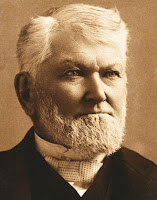
Therefore, when Wilford Woodruff (left) recorded in his journal seven and a half years later his excitement over the Stephens and Catherwood discoveries and said that these discoveries “brought to light a flood of testimony in proof of the Book of Mormon,” he was not being untrue or unfaithful to the Prophet Joseph, to his own conscience, to the Lord, or to the 1834 revelation given to the Prophet Joseph about Zelph. After all, Wilford Woodruff was a man of integrity and was true to the Prophet and true to every revelation from the Lord. When all the facts are understood, no conflict of interest or breach of integrity is evident in the actions or words of Wilford related to Zion’s Camp, the revelation received by Joseph, or Joseph’s stated feelings about the Book of Mormon being validated by the findings in Central America.
    Thus, when it is shown that men, no matter who, state their opinions about matters, we have nothing more or less than their stated opinion. Such understanding led the prophet Joseph Smith to record in his journal, “This morning I visited with a brother and sister from Michigan, who thought that "a prophet is always a prophet;" but I told them that a prophet was a prophet only when he was acting as such. (History of the Church, 5:265; see also Teachings, p. 278).
    Jesse W. Crosby wrote regarding the prophet: Brother Crosby said that he with some other brethren once went to the Prophet and asked him to give them his opinion on a certain public question. Their request was refused. [Joseph] told them he did not enjoy the right vouchsafed to every American citizen; that of free speech. He said to them that when he ventured to give his private opinion on any subject of importance his words were often garbled and their meaning twisted and then given out as the word of the Lord because they came from him. ("LaFayette C. Lee, Notebook," LDS Church Archives, Salt Lake City, Utah; also in Remembering Joseph).
Bruce R. McConkie (left), of the Quorum of the Twelve Apostles, wrote: “Are all prophetic utterances true? Of course they are! This is what the Lord’s system of teaching is all about. Anything which his servants saying when moved upon by the Holy Ghost is scripture....But every word that a man who is a prophet speaks is not a prophetic utterance. Joseph Smith taught that a prophet is not always a prophet, only when he is acting as such. Men who wear the prophetic mantle are still men; they have their own views; and their understanding of gospel truths is dependent upon the study and inspiration that is theirs. Some prophets—I say it respectfully—know more and have greater inspiration than others. Thus, if Brigham Young, who was one of the greatest of the prophets, said something about Adam, which is out of harmony with what is in the Book of Moses and in section 78, it is the scripture that prevails. This is one of the reasons we call our scriptures The Standard Works. They are the standard of judgment and the measuring rod against which all doctrines and views are weighed, and it does not make one particle of difference whose views are involved. The scriptures always take precedence. (“Finding Answers to Gospel Questions,” Letter dated 1 July 1980. Published in Teaching Seminary Preservice Readings, Religion 370, 471, and 475, 2004, emphasis added).
    Thus, when men of integrity speak, they may merely be uttering their own opinion on matters, and quite often do, especially when their words do not accompany a support reference or have a purpose to which we are not privy. As an example, a man of leadership may quote the First Article of Faith, “We believe in God, the Eternal Father, and in His Son, Jesus Christ, and in the Holy Ghost,” then launch into a discussion about the Adam-God Theory in which he speaks inconsistently with the scriptural record. It cannot be mentioned too strongly that the scriptural record is the basis by the rest of what the man says, not his position, nor his strength of opinion, or his argument, only what the scriptural record states.
This is why Joseph Smith (left) was careful what he said, as he was often misquoted or misunderstood by those who thought every word he uttered was doctrine, when even he told people frequently it was not. As Bruce R. McConkie stated, that is why we call the Standard Works the Standard Works—they are the standard by which the word is determined.
    Thus, we can again state, that it is imperative that we should understand that what was important to these early Church leaders and members is that evidences such as Stephens book on the Central America ruins, or the bones and vision about Zelph, is that for the Church at the time, having spent eleven years being ridiculed since the publication of the Book of Mormon over some “so-called” and unknown civilization occupying some unknown area in the Americas, raising scientific eyebrows and jocular reactions, was for the first time being supported and validated by scientific and factual findings.
    This was especially true of Stephens and Catherwoods findings since neither of them had, or ever did have, a known connection to the Church or to Joseph Smith.
    So what was Joseph Smith’s initial reaction to the Stephens and Catherwood books and findings? Although we cannot clearly discern the date when Joseph first started reading Stephens’s two volumes, Joseph expressed his feelings about these books on November 16, 1841, in a thank-you letter to Dr. John Bernhisel who had sent him the books. In the letter, Joseph said, “I have read the volumes”; so we can probably assume that Wilford Woodruff delivered the two volumes soon after his return to Nauvoo in the first part of October 1841. The thank-you letter is in the handwriting of John Taylor, who was a scribe for the Prophet.
Here is the one long sentence from that letter that refers to Dr. Bernhisel’s gift of Stephens’s two-volume set:I received your kind present by the hand of Er Woodruff & feel myself under many obligations for this mark of your esteem & friendship which to me is the more interesting as it unfolds & developes many things that are of great importance to this generation & corresponds with & supports the testimony of the Book of Mormon; I have read the volumes with the greatest interest & pleasure & must say that of all histories that have been written pertaining to the antiquities of this country it is the most correct luminous & comprihensive."
    While people can ask: “Why would the Prophet say that Stephens’s two-volume book “supports the testimony of the Book of Mormon” if the findings in Central America had nothing to do with the Book of Mormon?” But in so doing, they miss the intent completely. To someone who is strongly desirous to know where the Book of Mormon Land of Promise was located, or has staked their reputation and career, as well as their fortune and earnings, on such knowledge, it is understandable this is their focus—but to Joseph Smith and the members of the Church at the time, they had not staked their beliefs on a specific spot within the Western Hemsiphere as to where the location of the Book of Mormon lands were located—they had staked their reputations, their testimonies, their very integrity on the fact that the Book of Mormon lands were, in fact, located within the Western Hemisphere. Joseph Smith and early Church leaders and members were delighted that the Stephens-Catherwood book and drawings bore testimony that the Nephites existed, that they were here in the Western Hemisphere as the Book of Mormon clearly states, and that they built magnificent buildings and left testimony of their existence. Nothing else mattered to them at the time of this discovery in Central America.
    “See, I told you so, they were here and there is the evidence of their existence!”
    That was their message. Not, “See, I told you so, they were in Central America, and there is the evidence of their existence!”
    They were here! In the Americas! That had been Joseph Smith's message, and the message of the Book of Mormon since its publication. Now, thanks to Stephens and Catherwood's work, they had proof of that! It was worth shouting about.