Monday, October 31, 2016

Finding Lehi’s Isle of Promise – Part XXII

Continuing with more of the scriptural record statements that lead us to a clearer understanding of the location of the Land of Promise, for there can be no question that any Land of Promise must have all these descriptions Mormon and Moroni left us, must be reachable by ship “driven forth before the wind” by an inexperienced crew, and qualify for an island as Jacob said, or existed at the time of the Nephites. In this particular article, we take a look at the extensive use of metallurgy in the Land of Promise, from the time of the Jaredites onward. 
The Jaredites did dig it out of the Earth 

    As Moroni in his abridgement of Ether’s record, states: “And they did work in all manner of ore, and they did make gold, and silver, and iron, and brass, and all manner of metals; and they did dig it out of the earth; wherefore they did cast up mighty heaps of earth to get ore, of gold, and of silver, and of iron, and of copper. And they did work all manner of fine work… And they did make all manner of tools to till the earth, both to plow and to sow, to reap and to hoe, and also to thrash. And they did make all manner of tools with which they did work their beasts. And they did make all manner of weapons of war. And they did work all manner of work of exceedingly curious workmanship” (Ether 10:23, 25-27).
    This was in the days of Lib, who was the 17th generation from Jared (Ether 1:17-18), about in the middle of the Jaredite period, making the year around 1300 B.C., whether they were working metal before that it is not known, but one can surmise that they were, since Moroni’s statement suggests prior knowledge of metallurgy before the time of Lib.
    Of course, this continued with the Nephites, when Nephi tells us that either knew how or was going “to make tools to construct his ship” (1 Nephi 17:9), and then later tells us that he taught his people “to build buildings, and to work in all manner of wood, and of iron, and of copper, and of brass, and of steel, and of gold, and of silver, and of precious ores, which were in great abundance” (2 Nephi 5:15), which was around 580 B.C. Later, Jarom added, “fine workmanship of wood, in buildings, and in machinery, and also in iron and copper, and brass and steel, making all manner of tools of every kind” (Jarom 1:8), around 399 B.C., and about 240 years later, they are still working in metal (Mosiah 11:3, 8). We find this tradition still in full swing over two hundred years later with the Nephites “in the north and in the south” (Helaman 6:11). Consequently, for at least a two thousand year period, metallurgy was being worked in the Land of Promise, from 1300 to 25 B.C., and obviously later.
Left: Very early breastplate made binding gold plates together; Right: Hammered gold into writing sheets

    The Jaredites not only hammered out gold into thin sheets for writing, they had “breastplates, which are large, and they are of brass and of copper, and are perfectly sound“ (Mosiah 8:9-10; 28:11). They also made small things of metal, “ringlets, and their bracelets, and their ornaments of gold, and all their precious things which they are ornamented with” (Alma 31:28). In fact, “they did have an exceeding plenty of gold, and of silver, and of all manner of precious metals, both in the land south and in the land north.” (Helaman 6:9).
It would seem obvious that in the Land of Promise one should find evidence of metallurgy dating back to at least 3300 years ago, and worked from at least 1300 B.C. forward. However, this is not the case in Mesoamerica, where metallurgy dates no earlier than 600 A.D. (two hundred years after the demise of the Nephites), and as much as 900 A.D., depending on which archaeologist you encounter.
    John L. Sorenson, in his book An Ancient American Setting for the Book of Mormon (1985, p278), states: “Critics of the Book of Mormon have been fond of pointing out that statements in the scripture regarding use of metals by the Nephites and Jaredites run contrary to authoritative pronouncements on the subject by experts.” However, that statement is for Mesoamerica only—not for South America where numerous studies have shown metallurgy dating far back into B.C. times.
Sorenson then goes on to claim an earliest date of 600 B.C., inferring that this date is probably closer to the first century B.C. Yet, three years after his statement, Dorothy Hosler (above) in “Ancient West Mexican Metallurgy: South and Central American Origins and West Mexican Transformations,” American Anthropologist 90 (1988, pp832-855) stated that “The emergence of metallurgy in pre-Columbia Mesoamerica occurred relatively late in the region's history, with distinctive works of metal apparent in West Mexico by roughly AD 800, and perhaps as early as AD 600,” and again in 2009: “West Mexican Metallurgy: Revisited and Revised.” Journal of World Prehistory 22 (3): pp.185–212.
    Scott E. Simmons and Aaron N. Shugar in a research paper entitled “Archaeometallurgy in Ancient Mesoamerica, quoting from 117 professionals in the field of Metals in Antiquity and in Mesoamerica, with 90 of them written and published after Sorenson’s statement and several as late as just 6 years ago in 2009, all showing no earlier date for metallurgy in Mesoamerica than Classic Times 300-900 A.D.
    After 11 pages in his book (p278-288), Sorenson concludes with: “The conventional scientific view about the role of metal in Mesoamerica, and particularly about its date, is in the process of major change. Scholarly developments on the topic in the coming decade will be worth watching.” Well, as shown above, scholarly work on the subject has been reporting the same basic information about no metallurgy in Mesoamerica during Jaredite times, and a possible overlap of 100 years in Nephite times, though more likely after Nephite times since a period quoted covers 700 years. That is, Scholarly work on metal in Mesoamerica over the next twenty-five years after Sorenson’s book has turned up no changes at all in dates, and obviously has not been worth watching whatever.
Scott E. Simmons and Aaron N. Shugar: Top: (p2) table showing no metallurgy found in the Maya Lowlands, Maya Highlands, Basin of Mexcico and West Mexico until after 900 A.D., covering a period from 2000 B.C. to 1800s A.D.; Bottom: (p3) The area of (Red Arrow) West Mexico where metallurgy has been found after 600 to 900 A.D.; the area (Blue Arrow) of Guatemala where metallurgy has been found after 900 A.D. (along the border with Honduras)

    On the other hand, according to Jamie Turner, in “The History of Metallurgy in Mesoamerica,” Physical Science, (2015) states: “Metalworking in South America dates back to at least 1936 B.C.,” while adding that “Archeological excavations in Mesoamerica have found evidence for the use of smelting, casting, and alloying of metals starting in the Late Post classic period around 800A.D.,” and stating that: “From 800-1300 A.D. Mesoamerican metallurgy shared many common traits with Peru,” suggesting, of course, that it started much earlier in Peru and eventually moved northward into Mesoamerica.
    Monette Bebow-Reinhard, who has compiled the largest database of copper artifacts ever found, in “Mesoamerican Copper-An Industry of Connections,” (2013) states that “Mexico was a latecomer to the copper industry.” In fact, copper tooling suggests that South America began using copper in 2155 B.C., while Mexico is dated between 200 B.C. and 500 A.D.
Top  2 Rows: Ceremonial knives, such as those above (lower left) were plentiful around 300 B.C. along the Peruvian coast; also ceremonial masks were very common in the ground throughout Peru; Bottom Row: Left: An intricately worked gold piece dating to about 100 A.D., was discovered in Peru at the base of an eroded mud-brick pyramid. Other items were 19 golden headdresses, various pieces of jewelry, and two funerary masks; Center/Right: Chavin metal work dating to the last millennia B.C.

    In addition, according to Aldenderfer, Speakman, and Popelka-Filcoff, in the Proceedings of the National Academy of Sciences of the United States of America, in their report “Four-thousand-year-old gold artifacts from the Lake Titicaca basin, southern Peru, claim that “South American metal working seems to have developed in the Andean region of modern Peru, Bolivia and Chile,” with gold and copper being hammered and shaped into intricate objects, particularly ornaments.”
    In fact, it is widely reported that the metallurgy of the Andes outclassed most Old World accomplishments, using skills and techniques not known in the Old World until long after the period of use in America. Recent finds show that the Andean people were smelting copper for over a thousand years before the Spaniards arrived. Even today, according to the GSA (Geological Society of America), Peru is the leading producer of gold in Latin America, and the world's leading producer of silver, the world's second leading producer of copper, behind Chile, which produces five times more than any other country, and one-third of the world copper. 
   “The Andes represent the largest source of mineral wealth in the Americas and the birthplace of New World metallurgy, appearing millennia prior to colonial contact
On the other hand, the emergence of metallurgy in pre-Columbian Mesoamerica "occurred relatively late in the region's history," with distinctive works of metal apparent in west Mexico by roughly 800 A.D., and perhaps as early as 600 A.D., and that in Guatemala even later, basically around 900 A.D. In fact, metallurgy in Mesoamerica is reported to have developed from contacts with South America.

This boat route demonstrates how South America had contact with West Mexico, far more likely than coming up by land because these types of tools are completely absent from southern Mexico through Nicaragua between 200 and 600 A.D. Valentini wrote about copper in the lat 1800s, and confessed he had never seen a bronze Mexican artifact; he only assumed they existed 

    North American metallurgy also dates to the later A.D. periods, and according to Rapp, Gibbon and Ames in Archaeology of Prehistoric Native America, “Archaeological evidence has not revealed metal smelting or alloying of metals by pre-Columbian indigenous peoples north of the Rio Grande; however, they did use native copper extensively. Neither of these two areas, obviously, qualify for the Book of Mormon Land of Promise, as does Andean South America.
(See the next post, “Finding Lehi’s Isle of Promise – Part XXIII,” for more of Mormon’s statements that lead us to a clearer understanding of the location of the Land of Promise)

Sunday, October 30, 2016

Finding Lehi’s Isle of Promise – Part XXI

Continuing with more of the scriptural record statements that lead us to a clearer understanding of the location of the Land of Promise, for there can be no question that any Land of Promise must have all these descriptions Mormon and Moroni left us, must be reachable by ship “driven forth before the wind” by an inexperienced crew, and qualify for an island as Jacob said, or existed at the time of the Nephites.
     In this particular article, we take a look at the warning towers that were built, perhaps as early as Nephi’s day, but certainly by king Noah’s time, for he “built a tower near the temple; yea, a very high tower, even so high that he could stand upon the top thereof and overlook the land of Shilom, and also the land of Shemlon, which was possessed by the Lamanites; and he could even look over all the land round about” (Mosiah 11:12).
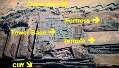
On the hill at Sacsahuaman overlooking (white arrow) the city of Nephi (Cuzco), and the approaching (yellow arrow) entrances and valleys beyond, behind a remarkable (green arrow) three-tiered, zig-zagged defensive wall, someone atop a tower there could see for miles and observe the three approaches into the valley and city below (the temple and tower were located top right on the crest of the hill)

    The tower Noah built was big enough, and tall enough, and sturdy enough for him to climb up, looking for protection from Gideon who was chasing him with drawn sword (Mosiah 19:4).
    Now this tower was near the temple, and very high, “even so high he could stand upon the top thereof and overlook the land of Shilom, and also he land of Shemlon…and even all the land round about” (Mosiah 11:12).
    “And Gideon pursued after him and was about to get upon the tower to slay the king, and the king cast his eyes round about towards the land of Shemlon, and behold, the army of the Lamanites were within the borders of the land” (Mosiah 19:6). When the Spanish arrived in these mountains under the leadership of Pizzaro, and entered Cuzco (from the southeast), “their armor glistening in the sunlight, their plumes waving in the fresh morning air, their banners flying and flapping, and their trumpets sending clear, loud blasts among the hills, advanced with sturdy step into the streets of Cuzco, the streets were crowded with an immense crowd of Peruvians, attired in the most brilliant variety of color; their curious head-gear, indicating the province from which each came, especially attracting the attention of the Spaniards. The multitude seemed dazed at the appearance of the strangers, but not at all disposed to resent their entrance.”
Pizzaro’s entrance into Cuzco, with the young Inca Prince, Manco, carried in a litter at his side, and as he passed, the Prince was greeted with the shouts of the people, who hailed him as their sovereign

    Francisco Pizarro marched directly to the great public square in the center of the city. On the way, the Spaniards were exceedingly struck by the noble edifices, the towers and temples, the palaces and vast private residences, the well-built streets crossing each other at right angles, the blooming gardens, the brightly-painted walls, the sparkling river which ran directly through the city, spanned by handsome stone bridges, and, looming on a crag high above the houses, the frowning fortress of the Incas.
    The square itself was surrounded by a number of low buildings, and by several palaces. In these Pizarro lodged his officers; while the troops encamped in their tents in the broad open space, which they found to be neatly paved with small pebbles. From their positions throughout the city, they looked up on the north cliff facing the city and saw huge edifices, including three tall towers. All that stands today is the foundation since the Spanish tore down the towers, after an Inca rebellion used it for defensive purposes
Top: The drawing of the Spanish descriptions of what they saw as they entered Cuzco for the first time; White Arrow points to the tallest of three towers on the northwestern hill of Sacsahuaman; Bottom: Yellow arrow: outer ring of the actual tower; White arrow: Outer of two support foundation rings; Green arrow: Foundation of walled structure building around the base of the tower

    The main precinct of Sacsayhuaman is made up of three large terraces, whose plots were leveled and flattened. Several buildings and three big towers were erected on these terraces. To the east side was located the tower called Paucar Marca (Precious Precinct), in the middle was the tower Sallac Marca (Precinct with Water) and to the west was the main tower, shown here, Muyuq Marca (Round Precinct). The first two had rectangular floors. Today there are only a few slight vestiges of the first two towers, and only the foundations of the third tower survived. These remains indicate that it was a rectangular-floor construction of a round tower. This tower ended up in a triangular ceiling with great slant over a top lookout opening so the viewer could see 360º.
These towers were so impressive to the Spanish that the chronicler Garsilaso (left) wrote about them. Having been born in Cuzco, in the Spanish Viceroyalty of Peru, to an Inca noblewoman or Princess named Palla Chimpu Ocllo and a Spanish Captain and conquistador named Sebastian Garcilaso de la Vega y Vargas, he played among the buildings at Sacsayhuaman as a child, even within the labyrinth of tunnels and rooms beneath.
    Born in 1539 as Gómez Suárez de Figueroa and known as El Inca or Inca Garcilaso de la Vega Spanish, he was a chronicler who wrote that on the top of the three "walls" or "bulwarks" there were three strong towers disposed in a triangle. The main tower was in the middle and had a circular shape, it was named as Moyoc Marca (Muyuq Marka), the second one was named as Paucar Marca, and the third Sacllar Marca (Sallaq Marka); the last two were rectangular.”
    The tower of Muyuq Marca was also called the Tower of Chauide because the Inca Titu Cusi Huallpa, called Cahuide, jumped from its highest part in order to avoid being captured by the the Spanish during a rebellion at the end of the Inca period. It was first discovered in 1034 at the top of the Temple of Sacsahuaman, and consists of three concentric, circular stone walls connected by a series of radial walls. There are three channels constructed to bring water into what many scientists consider to be a reservoir. A web-like pattern of 34 lines intersects at the center and also there is a pattern of concentric circles that corresponded to the location of the circular walls. According to the chronicles and modern excavations, it was a building with 4 superposed floors. The first body had a square floor; the second and third were cylindrical shape, forming circular cultivation terraces with decreasing width, being the widest of 12-feet and the narrowest of 10 feet. The tower ended in a conic or cone shape and reached a total height of 65 feet (6-story building by today’s standards).
It was as amazing work that generated the admiration of several chroniclers, as befitting the comment about Noah building it “and thus he did do with the riches which he obtained by the taxation of his people” (Mosiah 11:13), during a period of lavish remodeling and construction, described by Mormon as “building many elegant and spacious buildings; and he ornamented them with fine work of wood, and of all manner of precious things, of gold, and of silver, and of iron, and of brass, and of ziff, and of copper; And he also built him a spacious palace, and a throne in the midst thereof, all of which was of fine wood and was ornamented with gold and silver and with precious things” (Mosiah 11:8).
    Mormon also tells us that this tower was “a very high tower” (Mosiah 11:12), and indeed it must have been to see from its top floor into two entirely different far areas of “the land of Shilom and also the land of Shemlon” (Mosiah 11:12) situated beyond the area of the city of Nephi, and since it was built “next to the temple,” we can only conclude that it would have been built of stone, for there is no way a tower that high could have been built of wood or other perishable material.
    Thus, for theorists to claim that Nephite buildings would not have survived the ages because there are not such magnificent structures in the location of their models, other than Mesoamerica and Andean Peru, is simply a very weak argument and one that cannot be supported by reality, history, and observation.
(See the next post, “Finding Lehi’s Isle of Promise – Part XXII,” for more of Mormon’s statements that lead us to a clearer understanding of the location of the Land of Promise)

Saturday, October 29, 2016

Finding Lehi’s Isle of Promise – Part XX

Continuing with more of the scriptural record statements that lead us to a clearer understanding of the location of the Land of Promise, for there can be no question that any Land of Promise must have all these descriptions Mormon and Moroni left us, or that they existed at the time of the Nephites. In this particular article, we take a look at the mighty construction that took place in the Land of Nephi after Nephi arrived from escaping his brothers. 
    In this, we are really looking at three different building programs. The first was with the Jaredites, the second with Nephi when he arrived in what became known as the Land of Nephi, and third was during the major renewal period after the destruction mentioned in 3 Nephi. Then there was the smaller renewal period when Zeniff returned to the City of Nephi (then called Lehi-Nephi), and rebuilt that city and also Shilom.
    The first we know of the Jaredite buildings is found in Mosiah, when Limhi describes to Ammon the report of his 43-man expedition to find Zarahemla who “having traveled in a land among many waters, having discovered a land which was covered with bones of men, and of beasts, and was also covered with ruins of buildings of every kind, having discovered a land which had been peopled with a people who were as numerous as the hosts of Israel” (Mosiah 8:8, emphasis mine). Since this is around 200 B.C., and the Jaredites last battle would have been sometime around 600 B.C., those buildings had stood to this time for some 400 years. Obviously, they were not made of wood, but of stone. This can also be seen by the fact that the Jaredites came from a land where the famed Tower of Babel was being built, where stone ziggurats standing today date back to shortly after that period.
Temples in Mesopotamia were originally built on platforms. During the third millennium B.C., these were made higher and bigger. Eventually it was decided to build even higher temples on platforms which were stepped, called ziggurats and by 2000 B.C. mud-brick ziggurats were being constructed in many Sumerian cities. Later, ziggurats were constructed in Babylonian and Assyrian cities; Top: In Sumaria, built around 3000 B.C., before the Jaredites; Bottom: The Ziggurat of Ur was built entirely of brick around 2100 B.C. (about the time the Jaredites left Mesopotamia) by king Ur-Nammu called Etenennigur (House whose foundation creates terror)

    As an example, the Ziggurat of Ur has been visible on the flat Mesopotamian plain for thousands of years. The ruins have fascinated different people passing through southern Mesopotamia. In the time of the Jaredites in Mesopotamia, the ziggurat was the city's center, and was surrounded by a courtyard with homes, storage, and other facilities designated for administrative purposes.
    Obviously, when one looks at or visits one of these ziggurats, the engineering and construction capabilities of these ancients appear astounding. That the Jaredites would have both known and understood their purpose and how they were built would have been obvious since they were the center of life at the time the Jaredites lived in Mesopotamia.
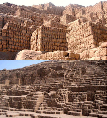
 These ziggurats have stood intact for at least 4000 years, these two are made of cut stone, and certainly such construction of buildings they represent of the Jaredite era would be visible in the Land of Promise, which eliminates all areas for their existence except Mesoamerican, Central America and Andean Peru

    Thus it should be obvious that the many and all kinds of buildings Limhi’s expedition found in the Land Northward would have been something similar in construction and certainly would have lasted over the years sufficiently to recognize today in the Land of Promise.
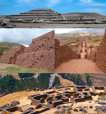
 And such construction like these  of ancient buildings are found all over Andean Peru (including Ecuador and western Bolivia)

    When Zeniff returned with his group to reclaim the city of Lehi-Nephi in about 200 B.C., they “began to build buildings, and to repair the walls of the city, yea, even the walls of the city of Lehi-Nephi, and the city of Shilom” (Mosiah 9:8). Zeniff’s son, king Noah, “built many elegant and spacious buildings; and he ornamented them with fine work of wood, and of all manner of precious things, of gold, and of silver, and of iron, and of brass, and of ziff, and of copper” (Mosiah 11:8), which included “a spacious palace, and a throne in the midst thereof, all of which was of fine wood and was ornamented with gold and silver and with precious things” (Mosiah 11:9). He also had his workmen create all manner of fine work within the walls of the temple, of fine wood, and of copper, and of brass (Mosiah 11:10). He also “caused many buildings to be built in the land Shilom” (Mosiah 11:13).
    The city of Zarahemla was the capital of the Nephite Nation (Helaman 1:27). Nephi had his house along the highway that led to the city of Zarahemla, and he had a tower there (Helaman 7:10). Zarahemla was called a great city (Helaman 13:12), the “strongest hold,” meaning fortified city, in all the land (Helaman 1:22), it had a prison, was burned during destruction (3 Nephi 8:8), and rebuilt (4 Nephi 1:8). We also see that there were houses, cities and temples, as well as synagogues, sanctuaries and all manner of buildings (Helaman 3:9); they had houses built of cement (Helaman 3:9), and many cities of wood and cement (Helaman 3:11).
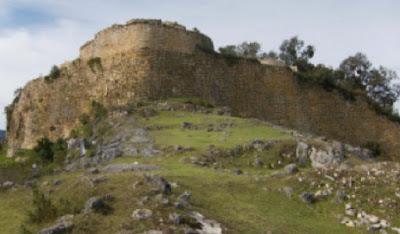
A huge mountain top fortress in Peru built anciently and overlooking the entire valley below

    It would seem obvious that such buildings, or remnants of them, would be visible today. Nor were these small areas that could easily have been overlooked for several cities were called “great,” (3 Nephi 8:24-25), even by the Lord (3 Nephi 9:3-5,9). The word “great” was defined in 1829 as: “Large in bulk or dimensions; a term of comparison, as in beyond what is usual; Being of extended length or breadth; Vast; extensive.” The sense of great is to be understood by the things it is intended to qualify; a great city is intended to convey huge, extensive, important; superior, preeminent.
    Again, there should be some prominent cities left to ruin that can be seen today in the area of the Land of Promise. And as such, there are only two areas in the Western Hemisphere where this is found: Andean Peru in South America, and Mesoamerica. There are no such ruins found in North America, or in any of the other suggested Land of Promise locations.
Ancient ruins in Andean Peru of fortified cities

    When Nephi arrived in the area they called the land and city of Nephi, he taught his people how to build buildings (2 Nephi 5:15), and they built a temple like unto Solomon’s (2 Nephi 5:16), which would have been built with cut and dressed stone as was Solomons. It would be unrealistic to think that Nephi would have built a House to the Lord in anything less than what could be the best done and he had personal knowledge of Solomon’s Temple, as did Sam and Zoram. Once again, it is also unrealistic to think that the Land of Promise would not have an abundance of ruins of ancient buildings only 1600 years after the demise of the Nephites.
More ancient ruins in Andean Peru

(See the next post, “Finding Lehi’s Isle of Promise – Part XXI,” for more of Mormon’s statements that lead us to a clearer understanding of the location of the Land of Promise)

Friday, October 28, 2016

Finding Lehi’s Isle of Promise – Part XIX

Continuing with more of the scriptural record statements that lead us to a clearer understanding of the location of the Land of Promise, for there can be no question that any Land of Promise must have all these descriptions Mormon and Moroni left us, or that they existed at the time of the Nephites. In this particular article, we take a look at two animals that were essential to the Jaredite and Nephite peoples, described by Ether as useful to man as the elephant, and in 1829, unknown in the United States and to Joseph Smith, a farmer from a farming family. 
    The scriptural record of the Jaredites tell us: “And they also had horses, and asses, and there were elephants and cureloms and cumoms; all of which were useful unto man, and more especially the elephants and cureloms and cumoms” (Ether 9:19). The three animals we know listed are beasts of burden, and their value to man covers both their working ability, load carrying ability, and their hides as well as in their domestication. For these two animals to be more valuable to man than the horse and the donkey, whose value trace back to the ancient Egyptians, according to Patricia D. Moehlman and Hagos Yohannes in a DNA study news release by the University of Florida (2010) for the National Science Foundation.
    Thus we are looking for animals that have proven of great worth to man at least over 1500 years or more, and such animals are hard to find anywhere in the world. There are, of course, some animals that might fit the bill, but few of those reside now or in the past in the Western Hemisphere.
Left: Sloth, which is related to the Anteater, are very slow-moving, dwell in trees, and are home to moths, beetles, cockroaches, ciliates, fungi and algae; Right: Tapir, similar in shape to a pig, they inhabit jungle and forest regions, and spend most of their time in and under the water of rivers, stand about 3 feet high and weigh about 330 to 700 pounds, and will attack humans if scared or in defense of themselves or their young. Neither of which are of much use to man, except possibly as food

    Certainly, John L. Sorenson’s idea of these animals being the Sloth and Tapir fall far short of the description and value, nor are either of these beasts of burden. Nor would the American Buffalo or Mountain sheep as others have suggested fill this purpose, since neither are or have been domesticated or provide any value beyond food and clothing, and no doubt rule out Water Buffalo since Joseph Smith would have known of Buffalo (Plains Bison) in 1829, which were the dominant animal (25-30 million) of the prairies of North America—by 1830, the Commanches and their allies on the southern plains reached a high in killing Buffalo of 280,000 a year. Obviously in Joseph Smith’s time, such activity would have been well known.
    Nor can it be suggested that these were cattle, oxen, cows, sheep, swine, or goats or just animals that were of value because they were useful for the food of man, since all of these are mentioned in the previous verse (Ether 9:18), which Joseph Smith translated without difficulty.
    Consequently, we are talking about something entirely different.
First of all, a pack animal or beast of burden is a draught or draft animal that carries or pulls heavy loads, such as a donkey, mule, llama, camel or ox. Others are the yak, reindeer, goats, water buffalo and camel and many of the domesticated Equidae (horse) family.
    Secondly, these two animals would have been unknown to Joseph Smith in 1829, and most likely to the average person in the area where the Book of Mormon was first published, read and distributed.
    Third, the animals, at least in Nephite times (Moroni translated the Ether record around 400 A.D.), would have been well known and heavily used, since Moroni adds a comment about the animals that they were more useful than the horse and the ass, and as useful as the elephant.
    Fourth, the animals need to be domesticated and be indigenous to the Western Hemisphere.
    Thus, to know of the Land of Promise, we must find a location where two animals that were unknown to Joseph Smith in New England America in 1829, but were present in the Land of Promise and of great importance to its inhabitants.
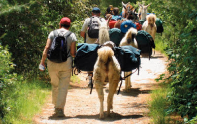
Even today, llamas are used as pack animals, they are more sure-footed than horses or donkeys in traveling on difficult terrain, rock ledges, etc.
 
    So far discovered, the only animals in the Western Hemisphere anciently and now that can qualify for this description are the Llama and Alpaca, the former being a pack-carrying beast-of-burden animal and the latter being a fiber-producing animal, with a very fine, soft fleece coat of lustrous and silky natural fiber that has been used for making knitted and woven clothing and fabric for thousands of years. Both provide food, and the larger llama can be ridden, though more often used to carry heavy packs.
Pottelry showing a man riding a llama

During the Inca Empire, llamas were the only beasts of burden, and many of the people dominated by the Inca had long traditions of llama herding. For the Inca nobility, the llama was of symbolic significance, and llama figures were often buried with the dead. There are figurines of llamas being ridden by the Moche (100-300 A.D.) 1400 years before the Inca
     Part of the Camelid family, of which there are five species: camel, guanaco, vicuna, llama and alpaca. Other than the camel, their indigenous habitat has been the Andean area of South America, specifically Ecuador, Peru, western Bolivia, and northern Chile.
Left: Vicuna; Right: Guanaco, the wild ancestors of the Llama and Alpaca

    In this Andean area of South America, there are two wild animals known as the Vicuna and the Guanaco, from which two domestic animals derive, the llama and Alpaca. These animals date back more than four thousand years. They have historically been used by ancient Peruvians for the purposes stated above as well as for guarding livestock. Even today, llamas, requiring no training and little care, are imported all over the world for guards to specifically sheep and goat herds, and have eliminated the losses to predators for many producers.  
    Today, llamas are still used as beasts of burden, and along with the Alpaca, used for production of fiber and meat—the fiber of the llama’s ancestor, the Vicuna, along with the Alpaca, are both considered the finest natural fibers of any animals in then world; twice as fine as Angora Rabbit, 2 ½ times finer than Cashmere, and four times finer than Chinchilla. They are also excellent pets if treated well, and require little attention to keep.
    From an agricultural standpoint, according to Alex Chepstow-Lusty, who finished his PhD at Cambridge University in Quaternary Research in 1990, and has subsequently been actively involved in botanical and palaeoecological projects from many parts of the world, particularly with a focus on sub-Saharan Africa and the Andes, now with the University of Montpellier as a researcher attached to the French Institute of Andean Studies in Lima, though base mostly in Cuzco, claims that the switch from a hunter-gatherer lifestyle to widespread agriculture in the Andes area was only possible because of the use of llama dung as fertilizer (Information Resoures on the South American Camelids, 2006).
    Obviously, the llama and alpaca are two very important animals to man in just about every way possible.
Left: the Llama; Right: the Alpaca, which was raised for its extraordinary fiber for clothing. These animals, and their two wild ancestors shown above (Guanaco and Vicuna) are indigenous only to Andean South America, as is the Spectacled or Andean Beara

    Typically, they are saddled with loads of 50 to 75 pounds. Under such weight they can cover up to 20 miles in a single day. Pack trains of llamas, which can include several hundred animals, move large amounts of goods over even the very rough terrain of the Andes. Llamas contribute much more than transportation to the human communities in which they live. Leather is made from their hides, and their wool is crafted into ropes, rugs, and fabrics. Llama excrement is dried and burned for fuel. Even in death, llamas can serve their human owners—some people slaughter them and eat their meat." It is not difficult to see why Moroni wrote that these two animals he called the curelom and cumom “were useful unto man, and more especially the elephants and cureloms and cumoms" (more useful than horses and donkeys).
(See the next post, “Finding Lehi’s Isle of Promise – Part XX,” for more of Mormon’s statements that lead us to a clearer understanding of the location of the Land of Promise)

Thursday, October 27, 2016

Finding Lehi’s Isle of Promise – Part XVIII

Continuing with more of Mormon’s statements that lead us to a clearer understanding of the location of the Land of Promise, for there can be no question that any Land of Promise must have all these descriptions Mormon left us, or that they existed at the time of the Nephites. In this particular article, we take a look at 3 Nephi 6:7-8, which reads “there were many cities built anew, and there were many old cities repaired. And there were many highways cast up, and many roads made, which led from city to city, and from land to land, and from place to place.”
Highways and roads in Andean Peru, the most complex and lengthy ancient road system in the entire Western Hemisphere

    No doubt these were the same highways and roads that Samuel the Lamanite foretold would be broken up at the time of the crucifixion (Helaman 14:24), and so reported by the Disciple Nephi (3 Nephi 8:13) that the Nephites, after the advent of the Savior, began to rebuild and renew their land after the destruction reported earlier.
    As recorded, these highways stretched long distances, and connecting roads that led from city to city, and place to place with the highways running from land to land. In fact one such highway ran by Nephi’s home in Zarahemla where he went to pray in his garden tower which “was also near unto the garden gate by which led the highway” (Helaman 7:10).
    This is another important criteria—the roads and highways that, from description, ran from place to place, city to city, and land to land, suggesting a very large and complex system.
    These highways were made of some type of solid material, like stone or a form of pavement, since Nephi also tells us that during the terrible destruction that “changed the face of the earth,” these highways were “broken up” (3 Nephi 8:13).
The Nephite roads and highways 1600 years later: Top: Stone highways found in Andean Peru, still travelable after more than two thousand years; Middle Left: This stepped, stone highway stretches for miles, obviously not intended for wheeled vehicles; Middle Right: This ancient road was “cast up” across a series of mountainous valley ravines with an irrigation channel in the middle; Bottom: Stepped roads and bridges meant only for foot traffic

    The highway system in Andean Peru is both remarkable and unequaled anywhere in the Western Hemisphere, and according to the conquistadors who first saw these roads, claimed they rivaled the highly acclaimed roads of the ancient Romans. This highway system ran 3,700 miles, from Chile to Ecuador, with an intertwining and interconnected network of 24,000 miles of roads and highways. Truly, this road system “led from city to city, and from land to land, and from place to place.”
A drawing depicting how the Inca used these pre-existing roads to conquer an entire people in three large countries (Peru, Ecuador, and Bolivia) and parts of two others (Chile and Colombia), a total of 690,000 square miles in less than 50 years. Had the roads not already been in place, the swiftness of their conquest would not have been possible

    The Inca called the main road Qhapaq Ñan (meaning Great Inca Road or Route of the Inca), who later used these well-built Nephite roads to help them conquer from Ecuador to Chile. They never could have been built by the Inca, whose existence is figured to be less than 100 years, and once subduing all of Peru, took 50 years fighting first in the south, then in the north and finally in the east into Amazonia, in which most of that time was taken up by fighting wars, subduing and replacing governments, and controlling or policing their Empire. Without these roads already in place, the Inca never could have conquered most of their eventual territory.
    In fact, it was these highways and network of interconnecting roads that allowed them to subdue Peru in the first place, since they could rush replacements and supplies to advanced fighting units in a matter of hours or a day or two—something others could not have managed since all roads centered on two locations, Cuzco (Inca homeland), which was the City of Nephi, and Pachacamac (near Lima) the city of Zarahemla. Once these roads were secured, and in any initial blitz could have been done before any other people would have known what was happening, the movement of troops and supplies could flow uninterrupted.
Today, these roads are described as the grandest engineering achievement of the pre-Hispanic Americas, stretching roughly 3,700 miles along the Andes, from present-day Colombia to Chile. During Inca times, “The Inka” and the royal family traveled by litter. The main road and network still exists in remarkably durable portions across six countries of South America, though it was built without iron tools, draft animals, a single arch, or the wheel. With suspension bridges and ramrod-straight roads laid out by ancient surveyors, the road brought civilization to the Nephite Nation, allowing Alma to go far and wide to preach the gospel as well as the sons of Mosiah and other missionaries. During Inca times, besides sending troops and supplies over the roads, it also functioned as a kind of map of Inca ambitions, an eternal landmark imposed by a preliterate society that left no written documents.
    These roads were indeed an engineering fete of some magnitude, not only because of their lasting value, indicating their road base and means to control erosion, but the standards of rock walls to keep out wind blown sand and debri from collecting on them, often having central irrigation channels down the highway and irrigation ditches on the side to control erosion of the ground beneath the roads. Most of the roads were made of smooth cobblestones, or flat rock slabs, or fieldstone. Over the centuries, in an extremely high earthquake country, most of these roads are still remarkably intact. Some sections are gone that the Spaniards tore up, because after 1000 years or more, the Spanish horses suffered terribly from the sharp edges of the roads’ stepped inclines. When the Spaniards rounded the turn in the road and entered the Sacred Valley and on into Cuzco, they entered the heart of an Empire they could neither understand nor even comprehend, surrounded with monumental palaces and temples, and everything glittering in gold.
    "The royal road!” It was the best-preserved section in Cuzco, a wide, straight portion of the Capac Ñan that ran hundreds of yards, neatly walled on both sides as it traversed the slopes of a steep hill. There were houses below, and a road clogged with traffic above. The path was more than three yards wide, neatly edged, and still floored with stones worn smooth by Inca religious processions.
Top Left: The main road to the northwest, called today the Chinchaysuyu road, but known to locals as hatun ñan (Main Raod) or chaski ñan (Pedestrian Road), which runs from Cuzco to Quito, Ecuador; Top Right: One of the many bridges over deep ravines—Yellow Arrow shows the stone stanchion to which the ropes are secured on either side; White Arrow: the length of these bridges, which today are replaced every two years, can be considerable; Bottom: Three roads: Yellow Arrow: a main north and south highway; White Arrow: An east-west connecting road; The Green Arrow is a modern road

    Looking at the road system today, it is obvious that all roads lead to Cuzco, which was the City of Nephi. A local named Amado said that “Every sacred place had a road that leads to it [Cuzco].” Karen Stothert, an archaeologist from the University of Texas at San Antonio, who began walking these roads in 1967 while still a Peace Corps volunteer said, “You are talking about thousands of miles in some of the most rugged topography in the world. The road climbs 5,000 feet straight up mountains. Sometimes it is built on a stone ledge, just wide enough for a llama. If you bump your backpack, it can bump you right off the cliff, 2,000 to 3,000 feet down.” She has conducted seminal research on the road system, especially in Ecuador and Peru, documenting and mapping bridges, walls, tunnels and drainage systems on the eastern slopes of the Andes. But she is adamant about who built the roads:  “First of all, we call them Inca roads, but many of us know some parts were built before the Inca.” For at least 3,000 years, other cultures, including the Moche and the Nazca, forged roads that connected to their larger world, and engaged in long-range trade for herbal medicine, gold and medicines.
(See the next post, “Finding Lehi’s Isle of Promise – Part XIX,” for more of Mormon’s statements that lead us to a clearer understanding of the location of the Land of Promise)

Wednesday, October 26, 2016

Finding Lehi’s Isle of Promise – Part XVII

Continuing with more of the scriptural record statements that lead us to a clearer understanding of the location of the Land of Promise, for there can be no question that any Land of Promise must have all these descriptions Mormon and Moroni left us, or that they existed at the time of the Nephites. In this particular article, we take a look at a statement made in Ether that seems to have baffled theorists for some time. As we have extensively pointed out, there were four seas (Helaman 3:8). However, another sea is mentioned and many have tried to make this a separate sea, however, the wordage of the scriptural record does not lead to that conclusion. 
Where the serpents gathered to block off the narrow pass, today known as the Pass of Huayna Capac because of the ancient Inca battle that took place there, but the pass has always existed as far as anyone’s memory; after the serpents were destroyed, the Jaredites preserved the land south of the pass as a hunting reserve

    In Ether 10:19 of Moroni’s abridgement, the discussion is about poisonous serpents that were, after many years—nine generations (Heth, Shiz, Riplakish, Morianton, Kim, Levi, Corom, Kish, Lib)—finally destroyed. Because the Jaredites had not been able to get through the pass and into the Land Southwasrd because of these serpents for all this time, all the animals that had escaped through the pass before the “serpents hedged up the way that the people could not pass” (Ether 9:33), had multiplied and filled up the land just south of the narrow neck of land in the land the Nephites called the Land of Bountiful. At that time, the Jaredites decided not to go into that land to settle, but to preserve it “And they did preserve the land southward for a wilderness, to get game” (Ether 10:21). The scriptural record tells us of this: “Wherefore they did go into the land southward, to hunt food for the people of the land, for the land was covered with animals of the forest” (Ether 10:19).
    Obviously, since this area would be the stepping off location for such hunting trips, we are told that, “they built a great city by the narrow neck of land, by the place where the sea divides the land” (Ether 10:20).
    Now this sea that divided the land was located at the narrow neck of land, thus, the waters or sea that ran on either side of the narrow neck was evidently larger on one side, thus providing a type of Bay or Gulf.
Based on the map of today’s Ecuador and Gulf of Guayaqil: Left: A Land Northward and a Land Southward with a narrow neck of land in between, with the Land Desolation to the north and the Land of Bountiful to the south, just as Mormon describes it in Alma 22:32); Right: This Bay or Gulf to the west of the narrow neck of land would form the water the Jaredites called the Sea that Divided the Land; to the right of the narrow neck would be the Andes Mountains that rose at the time of the crucifixion

    It should also be clearly understood that in the case of the Jaredites, they did not use terms or names for seas, like East Sea or West Sea, etc. The only name we know of applied to a body of water is Ripliancum, “which by interpretation is large or to exceed all” (Ether 15:8). At no other time do we find a name given a sea, though the term “seashore” is used four times referring at least twice to an east sea (Ether 9:3; 14:26), probably twice to a west sea since referring to being in the land of Moron (Ether 14:11,12- 13), which was in the West near where the Jaredites landed.
    The term “sea in the wilderness” (Ether 2:7) is given, and “that great sea which divideth the lands” (Ether 2:13) but thereafter was simply called “sea,” by the Lord (Ether 2:24, 25) and “sea” by the Brother of Jared (Ether 3:4), and simply “sea” in the narrative (Ether 6:4, 5, 6, 10), though they did call the land there Moriancumer (Ether 2:13).
    With that in mind, it might be understood that in this case, as in the others, because the Land of Promise was an island in Jacob’s time (2 Nephi 10:20) and, therefore, no doubt in the time of the Jaredites, that the term “sea” was simply understood, i.e., that great sea that surrounded the entire land. Thus, the reference in this case to “the sea that divideth the land,” is merely a statement that “the sea” meaning the waters around them, at this particular spot, divided the Land Northward from the land Southward.
    Thus, the name or the reference given was “the sea that divideth the land,” to this gulf or bay by the Jaredites, because it divided the Land Northward (their homeland) from the Land Southward (the land they did not occupy and were saving for an animal preserve).
The Jaredites, at this point, decided not to venture into the Land Southward for settlement, but to keep it pristine so that the animals who had escaped into that land nine generations earlier, would remain nearby and could be hunted from time to time for food. Consequently,
No Jaredite settlements were built in the Land Southward as seen by the following statement: “And they did preserve the land southward for a wilderness, to get game. And the whole face of the land northward was covered with inhabitants” (Ether 10:21).
    This, by the way, should eliminate from Mesoamericanists thinking the idea that the Olmec were the Jaredites, since the Olmec built settlements all over their Land Southward. The problem for most theorists, however, is the question “what sea is being described here?”
    To answer this question, we need keep in mind that the sea that divides the land is mentioned in conjunction with the narrow neck of land. And the city they built, and the sea mentioned, is along by this narrow neck of land. So to understand the sea, we need to understand what made this land narrow at the neck. We also need to keep in mind that this is written by Moroni who is reading the Jaredite record, and who had the advantage of spending most of his life in the Land Southward, knowing very well what that land looked like, how it was shaped, how the land narrowed to form the narrow neck of land, and what waters flowed around the south countries, i.e., south of the narrow neck of land.
    He also knew how the waters formed around this narrow neck and its narrow passage which had seas on the west and east (Alma 50:34). He also knew about Hagoth’s shipyard and from where the ships that went northward sailed.
 Left: The Ba of Guayaquil in southern Ecuador that divides the western coast of Andean South America, today leaving about a 25-mile-wide corridor , or neck, between Peru (south) and Ecuador (north), blocked on the east by the sheer height of the Andes Mountains, and on the left by the sea; Right: In Nephite times,the Andes had not yet risen and this area on the east was a sea, today referred to as the Pebasian Sea by geologists (See the post "The Rising of South America--Part III," dated September 7,2012)

    Thus, from a viewpoint of knowing this configuration, Moroni wrote the words “where the sea divides the land.” Or, where the sea encroached into the land and divided it. Or where the sea separated the Land Northward from the Land Southward.
    This, of course, is the same sea into which Hagoth launched his ships, which Moroni knew very well from reading the records and knowing what his father wrote and knew. No doubt Hagoth’s shipyards at the narrow neck existed long after the period in which he is mentioned, since the Nephites were involved in shipping and the building of ships  (Helaman 3:14).
    And since Moroni was in the narrow neck area during the ten year hiatus of peace (Mormon 2:29; 3:1), and was part of Mormon’s army which withstood the Lamanite invasion through the narrow neck of land (Mormon 3:5) during the following three years. Consequently, it must be understood that Moroni, when writing about the Jaredites around the narrow neck of land some forty years later, was well versed in the area he was describing.
    The fact that this sea had no name is consistent with the Jaredite manner of not giving names to seas; at least the record lists no names, though directions are understood. Take the example of Omer when he departed out of the land and traveled many days, it says he traveled “eastward, and came to a place which was called Ablom, by the seashore, and there he pitched his tent” (Ether 9:3). Again, “And it came to pass that in the first year of Lib, Coriantumr came up unto the land of Moron, and gave battle unto Lib. And it came to pass that he fought with Lib, in which Lib did smite upon his arm that he was wounded; nevertheless, the army of Coriantumr did press forward upon Lib, that he fled to the borders upon the seashore” (Ether 14:11-12), and also “Shiz did pursue Coriantumr eastward, even to the borders by the seashore, and there he gave battle unto Shiz for the space of three days” (Ether 14:26).
    In these three uses of the word “seashore,” no name is given to the sea, though a direction, “eastward,” is mentioned. In fact, there are very few directions given in the entire Jaredite record. Moroni uses the term “north country” twice, Land Northward once, the term “southward” once, and the Land Southward four times. The terms “north” or “south” are never mentioned as a direction, and the word “sea” is mentioned only four times, and never with a name, unless Ripliancum, meaning “to exceed all,” is their North Sea.
Thus, when the words “where the sea divides the land,” is given, it should be considered that this sea is the main sea with which Moroni was well familiar and the Jaredites evidently simply called “the sea.” Obviously, the sea Moroni would have associated with the narrow neck of land would have been the Nephite West Sea (Alma 63:5).
    Another consideration is that the wordage “divides the land” is the same terminology used earlier in Ether 2:13, referring to the oceans that separated them from their homeland and the land of promise, when Moroni wrote: “And now I proceed with my record; for behold, it came to pass that the Lord did bring Jared and his brethren forth even to that great sea which divideth the lands.”
    Thus, we see that both statements are Moroni’s, and again, Moroni was well familiar with the sea that divided the land in the Land of Promise—the West Sea, where it cut into the land to create the narrow neck.
    Once again, we can see that Mormon (and Moroni) described the Land of Promise as two main land masses, the Land Southward, and the Land Northward, which were connected by a small and narrow land mass he called a neck. And these two lands were divided by the West Sea except for the narrow neck, and within this narrow neck was a narrow pass, which was the only passage between the two lands. And that pass was narrow enough that it could easily be guarded against an army trying to move from one land to the other,.
     Obviously, then, any true Land of Promise must match all of the descriptions listed in the Book of Mormon—it is not a pick and choose arrangement in selecting those that agree with your point of view, but must match all of the descriptions thus covered.
(See the next post, “Finding Lehi’s Isle of Promise – Part XVIII,” for more of Mormon’s statements that lead us to a clearer understanding of the location of the Land of Promise)