
While looking for a trade route to the Far East in 1609 Henry Hudson came up La Grande Riviere, as named by French explorers in 1540. The Dutch named the river for Hudson. In 1624 the first settlers, actually French-speaking Belgium Walloons, set up a colony which was named Fort Orange for the House of Orange, the royal family of The Netherlands.
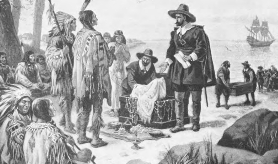
The Dutch set up trading posts along the New York coast and inland in
the early 17th century
In 1664 when the Dutch surrendered to the British without a battle, King Charles II granted territory including New Netherland, New England, Long Island and Delaware to his royal brother James, the Duke of both York and Albany. Thus Beverwyck became Albany and New Amsterdam became New York. Albany remained under British rule until the American Revolution. During all this time, not a single mention or discovery of any ancient forts were ever reported being seen, found or located.
According to Pete Payette of the New York State Military Museum, Division of Military and Naval Affairs, New York’s Forts and Military History, American Forts Network, in December 2013, only one fort out of 39 identified in western New York, was built before 1600, and that was Fort Oneida, an Indian fort built in 1480 (currently in the Fenner Township, Madison County). It was an Indian village located about six miles south of Canastota and about 2.5 miles south of Clockville, just outside of Alene near Nichols Pond, along Clockville Creek. The other 38 forts were built in: 0 in 1500s; 4 in 1600s; 17 in 1700s; 15 in 1800s; and 2 in 1900s.
The extensive research, which among others contained the many years of diligent research of Col Michael J. Stenzel, of the New York Guards, plus numerous other military contributors, including archaeologists and historians, and public workers involved in New York’s Office of Parks, Recreation and Historic Preservation, shows that 16 forts were listed in and around the area the author of the blog has singled out for the Nephite forts to have been built. The report states: “16 forts are listed, of which three are considered to have been French built, leaving 13 forts of the pre-European contact period, meaning they were built by the Indians. Of those, 6 are dated, leaving 7 of questionable dates:
1. Algonkin Indian Fort
(pre-contact), Rochester. An early Algonkin Indian semi-circular earthwork enclosure once located on the west bank of the Genesee River, east of the north end of present-day River Street, outside Kodak Park.
2. Fort Alleghan
(pre-contact, 1760's ?), Auburn. Located at Fort Hill Cemetery, earthworks originally built by the ancient mound builders. Also later known as Fort Wasco, used as a Cayuga Indian (an Indian nation in New York) council seat and village site.
3. Great Gully Fort
(unknown - 1779), Springport Township, Cayuga County. An Upper Cayuga Indian palisaded village or "castle" located on the Great Gully between Springport and Ledyard Townships, on the east side of Cayuga Lake (also known as Goi-o-goven). Destroyed by Patriot forces under General Sullivan in September 1779.
4. Cayuga Indian Fort (unknown dates), Venice Township, Cayuga County. This was an ancient Cayuga Indian fort.
5. Cayuga Indian Fort (pre-contact), Waterburg. A Cayuga Indian palisaded circular earthwork was located around a pond on Spring Brook, west of town on Indian Fort Road.
6. Otsiningo Castle (unknown - 1779), near Hinman's Corners. A palisaded Indian fort and village, or "castle," located near the mouth of Castle Creek at the Chenango River. Destroyed by the Patriots under General Sullivan in August 1779.

This drawing of Champlain’s Plan of
Oneida Fort, 1615, should dispel any idea of an earlier fort. Though built
early in the 1600s, it follows the pattern claimed by these North American
theorists of the so-called Nephite forts found in the area, complete with ditch
all around, stockade walls and guard tower
A palisaded Oneida Indian village was located here before or until 1790.
Of these seven, not a single fort
has survived severe deterioration or complete disappearance, with dirt mounds
here and there mute evidence something once existed there. But none date forts
precede the Iroquois Period of about 1200 AD.
Take, for example, the two ruins of Cayuga County forts along the upper Cayuga (Goiogouen) on the south side of Great Gully Brooke. One fort, situated between two deep ravines and occupied by the Cayuga Indians, was destroyed by Gen Sullivan’a army in September 22, 1779, and had been the site of a Jesuit Mission 1655-1684; another stockade fort at Elsworth, on Payne’s creek, at the juncture of two deep ravines was occupied by either Iroquois or Algonkin (Algonquian); and the third prehistoric Iroquois fort at Lock, between two deep ravines from 200 to 800 feet deep, where fine pottery and pipes have been removed (33rd Annual Report of the American Scenic and Historic Preservation Society,1918, to the Legislature of the State of New York, April 12, 1918, pp328-329).

According to Donald A. Cadzow,
“The Alonkins are considered to be the original settlers of this western New
York area and described as very primitive, “Eskimo-like” in appearance, making
crude arrowpoints and other tiltarian objects out of bone, sedentary and
agricultural. They lived in crudely constructed huts, covered with bark, with
an opening in the roof to let out the smoke, with the earth floors covered with
mats made of rushes and skins of animals” (Cadzow is the Field Director of
American Anthropology and Museum of American Indians, “Algonkin Indians of
Finger Lakes,” Cambridge University, England, 1929, p51). The Alonkins historically
were prominent along the Atlantic Coast and into the interior along the St.
Lawrence River and around the Great Lakes. Before the Europeans, they lived by
hunting and fishing, although quite a fw supplemented their diet by cultivating
corn, beans and squash, with the Ojibwe, an Algnkin-speaking people also known
as the Chippewa, also cultivating wild rice. They lived in longhouses, building
villages at coastal locations and waterfalls in the spring and summer, mostly
of portable wigwams, a type of hut usually with buckskin doors.

These people were driven out of
the Great Lakes area by the Iroquois, a well-armed, disciplined and aggressive
tribe who came into the Great Lakes area around 1590. In fact, while Great
Lakes Theorists like to claim that battles took place throughout this area
showing Nephi-Lamanite history; they fail to tell you, or even understand
themselves, that this area, the Great Lakes and Western New York, was a hotbed
of Indian intrigue dating back to at least 1600 if not 1400 A.D. In this area
the Mohawk fought continual battles with the Mahican, the latter controlling
the access of the Iroquois to the area.
The Iroquois were defeated and driven out of the St. Lawrence Valley in 1610, a fact they never accepted as a permanent situation and fought numerous battles to reclaim the land. And except for a brief truce arranged at the Trois Rivieres in 1622, fighting continued between the Mohawk, Algonkin, and Montagnais. Finally, the Mohawk prevailed over the Mahican, driving them out of the area and to the east of the Hudson. In addition, when the Dutch arrived, they created beaver wars among the major native American tribes, and though the Iroquois had depleted the beaver in their own land, they fought for greater territory to meet the needs of the European trade. The Mohawk, gaining beaver rich lands defeated the Mahigan and Algonkin and the Montagnais, though the eventual defeat of the French, eventually ended the Mohawk control of the area.
(See the next post, “Have They Found Where Battles Were Fought Around Cumorah? – Part VII,” for more information on the results of the numerous Indian wars fought in and around the area of the Great Lakes and its effect on artifacts found there today)
Take, for example, the two ruins of Cayuga County forts along the upper Cayuga (Goiogouen) on the south side of Great Gully Brooke. One fort, situated between two deep ravines and occupied by the Cayuga Indians, was destroyed by Gen Sullivan’a army in September 22, 1779, and had been the site of a Jesuit Mission 1655-1684; another stockade fort at Elsworth, on Payne’s creek, at the juncture of two deep ravines was occupied by either Iroquois or Algonkin (Algonquian); and the third prehistoric Iroquois fort at Lock, between two deep ravines from 200 to 800 feet deep, where fine pottery and pipes have been removed (33rd Annual Report of the American Scenic and Historic Preservation Society,1918, to the Legislature of the State of New York, April 12, 1918, pp328-329).

This image is claimed to be a stockade fort of some type which stood on
this spot prior to the 1700s. As can be seen, there is nothing left of the
fort, and what it looked like or how it was built is mere speculation. It’s
existence is from early oral tradition of the Iroquois Indians and a few relics
like pipes and pottery

An Ojibwe wigwam constructed along a river in western New York
The Iroquois were defeated and driven out of the St. Lawrence Valley in 1610, a fact they never accepted as a permanent situation and fought numerous battles to reclaim the land. And except for a brief truce arranged at the Trois Rivieres in 1622, fighting continued between the Mohawk, Algonkin, and Montagnais. Finally, the Mohawk prevailed over the Mahican, driving them out of the area and to the east of the Hudson. In addition, when the Dutch arrived, they created beaver wars among the major native American tribes, and though the Iroquois had depleted the beaver in their own land, they fought for greater territory to meet the needs of the European trade. The Mohawk, gaining beaver rich lands defeated the Mahigan and Algonkin and the Montagnais, though the eventual defeat of the French, eventually ended the Mohawk control of the area.
(See the next post, “Have They Found Where Battles Were Fought Around Cumorah? – Part VII,” for more information on the results of the numerous Indian wars fought in and around the area of the Great Lakes and its effect on artifacts found there today)


No comments:
Post a Comment