Thursday, March 7, 2013

The Advanced Civilization of the Nephites

As stated in the last post—we are looking at the advanced civilization of the Nephites, whose first progenitors came from Jerusalem around 600 B.C. at a time when advanced civilizations were developing and existing in Greece, Egypt, Asia Minor, Mesopotamia and Sicily; when the most important center of learning was Alexandria in Egypt, which attracted scholars from across the Hellenistic world, mostly Greek and Egyptian, but also Jewish, Persian, Phoenician and even Indian scholars.
At the time Lehi left Jerusalem, the eastern world was achieving greatness in many areas—and, along with Greece, considered the most advanced in civilization on the planet. In 600 B.C., Babylon was not only one of the greatest, if not the greatest civilization at the time, but also led the world in advanced urban development and construction. Historians refer to Babylon as a city of many gates with each gate crafted with splendid architectural elegance. The hanging gardens of Babylon according to some historical accounts, are considered one of the wonders of the world. Historians also write about the cities of the area that had very straight streets, multi-story buildings and a well-developed economic system, and though having little rainfall, had abundant crops attributed to a very sophisticated irrigation system.
The Ashurbanipal Library Project, the oldest surviving royal library in the world is that of Ashurbanipal, 7th century B.C. King of Assyria, where more than 30,000 cuneiform tablets and fragments were excavated in the 1850s
Around 600 B.C., astronomy was beginning to be well known; law and order along with an advanced form of civil law was on the rise; libraries were well stocked with books in many cities; the circumference of the earth was basically known; dams were being built; irrigation channels and systems were invented; Solomon’s Temple was one of the wonders of the world (according to a list of seven wonders along with the Pharos of Alexandria and Noah’s Ark, by Bishop Gregory of Tours in the 6th century A.D.); trade, culture and colonization was on the rise; poetry was flourishing; marshes were drained and roads built by engineers; splendid houses with many rooms arranged around courtyards were being built; luxurious furniture was designed and built; central governments with elected senates came into being; wheeled chariots and mounted archers fought wars; art was flourishing, learning was advancing, and construction techniques of building with stone for walls, public buildings, and houses were well known.
This Egyptian building, the Temple of Karnak, dates back to 1900 B.C., showing an expert use of carving stone. (Note the size of the man in the left picure in the middle background)
The civilizations of the Mediterranean were highly developed, as were those in Mesopotamia and Egypt. Jerusalem was at the crossroads of the world and exposed to the development of many nations, from Mesopotamia in the north, Greece in the west, and Egypt in the south; the king’s highway was one of the trade routes of the ancient world over which most products from frankincense to gold to silks to daily wares passed by Jerusalem.
The Jews of 600 B.C., though not as advanced in many ways as the Babylonians, Greeks or Egyptians, had interaction with all three and were knowledgeable of these cultures and their achievements. Solomon built his famous temple around 1000 B.C., which stood for over 400 years before being destroyed by the Babylonians (Sir Isaac Newton studied and wrote extensively upon the Temple of Solomon, dedicating an entire chapter of The Chronology of Ancient Kingdoms to his observations regarding the temple, and was intrigued by the temple’s sacred geometry and believed that it was designed by King Solomon with privileged eyes and divine guidance).
Left: Jerusalem in 587 B.C. being destroyed by the Babylonians. The city was vast in size, walled in stone, with buildings, palaces, temples, etc., all  built of stone. What burned was the wooden frames, stairs, roof supports, etc.; Right: Ishtar Gate, City of Babylon, 600 B.C., all made of stone
Though the First Temple was much smaller than the later one built (which stands today), it was still considered a marvel and people came from afar to see it and others to worship there. It was surrounded by impressive walls of stone, as was the entire city, which housed about 25,000 people at the time of Lehi, with its stone walls about 15-foot high (they are much higher today).
The houses inside the walled city of Lehi’s time were mostly two-story, with the roof usually serving as another floor where meals were often cooked and eaten and people slept during the heat of the summer months. The houses were not large, and were light tan in color because they were built from local stone with some mud and wood. Inside, wood beams and joists supported the roofs, and the house itself, typically about 900 to 1000 square feet, though some were larger, always surrounded an inner courtyard. The houses outside the city were agrarian by nature, though Lehi might have also had a business involving the use of transporting donkeys, large tenets and being gone from time to time to “return to his own house at Jerusalem.”
This is the city Lehi left, and around which Nephi and Sam grew up and were well familiar with its construction and building materials
In addition, Lehi knew the Egyptian language and obviously had some contact with Egypt. At this time, the Egyptian system of record keeping was widespread and used in numerous ways by numerous peoples. In Lehi’s day, the court of Tiglath Pileser III found it necessary to have an Aramaic scribe to deal with the multiple languages of the Egyptian record keeping employed in Arabia.
Finally, we come to the Lehi Colony in the Land of Promise. Obviously, they brought with them all their knowledge, experiences and understanding of the city and land of Jerusalem, as well as that of the Egyptians and Babylonian buildings of which they knew and heard about. On the way, the Lord taught Nephi how to construct a ship, where to find ore, and many other things in personal conversations (1 Nephi 18:2-3). When Nephi separated from his older brothers and traveled for many days before stopping in an area they called the Land of Nephi, he built a city, a temple, and showed his people the knowledge he had gained, and how “to build buildings, and to work in all manner of wood, and of iron, and of copper, and of brass, and of steel, and of gold, and of silver, and of precious ores, which were in great abundance” (2 Nephi 5:15).
In that group besides Nephi was his older brother Sam, and Zoram, Laban’s keeper of his treasury, who all knew Jerusalem intimately, and at least two sisters who might also have been in Jerusalem. If not they, like Jacob and Joseph, were raised by their parents, Lehi and Sariah, and would have been brought up in the civilization of the Jews of 600 B.C.—a civilization that had at least 1000 years of development and history before that time, and who had been in Jerusalem since the days of King David.
This is the people who became the Nephites, who were the people’s leaders and elder statesmen, who carved out a nation in the Land of Promise, and who  built up the City of Nephi, and whose descendants expanded the city and built other great cities. These people would not have built out of sticks and mud, but out of stone, brick and timber. They would have built houses like those they had known in Jerusalem, or been told about by their parents and grandparents. They built temples and palaces, towers and walls, knew how to work iron and steel, and how to adorn their buildings with gold, silver and copper, which was plentiful in the land.
Nephi, Sam and Zoram, at least, had personal knowledge of the great civilizations of their day, knew the history of their people, and the heritage of the Jewish nation. How can anyone assume they came to the Land of Promise and settled into making houses of sticks and straw, piled dirt into mounds for no apparent reason (not a Jewish tradition), and left no mark of their passing on the land that can easily be identified.
Such thinking is far beneath the abilities of the Nephite people, of their Jewish heritage, and of their Old World knowledge. To think otherwise is simply a degrading of these exceptional men and women who walk so uprightly through the pages of the Book of Mormon for hundreds of years, who saw the Savior, who lived in peace and tranquility for some 200 years, before succumbing to the evil ways that ultimately destroyed them.
And the Jaredites before them whose civilization built the ziggurats, palaces and a nation that was the greatest on earth in its day. Surely, such people would leave some significant mark behind them after some 2500 years in the Land of Promise.
(See the next post, “The Connection Between Peru and the Book of Mormon,” for more on this subject of the Nephite Nation and the Land of Promise)

Wednesday, March 6, 2013

How and Where to Look for Answers about the Land of Promise

With all the many variations of a Land of Promise location espoused by numerous scholars, researchers and writers, each claiming their model is the correct one, it is not possible that the Spirit has influenced so many different and opposing interpretations of the scriptural record, each incompatible with the other. Consequently, it must be assumed that many, if not most, or even all, are not the location of the actual Land of Promise.
The only way one can come to any worthwhile and effective conclusion to such a search is to eliminate pre-determined ideas about the location and start with the actual scriptures involved as written by Nephi (how he got to the Land of Promise and what he found there), and Mormon (the locations, directions, and overall layout of the land) and Moroni (the Jaredite lands). This means that, just because Mesoamerica and Peru have ruins of an ancient civilization that overlaps with the Nephite period does not mean that is the location of the Land of Promise. It also means just because the hill Cumorah, a 19th century naming, is located in western New York, that this is the location of the Book of Mormon lands.
Nor can we arbitrarily look on a map and see something that resembles what we think the Land of Promise would look like and then set out to try and prove that such a locality is the actual Land of Promise location. Nor can we ignore all the descriptions of the land outlined in the scriptural record, and choose just the ones that match our model.
After all, the scriptural record is not open to private interpretation. We cannot pick and choose which descriptions we are going to champion and which ones we will ignore, if we are going to actually have any chance at finding a location that is based on the record and not our own or someone else’s, feelings or beliefs.
And lastly, we cannot refer to modern day prophets or General Authorities, who may have spoken on the matter if those comments are not consistent with the scriptural record. After all, the Church and all of its leaders, have refused to make any claim as to the location of the Book of Mormon lands other than to say it was in the Western Hemisphere, that is, the Americas. In fact, several had flatly stated that the entire Americas—north, south and central—is the promised land. But beyond that, all have been silent regarding any official declaration, though some have suggested their own opinion on the matter.
It all boils down to what is in the scriptural record that could lead one to a modest belief that a certain locality could be the Land of Promise location. And all we have to go by, or at least the total foundation, must be the scriptural record and nothing else. Other information, such as archaeology, history, linguistics, etc., can only be used as a support factor, not as the basis—for all such matters are merely opinions, some educated, other merely hypothetical and guesswork. Thus, the basis and foundation has to be reserved to the scriptural record and nothing else.
As Paul told us, the Lord is not the author of confusion (1 Corinthians 14:33), and Nephi said, “For my soul delighteth in plainness; for after this manner doth the Lord God work among the children of men. For the Lord God giveth light unto the understanding; for he speaketh unto men according to their language, unto their understanding” (2 Nephi 31:3). And having the Lord’s simple language that we can and should understand before us, Ether made it quite clear that the scriptural record is all that really matters: “And he that will contend against the word of the Lord, let him be accursed; and he that shall deny these things, let him be accursed; for unto them will I show no greater things, saith Jesus Christ; for I am he who speaketh” (Ether 4:8).
Thus, it should be understood that we do not need scholars to tell us what north, east, south or west means as used in the scriptural record; we do not need academicians to claim the simple language of the scriptures mean something other than what they say; we do not need historians to tell us things in opposition of the record; nor should we be trying to "look beyond the mark," as Elder Quentin L. Cook taught in General Conference a few years ago. He also said, "[Some people] want to add complexity and even obscurity to the truth to make it more intellectually challenging or more compatible with current academic trends". In fact, if we are going to write about the Book of Mormon today, shouldn't we accept the words of the early prophets, of those who lived upon the Land of Promise, who knew where it was in relationship to the seas around it, who walked the land, who fought for it, retreated across it, and defended it against a hereditary enemy, and eventually died upon it? Ought not we to understand and use the exact knowledge Mormon gave us regarding the northward placement of lands, from the Land of Nephi to the land of the Jaredites?
When Mormon tells us he writes to all of us: Gentiles, Twelve Tribes and House of Israel, to the remnant of the Lamanites, “these things the Spirit manifest unto me” (Mormon 3:18-20), shouldn’t we listen, rather than substitute ideas, thoughts, locations, directions, etc., etc., etc., that appeal to us more than what Mormon said? Or worse, try to tell us that Mormon simply was mistaken in his directions, placement, and knowledge.
After all, can we really think that when Mormon tells us what was northward, that a modern academic knows that he really meant westward? Can we think that when Nephi tells us his ship was “driven forth before the wind” that he actually said against the winds and currents?
We need to understand that the Spirit will not inspire us to think or know that the scriptural record of the Book of Mormon is wrong or misleading, or needs a different interpretation, or to know what the world thinks in opposition to what is written. If the scriptural record says “north” or “northward,” we do not need some academician, scholar or historian telling us that the wordage really means “west or westward” because the authors didn’t know their correct compass points. After all, when the Spirit acknowledged to Joseph Smith that he had translated “north” or “northward” correctly, the Spirit was not confused! But evidently the academician is!
Confusion only comes when man thinks he knows more than the Lord, more than the scriptural record, more than those who lived upon a land. Those who write about the Book of Mormon should use what the scriptural record says, not their “private interpretation” of it! When they do use their own “private interpretation,” they do their work--and all the rest of us--a grave disservice!
Having said all that, let us consider what we do know about the Land of Promise that Nephi, Mormon and Moroni have told us, keeping in mind that these individuals lived upon that land, and one guided his ship to the discovery of the land, knowing how he got there and what propelled his vessel; and two knew all of the land from the southern most area to the northern most, having lived upon it, traveled upon it, with one fighting an enemy from one end to the other. And especially what Mormon told us, who continually inserted descriptive topographical information for our benefit in a later day.
That will be the topic of our next post—the advanced civilization of the Nephites, whose first progenitors came from Jerusalem around 600 B.C. at a time when advanced civilizations were developing and existing in Greece, Egypt, Asia Minor, Mesopotamia and Sicily; when the most important centers of learning was Alexandria in Egypt, which attracted scholars from across the Hellenistic world, mostly Greek and Egyptian, but also Jewish, Persian, Phoenician and even Indian scholars.

Tuesday, March 5, 2013

Time to Bury the Beringia Land Bridge

One of the most ridiculous and irrational beliefs archaeologists and anthropologists has tried to foster on man is the idea of a land bridge across the Bering Straits 15,000 to 12,500 years ago over which the Western Hemisphere was populated. There are so many flaws in this hypothesis that it does not warrant more than a chuckle and then quick dismissal; however, it is one of the more pervasive ideas that continues to linger on despite its invalid and unsound precepts, and is used for the basis of DNA movement and population distribution in almost every article on the subject.
According to these evolutionary scientists, this bridge existed during the last Glacial Period, when Siberia, Alaska, northern Canada, and Greenland were covered with thick glacial ice.
Lest we forget our school teachings of glaciers, they are huge, solid sheets of ice, sometimes as thick as the highest mountains. During the ice age, glaciers covered North America, including all of Canada with a large Cordilleran Ice Sheet, and extending as far south as Pennsylvania and Missouri
The almost ridiculous idea is, that at this time (15,000 to 12,500 B.C.), with ice sheets and glacial ice everywhere in the northern lands, that the oceans were lowered and an area of land 58-miles wide and now 165-feet below the freezing ocean water of the Bering Strait (394-feet along a vertical canyon), was dry grassland over which large numbers of people could cross from Siberia to what is now Alaska. These ocean waters receded so far that the land was dry over 580,000 square miles, from as much as 165 feet to 262 feet through the straits, and as much as 394 feet along the outer edges of the pink area in the map below.
The lighter color area is the ocean floor claimed to have been exposed by receding ocean levels. Also note the glacial ice (white area) covering any movement toward the south or east across Canada
In order for this land to have become dry and an actual land bridge to have existed, the world’s oceans would have been 300-feet lower than they are today; however, though the oceans were considered to be over 300 feet lower 20,000 years ago, during the time frame that the Beringia Land Bridge was supposed to have existed, according to the National Aeronautics and Space Administration’s Sciences and Exploration Directorate, Earth Sciences Division, in an article “Sea Level Rise, After the Ice Melted and Today,” by Vivien Gornitz, in January 2007, the depth difference was approximately 130 feet lower than today—a depth that would not have reached the land beneath the sea through the Bering Strait (165-feet to 394-feet ) or any of the other areas claimed to be the area called Beringia.
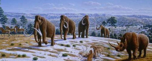
In addition, these scientists claim that sea beds buried for millions of years, beneath millions of tons of freezing ocean sea water, sprouted grasses and shrubs during a time of huge ice glaciers covering nearly all the surrounding areas on both sides of the land bridge. In addition, it is claimed that animals, such as the saber-tooth cat, woolly mammoth, and various ungulates (horses, cattle, deer, swine, and elephants), left warmer climes and traveled into thee frozen lands, crossed the glaciers, in search of food, then found the grasslands of Beringia in the midst of all these frozen ice sheets.
Now, if that isn’t strange enough, these same scientists claim that people also left the warmer climate areas, covered with grass, trees and game, to follow these animals into the frozen northern lands, across the glaciers to the supposed grassland along Beringia and the land bridge, where they settled down.
Then at some point, the seas began to rise and waters encroached upon the land bridge forcing the people to leave; however, instead of going back the way they had come, a way they knew had been safe and above the sea levels, scientists would have us believe that these people, threatened with rising flood waters, chose to head further eastward into the unknown where nothing but glacial ice awaited them.
Now if that isn’t enough for you, these people not only progressed into the unknown lands covered with glacial ice for 2,000 miles to the south before leaving the glaciers and entering the dry land of the northern U.S., but they never stopped there. They continued to travel southward, across the lush area of the northwest and leaving that behind to cross into the desert lands of the southwest, clear through barren Mexico, the rain forests of Central America, the swamps of Panama and into South America, all the way to the southern frozen lands of Patagonia.
At this point we need to back up to those people crossing the land bridge—not all went south. According to these scientists, some of these people went east, crossing 3,000 miles of frozen, glacial ice, to the east coast of northern Canada where they crossed 225 miles of sea and then into the ice-covered interior of Greenland where they settled.
Now, I ask you—would anyone really believe people would do that? I mean, who would leave warm climates where game for food was available to travel further and further into colder and colder climates and keep going across glacial ice and snow? We are not talking about a few hearty hunters, but entire clans, tribes, or groups of people, with men, women and children, including some types of flocks or herds for meat and milk, etc.
According to these scientists, the entire Western Hemisphere was settled from the north and their expansion went southward. This means that Alaska, western Canada, and northwestern United States, were all settled long before Central America and South America. It also stands to reason that the settlements in the north should be older than those in the south; however, archaeology tells us emphatically that the opposite is true!
The oldest settlements in the entire Western Hemisphere are found in the Peruvian Andes and along the coasts of Peru of South America. In fact, the only two places in the entire Western Hemisphere where buildings can be dated show that those in the Andean area of South America are far older than those of Mesoamerica, which are far older than anywhere else in the Americas.
Now why do we find the oldest settlements in western South America, about 8000 miles south of the Beringia Land Bridge? And the only buildings or settlements that can accurately be dated (meaning hard evidence, i.e., buildings, structures, etc.) to the north of the Peru settlements are those of Mesoamerica, still about 5500 miles south of  the land bridge.

Left: Tiwanaku in Peru, South America; Right: Palenque in Chiapas, Mexico, in Mesoamerica--both very advanced cultures unlike anywhere else in the Western Hemisphere
It is also quite interesting that the only two really advanced ancient cultures in the history of the Western Hemisphere are found in the south with nothing like them or anything close to their development and age between the their areas and the land bridge.
Simply put, the idea of a north to south migration history is not supportable by any evidence in the ground under any circumstances, yet true to their natural colors, the scientists continue to cling to their land bridge crossing and southward migratory patterns.
Is there anything more obviously incompatible with reason and facts?
Yet, this irrational idea of the land bridge crossing is so deeply embedded in the scientists’ conscience that it lies at the basis of all modern thought on the settlement of the Western Hemisphere--and no doubt has colored the DNA research of the subject. Isn’t it time we buried such antiquated thinking and look for other methods of settlement that agree with the factual data of settlement from south to north?

Monday, March 4, 2013

Doesn’t Anyone Understand the Untenable Claims About Beringia? Part II

In the last post we mentioned how preposterous it was for people to move from a warm climate area into a freezing cold area, cross a frozen land bridge into another freezing cold environment to travel at least 2000 miles before leaving the glaciated area and into a warmer climate (Washington State).
Does anyone really believe that people would leave warm areas and migrate into frozen, glaciated land and across it for thousands of miles, even if there was a continuous land?
However, even more preposterous is the utterly unsubstantiated belief that the land bridge was a grassland, which it is claimed enabled humans to cross the Bering Sea and enter North America. It is also believed that these early settlers were following migrating animals across the Bering Land Bridge and for a time may have settled on the bridge itself. As the Bering Land Bridge began to flood once again with the end of the ice age however, humans and the animals they were following moved south along coastal North America. If all this is true, why would they not have escaped back the way they had come, rather than forging further ahead into a flooding plain whose distance and circumstances was beyond their knowledge.
It is certainly curious that animals would willingly leave a warmer clime and go into freezing country and travel in that freezing country for thousands of miles. As an example, the American Bison (Buffalo) is said to have traversed the plains area of the U.S. for thousands of years—but never, ever, migrated into colder lands, staying along the Great Plains for their entire existence. Neither have the Aracaris, Toucans, Anhinga, Toucanets, Motmots, Macaw, Quetzal, Cotinga, Topaz, Caracara, Hoatzin, Parrots, and Cassowary, to name a few, which are birds that live in the rainforests of Central and South America, have never voluntarily migrated to anywhere else, let along a colder climes.
Rainforest birds have never willingly migrated out of the rainforest
Of the 10,000 bird species, the vast majority are sedentary (non-migratory), while about 1800 of the species are long-distance migrants. Many bird populations migrate long distances along a flyway, with the most common pattern involving flying north in the spring to breed in the temperate or Arctic summer and returning in the autumn to wintering grounds in warmer regions to the south. But these migrations are seasonal with birds maintaining the same basic climate environment at all times.
The permanently frozen soil of Siberia, Canada, Alaska and Greenland has always been the home of the Arctic Musk Ox (Ovibos moschatus), though today its habitat has grown smaller. Nonetheless, this mammal has never ventured out of its cold environment, has never migrated to warmer climes
One of the points to be made is simply that animals, with very few exceptions—mostly in migrating bird species—remain in their environments from birth to death, though many scientists would lead us to believe otherwise in order to promote their migration beliefs and models. As shown above, animals living in cold environments stay in cold environments, while those in warm weather environments stay in those environments.
Take the Saber tooth cat (Smilodon gracilis and populator), its remains and considered habitat was (southern) North, Central and (northern) South America. Fossils have been discovered in the La Brea asphalt deposits (Tar Pits) in Los Angeles, California, as well as at Talara tar seeps in Peru. It is believed that they lived in forest habitats, brushy plains and margins of woodlands—hardly an animal that would migrate into and across frozen tundra, let alone glaciated land. The largest collection of remains of the smaller cat species (Homotherium serum), was found in the Friesenhahn Cave in Texas, far from any cold, let along frozen, environment.
Scientists claim that the woolly mammoths' habitat was a cold and windy grassland that was a tundra like steep environment. It is claimed that “nearly all of these giants vanished from Siberia by about 10,000 years ago.” Other scientists claim they lived in the area now called Beringia and under hundreds to thousands of feet of icy water in the Bering Sea, killed off some 20,000 to 25,000 years ago as the area became colder during the “Last Glacial Maximum” and more barren, with the very last mammoths disappearing some 10,000 years ago from the north countries.
The problems with all of this, besides ones already stated, is that it violates a couple of very strong and highly understood factors: 1) The Earth is about 6000 years old, not only does Moses and Abraham tell us that, but the genetist Ann Gibbons (see earlier post in this series) showed that using the criteria discovered in 2002, suggests that mitochondrial DNA used to suggest a Mitochondrial Eve, said to date to 200,000 years ago, actually dates only to about 6000 years ago; 2) The oldest settlements discovered in the Americas have been shown to be in the Andean area of South America, with the next oldest in Mesoamerica, which suggests to archaeologists and anthropologists (not already steeped in Beringia) to claim a proven process of human development in the Americas from South to North!
Now, here is the kicker! Even if we concede the first point since there are so many critics who disbelieve in the Bible and Creationism, it is the second point that cannot be swept under the rug along with the Biblical or Creationist rejection. The South to North development is not based on any religious beliefs, ideas, or dogma! It is proposed by scientific people, both archaeologists and anthropologists, who have done “ground work” in the Americas and determined the dates through Scientific radiocarbon dating that cultural and building development is positively shown, without any claims to the opposite of such evidence, to have originated in the Andean area of South America and moved northward through Central America and into the southern United States.
Considered by Archaeologists to be the oldest city in the Americas, built about 5,000 years ago 120 miles north of Lima, Peru. It is only one of scores of ancient ruins uncovered in Peru that date far into B.C. times

People can make claims about a Land Bridge in Beringia, can make claims about a so-called migration pattern, can make claims about DNA, genetic groups and clans, or genealogies--but factual, observable, and unquestioning dating methods shows, without question, a specific South to North migration or development pattern in the Americas.
This, and this alone, should be sufficient for the most suspicious critics out there that migration in the Americas did not begin across the hypothetical land bridge from Siberia to Alaska!
Scientists can draw pictures and maps of claimed ancient migratory paths, but they cannot show any evidence of a north to south cultural development nor, especially, of any building, construction, roadways, metallurgy, textiles, mining, etc., etc., etc., that was superior in the north over what has been found and written about for decades in the south!
So we end with the beginning question: “Doesn’t Anyone Understand the Untenable Claims About Beringia?"

Sunday, March 3, 2013

Doesn’t Anyone Understand the Untenable Claims About Berangia? Part I

The news out of Harvard University last year was that “An exhaustive study of DNA taken from dozens of Native American groups that span from Canada to the tip of South America is helping to settle a question that has long divided scientists: When people arrived in the Americas more than 15,000 years ago, the Harvard-led research shows, they came in successive waves, not all at once.”
The 58-mile-wide Bering Strait separating Alaska and Siberia
The analysis published last July reveals that while one population of “First Americans” crossed a land bridge from Siberia during the last Ice Age, about 15000 to 12000 B.C., giving rise to most Native Americans, there were at least two subsequent migrations. These people mixed with the founding group later, leaving traces of their genes in the DNA of present-day populations in Alaska, Greenland, and Canada.
Beringia, or better known as the Bering Land Bridge, sometimes called the Siberian Land Bridge, is a so-called, hypothetical area of land, now about 165 feet beneath the freezing waters of the Bering Strait, that some scientists claim was exposed due to the lowering of sea level during the last Glacial Period, which is said to have ended 12,500 years ago.
The Bering Strait is a narrowing of the sea between Cape Dezhnev (Dezhnyov), Russia, the easternmost point of the Asian continent, and Cape Prince of Wales, Alaska, the westernmost point of the American continent, slightly south of the polar circle. The strait is approximately 58 miles wide, with a depth of 165 feet (at its lowest point) and connects the Chukchi Sea, which is part of the Arctic Ocean, in the north with the Bering Sea, which is part of the Pacific Ocean, in the south.
However, according to Robert F. Spielhagen, et al, in "Arctic Ocean deep-sea record of northern Eurasian ice sheet history," Quaternary Science Reviews, Vol 23, 2004, pp 1455–83, “the Arctic Ocean between the huge ice sheets of America and Eurasia was not frozen throughout, but like today probably was only covered by relatively shallow ice, subject to seasonal changes and riddled with iceberg calving from the surrounding ice sheets, based on the sediment composition retrieved from deep-sea cores there must even have been times of seasonally open waters.”
Amidst a solid pack of ice covering thousands of square miles, the scientists claim an area in Beringia would not only be above water, but unencumbered by the ice sheets everywhere else; but even so, people would have had to leave the preferred area to travel across sheets of ice for some 2000 miles to reach dry land in a warmer clime--it is simply an untenable hypothesis
The idea of people crossing this hypothetical land bridge is an outgrowth of belief in the bridge itself, a theoretical understanding of biogeographical data showing connections between species on the Asian and North American continents, such as saber-tooth cats, woolly mammoths, various ungulates and plants were believed to have existed on both continents around the last ice age. Biogeography looks at phytogeography (the past and present distribution of plants) and zoogeography (the past and present distribution of animals), with historical biogeography called paleobiogeography, which studies the past distributions of species, and their evolutionary history. For the most part, it is based on hypothesis about species and why they developed, migrated, and exist in certain ways.
Thus, when similar human DNA was found in both Siberia, Alaska and Greenland, the giant leap of faith of these scientists decided it had to be connected via a cross-over of a land bridge that cannot be factually shown to have existed even with modern technology. The existence of such a land bridge is only a belief—an example is stated by scientists: “The Bering Land Bridge is believed to have existed through numerous ice ages- from earlier ones it is thought around 35,000 years ago to more recent ice ages around 22,000-7,000 years ago. Most recently it is believed that the strait between Siberia and Alaska became dry land about 13,500 B.C., and believed that 4000 B.C., the strait was again closed due to a believed warming climate and rising sea levels. It is believed that during the latter period, the coastlines of eastern Siberia and Alaska developed roughly the same shapes they have today” (emphasis mine).
Top: Cape Dezhnev, Russia (Siberian side of the land bridge area); Bottom: Just inland from Cape Dezhnev (the cape is seen in the background). A most inhospitable land of ice and rock
Cape Prince Wales, the westernmost point of the North American Continent, and the eastern side of the so-called Land Bridge. It is a formidable area of ice, with winter temperatures ranging from -10 to 6 °F. Annual precipitation averages 10 inches, with 35 inches of snow. Frequent fog, wind, and blizzards limit access to this area--there are no roads leading to the village of Wales shown in the distance
It is also believed that the land bridge was not glaciated, even though it was during the glacial period, and it is believed that precipitation was light, therefore it is believed that grasslands were most common on the Bering Land Bridge itself and for hundreds of miles into the Asian and North American continents—again, this is during the glacial period that covered this area! It is also believed that there were very few trees and all vegetation consisted of grasses and low-lying plants and shrubs on a small patch of land that had for milennia been submerged far beneath ocean sea water. These scientists today point to the region surrounding what remains of Beringia in northwestern Alaska and eastern Siberia to show that it still features grasslands with very few trees--but that is misleading since the areas adjoining the ocean where any such land bridge would have been is thick ice as shown in the pictures above. Of course, nothing can be proven or disproven that existed or didn't exist in this area 12000 to 15000 years ago--it is all a typical scientific hypothesis, more correctly called a guess.
The proposed map by scientists showing their belief in a migration across the hypothetical Bering Land Bridge, and down into South America or across into Greenland
What the map doesn’t show (see the previous post for the complete migration map) is that this migration across the Land Bridge began in central Africa, crossed into Europe, went east to China, then north into Siberia before reaching the land bridge—a migration of about 7000 miles. The last half of that, about 3500 miles, into ever-increasing colder and colder climates. Consequently, it has to be asked,
"What would prompt any group of people to leave warm, healthy and safe climates to travel into forbidding colder and colder climes of ice and snow?" Scientists claim these people were following Woolley Mammoth herds--however, nobody follows a herd into forbidding climes when there are plenty of animal herds in the warmer climes. It is simply an untenable belief that cannot be supported by reason or fact!
The utterly preposterous idea of a huge group of people voluntarily choosing to leave a warm climate and travel thousands of miles into a freezing climate not conducive to humans, cross a solid ice area for some 100 miles to reach another freezing cold area, before traveling into a warmer climate--a distance from the land bridge to a warmer climate southward would be approximately 2000 miles before reaching the present-day northern border of the State of Washington in the U.S. Or or as the claims of DNA findings would mean some of these people traveled clear across northern Alaska and Canada, and, as the DNA trail leads into Greenland, some would have had to travel from the land bridge 3000 miles eastward and then, for some unknown reason, cross a 225-mile sea to reach Greenland as the map below shows, which itself is mostly ice, is beyond imagination.
Note the glaciation of Siberia, Alaska, Canada, and Greenland during the time the scientists claim people migrated across a land bridge into Alaska, then across Canada to Greenland
This leads to an interesting evaluation: on the one hand we have scientists who claim people migrated across Alaska and Canada to Greenland at a time, on the other hand, when other scientists claim this entire area was covered with ice-age glaciation. That of course presents a problem. But just one problem out of many.
(See the next post, “Doesn’t Anyone Understand the Untenable Claims About Beringia? Part II, to show more of the problems the two concepts mentioned in this post regarding the Beringia Land Bridge, and the migration over it during the Ice Age glaciation of these lands)

Saturday, March 2, 2013

DNA and the American Indian – Part II

For quite some time, people have considered that Amerind (American Indian) DNA is easily determined through tests, and that certain so-called Lamanite ancestry markers can be traced to middle Asia, thus eliminating the possibility that Lamanites in the Western Hemisphere could trace their DNA ancestry to the Hebrew Middle East. This has become a major point for critics to question the validity of the Book of Mormon, and some members unfortunately have questioned their beliefs because of it.
However, as pointed out in the last post, Native American DNA testing is far from conclusive—in fact, it is often more confusing that not. Take, for example, that supposedly known DNA markers of Native Americans (Indians) have shown up in Japan, North Asian, and even Turkey, suggesting that in a blind test, those individuals would fall into the Native American Indian category.
DNA tests actually show that so-called Native American markers are the same as some Japanese, northern Asians, and even people of European and Turkish descent as well as Samoan—LtoR: American Indian, Asian, Japanese, Samoan
Still more confusing, some of the haplotypes attributed to Native Americans are also found in people from other parts of the world. Several are found in North Asia, and one is found in southern Europe and Turkey. In fact, the principal marker of haplotype B, called the "9-Base Pair Deletion," is found in some Japanese and almost all Samoans. Should they then be classified as genetically Native American? These tests cannot even establish with certainty that, for example, someone’s mother’s mother’s mother was Native American‚ they can at best establish only the possibility that this was the case.
However, it was the practice of geneticists working with DNA to establish probabilities that led to the disastrous findings in 1987 and the so-called discovery of Mitochondrial Eve (See our post of Feb 26, “The Demise of Mitochondrial Eve”). The problem lies in the fact that as 2011 figures, the World’s population stood at 6,973,738,433 people (that’s a hair under 7 billion), of which the largest claimed genetic profile database claims to include over 554,000 individuals. This means that, even if they actually had DNA testing on all half million, which is not likely the case since they are talking about covering 1227 populations including 918 indigenous populations, covering every continent throughout the world, we are talking about DNA tests on less than .00008 of the population (that is 8/10000ths).
Now tell me, is that a workable figure on which to make such lavish claims? What if we then went back one generation, five generations, 10 generations, etc.?
The percent of people tested would be so astronomically low that there is no possible way anyone can say that this marker or that marker, this haplotype or that haplotype belongs to this group or that group. Of course, scientists like to claim they can extrapolate small numbers to get very large numbers, but that was the problem with the creation of the 1987 finding of Mitochondrial Eve, which was proven wrong in 2002 because, as one of the newer researchers stated: “Until approximately 1997, we did not have good empirical measures of mutation rates in humans.  However, that situation greatly improved when geneticists were able to analyze DNA from individuals with well-established family trees going back several generations”--something that had not been available to the geneticists a mere ten years earlier. And if we are even now, 26 years later, still only measuring .00008 of the population, how many errors are we making today that will be altered in the future when we have far more "better-established" family trees going back a great many generations.
This means that for approximately 10 years, during which time Mitochondrial Eve became the newest buzz word or concept on the planet, DNA scientists were making claims they simply did not have sufficient empirical measurements to make—that is, enough generations to see what the mutation rates of DNA in humans actually were. However, since 1997, sufficient generational information became available of individuals with "well-established family trees going back several generations," which enabled geneticists to make more accurate measurements and realize the error of a decade earlier. But of course they didn’t know their assumptions (guesses) of "random mutations in the DNA occurred at documented, steady rates," was inaccurate. It took a later, more complete generational database to learn of their error—an error that set thousands, if not millions, of people, programs, companies, and individuals on the wrong road to understanding DNA.
Are we still on such a road? It would seem so, since science is still claiming Western Hemisphere settlement via the Siberian Land Bridge in opposition to all archaeological finds in Andean South America showing the oldest cultural existence and building in the Americas, with new finds occurring regularly, pushing back the dates of Andean settlement to very early periods, earlier (older) than anything else yet discovered in the entire Americas.
Scientists still hang on to the old paradigm that man originated in Africa and spread throughout the world, reaching the Western Hemisphere over a so-called Land Bridge between Siberia and Alaska, called Beringia, despite growing evidence of a south to north development in the Americas
Another issue in the Amerind DNA is the widespread belief that genetics can help determine specific tribes of either living or ancient people; however, this is quite simply false according to the report noted in the last post. Neighboring tribes have long-standing complex relationships involving intermarriage, raiding, adoption, splitting, and joining. These social historical forces insure that there cannot be any clear-cut genetic variants differentiating all the members of one tribe from those of nearby tribes. At most, one can identify slight differences in the proportions of certain genetic variations in each group, but those do not permit specific individuals to be assigned to particular groups.
The conclusion of the report shows that "the concept of genetic testing to prove Native American ancestry is one that is discussed more frequently in recent times, but there are many problems with the idea. Perhaps foremost of these problems is that to make a genetic test the arbiter of whether someone is Native American or not is to give up tribal sovereign ability to determine membership and relations. But even taken on their own scientific terms, the tests cannot do much to identify who is and who is not Native American." This is because they yield many false negatives and false positives (they readily misidentify non-Native people as Native, and misidentify Native people as non-Native), and "the positive results they do yield at best are only probabilities, not certainties." the researcher went on to add, "If these were medical diagnostic tests, they would never be approved or adopted."
But the most important argument against this type of testing to establish tribal affiliations is that biology (and genetics) track just part of the tribal inheritance. These DNA tests treat Native American biology as though all Indians were essentially the same. But that is far from the truth.
In a study before MtDNA was shown to be in error in the way geneticists had been using it, scientists measured Amerind MtDNA and found one interesting factor—“The HincII np 13,259 and AluI np 5,176 lineages were observed exclusively in Amerinds and were shared by all such tribal groups analyzed, thus demonstrating that North, Central and South American Amerinds originated from a common ancestral genetic stock” (Antonio Torroni, et al, Center for Genetics and Molecular Medicine and Departments of Biochemistry and Anthropology, Emory University School of Medicine, Atlanta, Georgia).
It seems the idea that the American Indians, who we call Lamanites, all came from “a common ancestral stock”—correct me if I’m wrong, but isn’t that what the advocates of the Book of Mormon have been saying that everyone is criticizing? Perhaps when DNA sampling and testing reaches a point where scientists involved are not bent on blindly following the evolutionists’ fossil record, and rely more and more on their actual findings through factual testing, we might find a more accurate location of that ancestral record.

Friday, March 1, 2013

DNA and the American Indian – Part I

For quite some time now, people have considered that the Amerind (American Indian) have known DNA markers that can be traced to certain areas of the world, namely to parts Asia. As an example, a Mitochondrial DNA analysis by an Atlanta, Georgia, group tested 167 American Indians with the result “All Native American MtDNAs clustered into one of four distinct lineages.” As of 2010, there were 2.9 million American Indians in the United States; consequently, what portion of the numerous American Indian groups could be determined by a test of 167 people?
In any event, despite the claims by many, especially critics of the Book of Mormon, this might be laid to rest by a recent study and report appearing in Indigenous Peoples Council on Biocolonialism, written by Jonathan Marks, PhD, (above left) Vice-Chairman, Department of Sociology and Anthropology, University of North Carolina, Charlotte, and Brett Lee Shelton, J.D. (above right), entitled “Genetic Markers Not a Valid Test of Native Identity,” in Counsel for Responsible Genetics.
This article draws on actual testing and evaluating for the purpose of determining the reality of who is and who is not a Native American—that is, who is an “Indian” and who is not. In so testing and evaluating, a lot of problems about such testing have surfaced and, frankly, seem to cast a huge shadow across the land as to the usefulness and even the validity of the DNA testing results. In fact, such tests seem to create more problems than they solve.
As the reports states: “Current DNA testing cannot distinguish among separate Native American tribes,” and that “The point that is frequently lost in the debate about using genetic analysis to determine whether one is Native American is that the genetic analysis itself is not conclusive, even on strictly scientific terms.”
Scientists, of course, have found certain variations, or “markers” in human genes that they call Native American markers “because they believe all original Native Americans had these genetic traits.” The report also states: “The theory is that, if a person has one of these markers, certain ancestors of the person must have been ‘Native American’.” And also: “Since these markers are called ‘Native American markers’, they are believed to be a genetic signature of the founding ancestors.”
These statements seem to show a very big “IF” factor, that is, believe, theory, must be, etc., do not seem like positive or straight forward responses to something that most people in our society think is a tried and true proven science with specific and exact results.
And if that isn’t a concern, the report goes on to tell us that all testing of Native Americans has been based on the belief that “both females and males inherit their mitochondrial DNA (MtDNA) only from their mother,” and that this line of biological inheritance, therefore, stops with each male. That means that, if you think of your 4 great-grandmothers, you and all your brothers and sisters have inherited your MtDNA only from your maternal grandmother's mother.
The problem with this is simple—since 2002, this mitochondrial MtDNA belief has been shown to be inaccurate and completely wrong.
However, continuing with the previous belief that has permeated all testing results for the past twenty-five years, this means that, if all one’s great grandparents were Native American, and their mother’s mother’s mother was non-Indian, then they will not likely have one of the “Native American” MtDNA haplotypes. So, 7 of their 8 great-grandparents may be Indian, and yet they would not be identified as Indian from the DNA test
Moreover, it really goes farther than that, since it has been believed that the MtDNA only comes from the purely maternal line, if one goes back two more generations, 31 of their 32 great-great-great grandparents could be Indian. Yet they would not be identified as Native American using the DNA test if that one of their 16 (great-great-great) grandmothers who is part of their female lineage was not Native American (or more specifically if her mother did not have one of the five haplotypes called “Native American.”)
And if we keep going back further, and still only a single one of their female ancestors is detectable, while the number of ancestors invisible to this test increases enormously. Conversely, the opposite is also true—that is, if their mother’s line was back to 32 great-great-great grandparents and only 6 women in a single line were American Indian and the other 26 were not, they would be labeled a Native American.
And what about the males? Males inherit a close copy of their Y-chromosome from their fathers, while females do not have a Y-chromosome. So males could also be tested for Native American markers on their Y-chromosome, but the analysis has similar limitations as testing MtDNA. Here again, the test only traces one line of ancestry, and misses most of the subjects' ancestry because the vast majority of the ancestors are invisible to the test. If a man has 15 Native American great-great-grandparents, but his father's father's father's father was non-Indian, that person will not appear to be Native American under The DNA test. So, almost 94% of that person's genetic inheritance may be from Native Americans, but under this test he may be identified as “non-Indian.” And again, the opposite is true in that a man may be considered Indian though the vast majority of his ancestors were non-Indian.
Therefore, according to the researchers, like MtDNA analysis using the purely maternal line, using Y-chromosome analysis to determine Native American ancestry ignores a greatly increasing percentage of a person's ancestry as they go more generations into the past with the analysis.
There is another possibility of false negatives from these types of tests as well, which is that another type of false negative would arise if some Native American people simply do not have one or more of the ”Native American” markers. Scientists have not tested anywhere near all native people, so they do not know for sure that Native Americans only have the markers they have been identified, if their maternal or paternal bloodline does not include a non-Indian. After all, real peoples are not bound by the geneticist’s ideal of purity. The scientists already admit to some of this uncertainty when they estimate that, for example, 95% of Native American men without a known non-Native in their purely paternal line (father’s father’s father, and so on) have one of the two Native American variations they have identified. This implies that at least 5% of the men can have other genetic markers.
The point of all this is simply that DNA testing can be used for some things with degrees of probability, but not of certainty. To say this or that group came from this or that area is far afield of where the science is so far, despite many genetists, evolutionists and genealogists hopeful disagreement. 
(See the next post as we continue to look into this claim that the Amerind came fro East Asia--Mongolia, China, South Korea and Japan)